Reporoa
Reporoa is a rural community in Rotorua Lakes within the Waikato region of New Zealand's North Island.
Reporoa | |
|---|---|
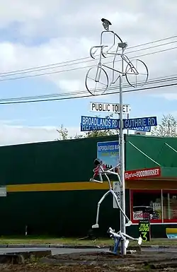 Road sign and sculpture | |
| |
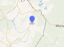
| Coordinates: 38.436003°S 176.340785°E | |
| Country | New Zealand |
| Region | Waikato |
| District | Rotorua |
| Population (2013) | |
| • Total | 453 |
It is located within the Reporoa Caldera,[1] a caldera in the Taupo Volcanic Zone containing the Deer Hill, Kairuru and Pukekahu rhyolitic lava domes and the active Reporoa geothermal field.[2][3] Several hydrothermal explosions have occurred in the area, with a large one being recorded in 1948, and another large one occurring in a cow paddock in April 2005.[4]
The New Zealand Ministry for Culture and Heritage gives a translation of "long swamp" for Reporoa.[5]
Demographics
Reporoa had a population of 453 at the 2013 New Zealand census, a decrease of 21 people since the 2006 census. There were 222 males and 228 females. Figures have been rounded and may not add up to totals.[6] 69.9% were European/Pākehā, 47.6% were Māori, 4.2% were Pacific peoples and 3.5% were Asian.[7]
| Year | Pop. | ±% p.a. |
|---|---|---|
| 2006 | 1,764 | — |
| 2013 | 1,797 | +0.27% |
| 2018 | 1,767 | −0.34% |
| Source: [8] | ||
The statistical area of Golden Springs, which at 499 square kilometres is much larger than this community, had a population of 1,767 in the 2018 New Zealand census, a decrease of 30 people (-1.7%) since the 2013 census, and an increase of 3 people (0.2%) since the 2006 census. There were 609 households. There were 939 males and 831 females, giving a sex ratio of 1.13 males per female. The median age was 31.6 years (compared with 37.4 years nationally), with 468 people (26.5%) aged under 15 years, 366 (20.7%) aged 15 to 29, 810 (45.8%) aged 30 to 64, and 123 (7.0%) aged 65 or older.
Ethnicities were 80.0% European/Pākehā, 29.9% Māori, 2.9% Pacific peoples, 4.9% Asian, and 1.5% other ethnicities (totals add to more than 100% since people could identify with multiple ethnicities).
The proportion of people born overseas was 12.4%, compared with 27.1% nationally.
Although some people objected to giving their religion, 59.8% had no religion, 26.1% were Christian, 0.7% were Hindu, 0.2% were Muslim, 0.5% were Buddhist and 4.9% had other religions.
Of those at least 15 years old, 165 (12.7%) people had a bachelor or higher degree, and 258 (19.9%) people had no formal qualifications. The median income was $39,800, compared with $31,800 nationally. The employment status of those at least 15 was that 771 (59.4%) people were employed full-time, 216 (16.6%) were part-time, and 39 (3.0%) were unemployed.[8]
Marae
Reporoa has four Ngāti Tahu - Ngāti Whaoa marae. Mataarae Marae and meeting house is a meeting place of Ngāti Mataarae and Ngāti Whaoa. Ōhākī Marae and Tahumatua meeting house is a meeting place of Ngāti Tahu. Te Toke Marae and Te Rama meeting house is a meeting place of Ngāti Te Rama and Ngāti Whaoa. Waimahana or Marapounamu Marae and Rahurahu meeting house is a meeting place for Ngāti Rahurahu.[9][10]
Education
Reporoa College is a co-educational state secondary school for Year 7 to 13 schools,[11][12] with a roll of 228 as of March 2020.[13]
Reporoa also has two primary schools for Year 1 to 6 students: Reporoa School,[14] with a roll of 94;[15] and Broadlands School,[16][17] with a roll of 89.[18]
References
- "Reporoa". Global Volcanism Program. Smithsonian Institution.
- I. A. Nairn; C. P. Wood; R. A. Bailey (December 1994). "The Reporoa Caldera, Taupo Volcanic Zone: source of the Kaingaroa Ignimbrites". Bulletin of Volcanology. 56 (6): 529–537. Bibcode:1994BVol...56..529N. doi:10.1007/BF00302833.
- S. W. Beresford; J. W. Cole (2000). "Kaingaroa Ignimbrite, Taupo Volcanic Zone, New Zealand: evidence for asymmetric caldera subsidence of the Reporoa Caldera". New Zealand Journal of Geology & Geophysics. 43 (3): 471–481. doi:10.1080/00288306.2000.9514903.
- Geothermal eruption in New Zealand paddock leaves big crater, The Star, 20 April 2005.
- "1000 Māori place names". New Zealand Ministry for Culture and Heritage. 6 August 2019.
- 2013 Census QuickStats about a place : Reporoa
- 2013 Census QuickStats about a place (Cultural diversity) : Reporoa
- "Statistical area 1 dataset for 2018 Census". Statistics New Zealand. March 2020. Golden Springs (201800). 2018 Census place summary: Golden Springs
- "Te Kāhui Māngai directory". tkm.govt.nz. Te Puni Kōkiri.
- "Māori Maps". maorimaps.com. Te Potiki National Trust.
- "Reporoa College Official School Website". reporoa.school.nz.
- "Reporoa College Ministry of Education School Profile". educationcounts.govt.nz. Ministry of Education.
- "Reporoa College Education Review Office Report". ero.govt.nz. Education Review Office.
- "Reporoa School Ministry of Education School Profile". educationcounts.govt.nz. Ministry of Education.
- "Reporoa School Education Review Office Report". ero.govt.nz. Education Review Office.
- "Broadlands School Official School Website". broadlands.school.nz.
- "Broadlands School Ministry of Education School Profile". educationcounts.govt.nz. Ministry of Education.
- "Broadlands School Education Review Office Report". ero.govt.nz. Education Review Office.