Risley, Derbyshire
Risley is a small village and parish[1] in Erewash in the English county of Derbyshire. The population of the civil parish as of the 2011 census was 711.[2] It is just over four miles south of Ilkeston. Sandiacre is adjacent to the east.
| Risley | |
|---|---|
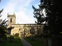 All Saints' church | |
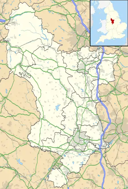 Risley Location within Derbyshire | |
| Population | 711 (2011) |
| OS grid reference | SK458356 |
| District | |
| Shire county | |
| Region | |
| Country | England |
| Sovereign state | United Kingdom |
| Post town | DERBY |
| Postcode district | DE72 |
| Dialling code | 0115 9 |
| Police | Derbyshire |
| Fire | Derbyshire |
| Ambulance | East Midlands |
| UK Parliament | |
It is almost midway between Derby and Nottingham and is near junction 25 of the M1 motorway, and the A52. In 1870 it had a population of 203 when there was a grammar school that served seven neighbouring parishes.[3]
History
All Saints' Church was built in Elizabethan times by members of the Willoughby family, who had acquired Risley in 1350 AD and who also founded a free school in the village. Risley is a long thin village with most properties lying on either side of the main road. With the village hall standing on one side of the church and the school on the other, this is the closest one can get to the village "centre". The church belongs to the Stanton group of churches with Dale Abbey and Stanton by Dale. The village pub is the Risley Park formerly the Blue Ball[4] on Derby Road
Risley Manor originally belonged to the Mortimers. It passed to the Sheffields and then the Willoughbys and, in 1870, it belonged to J. L. Ffytche.[3] The manor was held by Sir Hugh Willoughby, the navigator,[5] who sailed on 10 May 1553, with three ships, in search of the North-east passage, but was frozen to death with all his crew in the following January. It is now a country house hotel.
A silver vessel known as the Risley Park Lanx, 20 inches by 15, said to have belonged to a church in France in 405, was found near the Hall in 1729.[3]
Sport
Notable residents
- Sir Hugh Willoughby, the navigator, owned the manor here.
- Teresa Hooley, poet, was born here in 1888.
References
- Risley Parish Council
- "Civil Parish population 2011". Neighbourhood Statistics. Office for National Statistics. Retrieved 30 March 2011.
- John Marius Wilson's Imperial Gazetteer of England and Wales, 1870
- Risley Park
- Pigot's Commercial Directory of Derbyshire, 1828/9, accessed 5 May 2008
- Breakwell, Keith (1994). The History of Cricket in Long Eaton, Sandiacre & Sawley. ISBN 978-0-9521-4371-0.
- "About Us". Risley Cricket Club. Retrieved 10 January 2021.
- "Maywood Golf Club". English Golf Courses. Retrieved 10 January 2021.
- "Maywood Golf Club". Today's Golfer. 11 July 2017. Retrieved 10 January 2021.
- Harper, Christopher (3 September 2018). "Why this Derbyshire golf club is closing after more than a decade". Derby Telegraph. Retrieved 10 January 2021.
