River Hamble
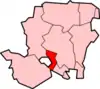
The River Hamble is in south Hampshire, England. It rises near Bishop's Waltham and flows for 10.1 km (6.3 mi) through Botley, Bursledon, and Lower Swanwick before entering Southampton Water near Hamble-le-Rice and Warsash.
| River Hamble | |
|---|---|
 Yachts on the Hamble | |
 | |
| Location | |
| Country | England |
| County | Hampshire |
| Settlements | Bishops Waltham, Botley, Bursledon, Hamble, Warsash |
| Physical characteristics | |
| Source | |
| • location | Bishops Waltham, Hampshire. |
| • coordinates | 50°57′15″N 1°12′56″W |
| Mouth | |
• location | Southampton Water |
• coordinates | 50°50′30″N 1°18′45″W |
| Length | 10.1 km (6.3 mi) |
River Hamble | ||||||||||||||||||||||||||||||||||||||||||||||||||||||||||||||||||||||||||||||||||||||||||||||||||||||||||||||||||||||||||||||||||||||||||||||||||||||||||||||||||||||||||||||||||||||||||||||||||||||||||||||||||||||||||||||||||||||||||||||
|---|---|---|---|---|---|---|---|---|---|---|---|---|---|---|---|---|---|---|---|---|---|---|---|---|---|---|---|---|---|---|---|---|---|---|---|---|---|---|---|---|---|---|---|---|---|---|---|---|---|---|---|---|---|---|---|---|---|---|---|---|---|---|---|---|---|---|---|---|---|---|---|---|---|---|---|---|---|---|---|---|---|---|---|---|---|---|---|---|---|---|---|---|---|---|---|---|---|---|---|---|---|---|---|---|---|---|---|---|---|---|---|---|---|---|---|---|---|---|---|---|---|---|---|---|---|---|---|---|---|---|---|---|---|---|---|---|---|---|---|---|---|---|---|---|---|---|---|---|---|---|---|---|---|---|---|---|---|---|---|---|---|---|---|---|---|---|---|---|---|---|---|---|---|---|---|---|---|---|---|---|---|---|---|---|---|---|---|---|---|---|---|---|---|---|---|---|---|---|---|---|---|---|---|---|---|---|---|---|---|---|---|---|---|---|---|---|---|---|---|---|---|---|---|---|---|---|---|---|---|---|---|---|---|---|---|---|---|---|
| ||||||||||||||||||||||||||||||||||||||||||||||||||||||||||||||||||||||||||||||||||||||||||||||||||||||||||||||||||||||||||||||||||||||||||||||||||||||||||||||||||||||||||||||||||||||||||||||||||||||||||||||||||||||||||||||||||||||||||||||
The Hamble is tidal for about half its length and there navigable, which has facilitated shipbuilding activities since medieval times.
The river's boat/shipbuilding yards have been used for military means, particularly in World War II.
Its lower reaches, with easily-reached (by water) Lymington and Cowes, accounting for a large percentage of UK yachting, sea pleasure cruisers and sailing.
Course overview and vessel making
From its source to mouth, the river makes a repeated curve heading south-south-west. It gains tributary streams before reaching Botley, the site of an ancient watermill.
Leisure craft are still built by the Hamble today.
One of the builders since medieval times was Luke & co, later Luke Bros a well-reputed yard from around 1890 to 1945 closure.
Botley to Bursledon (tidal)
Historic sites
Below Botley, the river becomes tidal and navigable. It gains strength from adjoining streams, draining surrounding Hedge End, Curdridge, Shedfield, and Burridge.[1]
This section has been extensively used for medieval shipbuilding, using timber grown locally in the neighbouring woods. Nearby Kings Copse, a cut-back form of Kings Forest,[2] speaks of this key use of the land.
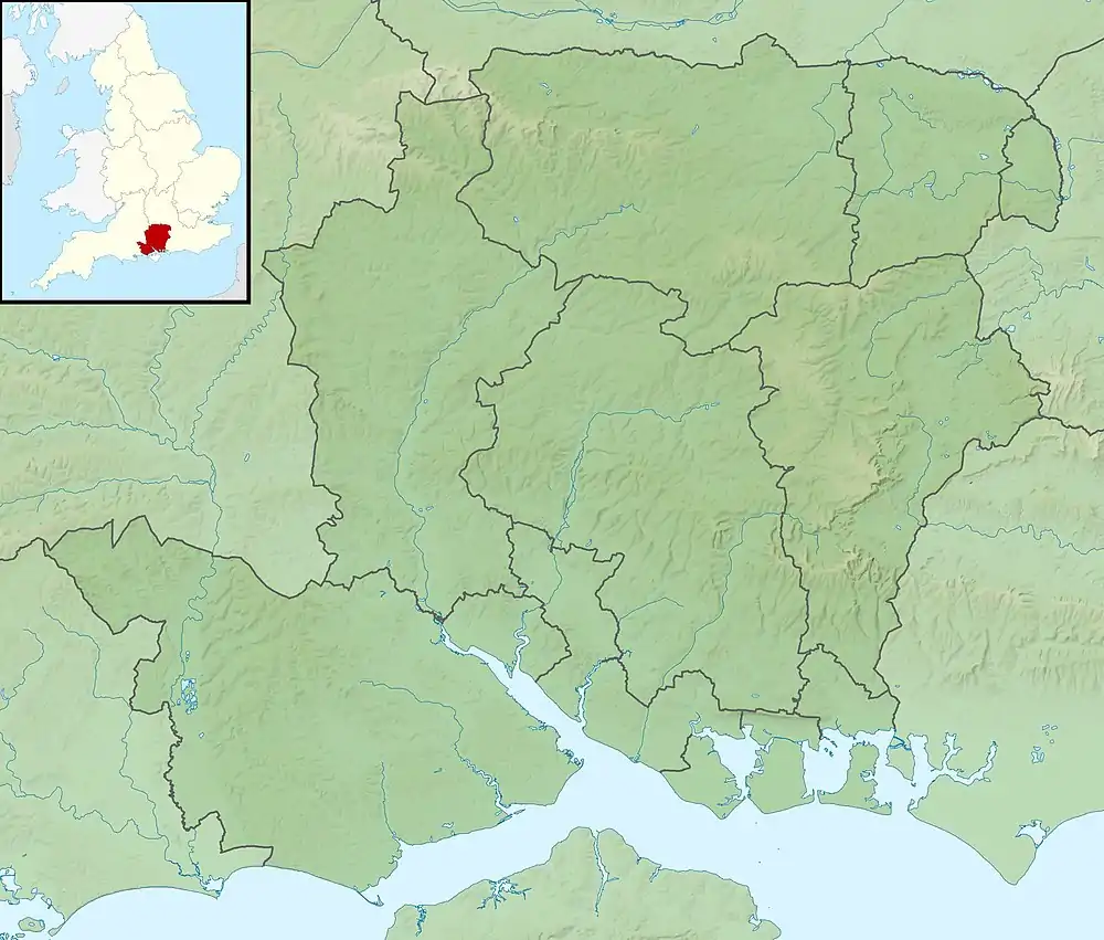
The river's west bank can be accessed from Manor Farm Country Park, where it is possible to walk through Dock Copse[1] and Fosters Copse.[1] At extreme low tide, it is just possible to see the remains of the wreck of Henry V's 15th century warship Grace Dieu. This section of the river was also home to HMS Cricket, the Royal Marine landing craft crew training base, during World War II.
At 2 mi (3.2 km) south of Botley, the river passes between the villages of Bursledon and Lower Swanwick and is crossed by the M27 motorway, the Portsmouth to Southampton railway line, and the A27 road via large bridges.
Yachting
A further 2 mi (3.2 km) south of Bursledon, the river flows between the villages of Hamble-le-Rice and Warsash before entering Southampton Water.[3]
A passenger ferry crosses the river between Hamble-le-Rice and Warsash, the attractive link for the Solent Way and E9 European Coastal Path. This section of the river is dominated by a number of marinas, the largest being the Port Hamble Marina, and boat yards on both banks as far upstream as Bursledon.[3]
Water quality
The Environment Agency measure water quality of the river systems in England. Each is given an overall ecological status, which may be one of five levels: high, good, moderate, poor and bad. There are several components that are used to determine this, including biological status, which looks at the quantity and varieties of invertebrates, angiosperms and fish, and chemical status, which compares the concentrations of various chemicals against known safe concentrations. Chemical status is rated good or fail.[4]
Water quality of the River Hamble in 2019:
| Section | Ecological Status | Chemical Status | Overall Status | Length | Catchment | Channel |
|---|---|---|---|---|---|---|
| Upper Hamble[5] | Moderate | Fail | Moderate | 5.309 km (3.299 mi) | 38.062 km2 (14.696 sq mi) | |
| Main River Hamble[6] | Moderate | Fail | Moderate | 4.823 km (2.997 mi) | 7.176 km2 (2.771 sq mi) |
In the 1970s and 80s the many yachts using the river polluted the water by leaching tributyltin from their anti-fouling paints. By 1988 it had the highest known level in the UK. With its banning for use by vessels under 25 m (82 ft) long, the general concentration in the tidal waters declined to that considered harmless.[7]
Gallery
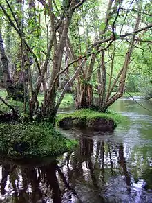
 The River Hamble looking upstream towards Botley from Fosters Copse. Dock Copse can be seen on the left bank. Bloomfield Copse is on the right bank
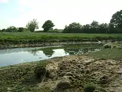 Medieval shipbuilding site on the River Hamble
 The Yellow X marks the site of the wreck of HMS Grace Dieu
 River Hamble Estuary
See also
References
- Ordnance Survey
- Joyce Blyth. The changing face of Hedge End
- Ordnance Survey (2005). OS Explorer Map 119 - Meon Valley, Portsmouth, Gosport & Fareham. ISBN 0-319-23596-3.
- "Glossary (see Biological quality element; Chemical status; and Ecological status)". Catchment Data Explorer. Environment Agency. 17 February 2016.
- "Upper Hamble". Catchment Data Explorer. Environment Agency.
- "Main River Hamble". Catchment Data Explorer. Environment Agency.
- Tubbs, Colin (1999). The Ecology, Conservation and History of the Solent. Packard Publishing. pp. 109–110. ISBN 1853411167.
External links
| Wikimedia Commons has media related to River Hamble. |
- Walks in the Hamble Valley
- Map sources for River Hamble for the source of the River Hamble.
- Map sources for River Hamble for the mouth of the River Hamble.
- The River Hamble Harbour Authority
- Port Hamble Marina
Settlements in the Borough of Eastleigh | ||
|---|---|---|
 | ||
| Main rivers main tributaries & sub-tributaries |
|  | ||||||||||
|---|---|---|---|---|---|---|---|---|---|---|---|---|
| Canals and Navigations | ||||||||||||
| Ordinary watercourses | ||||||||||||
| Lakes, ponds and wetlands | ||||||||||||
| Coast | ||||||||||||
Categories: Rivers, Canals | ||||||||||||
