Rohtas block
Rohtas is a community development block in Rohtas district of Bihar, India. The block headquarters is in the village of Akbarpur, 5 km east of the historic Rohtas Fort. As of 2011, the population of Rohtas block was 86,049.[1]
Rohtas block | |
|---|---|
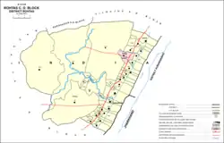 Map showing divisions of Rohtas block | |
| Country | India |
| State | Bihar |
| District | Rohtas |
| Headquarters | Akbarpur |
| Population (2011)[1] | |
| • Total | 86,049 |
| Time zone | UTC+05:30 (IST) |
History
The eponymous fortress of Rohtas was an important centre under Sher Shah Suri and during the Mughal period.[1]
The village of Akbarpur, in the foothills near Rohtasgarh, formed a pargana during the Mughal period. The tomb of Malik Wishal Khan, the daroga of Rohtasgarh under Shah Jahan, is located here.[1]
Geography
Rohtas block is geographically diverse, with parts of it lying on the Sasaram Plain and other parts on the Rohtas Plateau, a hilly outcrop of the Vindhya Range.[1]
Demographics
| Year | Pop. | ±% |
|---|---|---|
| 2001 | 78,625 | — |
| 2011 | 86,049 | +9.4% |
| Source: 2011 Census of India[1] | ||
In 2011, the population of Rohtas block was 86,049, of with 4,504 living in the census town of Telkap and 81,545 in rural areas. The overall sex ratio of the block was 944 females to every 1000 males, which was the highest in the district. The sex ratio was higher in rural areas (947) than in urban areas (904); it was also higher in the 0-6 age group than in the general population. In the 0-6 age group, the sex ratio was 957 (960 in rural areas, and 910 in urban areas), which was the second-highest in the district behind Dawath. (The rural 0-6 sex ratio, however, exceeded Dawath's, making it the highest in the district.)[1]
Members of scheduled castes numbered 15,794 in Rohtas block, representing 18.35% of the population; this proportion was almost identical to the district average of 18.57%. Members of scheduled tribes numbered 6,885, representing 8% of the population, which was much higher than the district average of 1.07%. Additionally, the town of Telkap, in Rohtas block, had the highest proportion of scheduled tribes membership among urban areas in the district of Rohtas (6.86%, compared to the average of 0.75%).[1]
Literacy in Rohtas block was somewhat below the district average: 66.41% of people in the block could read and write, compared with 73.37% in the district as a whole. Literacy was higher in men than in women; 76.24% of men but only 55.96% of women could read and write. The corresponding gender gap in literacy was 20.28%, which was marginally above the district average of 19.91%.[1]
A slight majority of the workforce of Rohtas block was employed in agriculture in 2011, with 12.13% being cultivators who owned or leased their own land and 38.77% being agricultural labourers who worked someone else's land for money. Another 5.77% of the workforce was employed in household industries, and the remaining 43.33% were employed in other forms of work.[1]
Economy
Near the village of Banjari there are significant limestone deposits which are mined for use in the production of cement.[1]
Of the total land area in Rohtas block, 31.57% is cultivable land; of the cultivable land, 54.92% was irrigated in 2011.[1]
Villages
Rohtas block contains 37 villages, of which 33 are inhabited and 4 are uninhabited.[1]
| Village name | Total land area (hectares) | Population (in 2011) |
|---|---|---|
| Tumba | 639.9 | 6,135 |
| Karma | 356.9 | 2,177 |
| Basarhi | 160.6 | 93 |
| Nawadih | 346 | 4,415 |
| Dhelabar | 297.4 | 2,707 |
| Khajuri | 253.7 | 1,838 |
| Rasulpur | 275.6 | 3,532 |
| Kasiawan | 298 | 4,047 |
| Bazidpur | 121 | 2,689 |
| Banjari | 270 | 2,629 |
| Lebura | 220.81 | 1,797 |
| Kalyanpur | 207.85 | 1,676 |
| Kachhuhar | 6,711.3 | 501 |
| Kaskudar | 82.72 | 0 |
| Amra | 121.46 | 0 |
| Mandha | 126.62 | 520 |
| Amdih | 103.53 | 174 |
| Kauriari | 6,235 | 2,349 |
| Budhua | 5,572.32 | 2,000 |
| Rohtas | 4,213.6 | 2,718 |
| Diadih | 916.83 | 627 |
| Bharuhi | 141.8 | 472 |
| Samahuta | 545.56 | 2,943 |
| Murli Pahari | 53.38 | 250 |
| Baknaur | 723.07 | 7,558 |
| Merara | 53.64 | 0 |
| Akbarpur (capital) | 333 | 9,236 |
| Uchaila | 517.93 | 5,125 |
| Baskatia | 178 | 2,416 |
| Kusdihra | 342 | 2,010 |
| Rajpur | 77.97 | 0 |
| Milki | 30.18 | 858 |
| Jamua | 204.84 | 2,541 |
| Kanakpur | 52.73 | 69 |
| Nawadih | 261.11 | 2,226 |
| Maghigawan | 235.64 | 1,904 |
| Thummha | 338.36 | 1,313 |
References
- "Census of India 2011: Bihar District Census Handbook - Rohtas, Part A (Village and Town Directory)". Census 2011 India. pp. 33, 44–70, 94, 97–99, 1156–1171, 1191–1192. Retrieved 21 May 2020.