Romania–Serbia border
The Romania–Serbia border is the international border between Romania and Serbia, established after the formation of the United Principalities of Moldavia and Wallachia (later renamed to Romania) in 1859 and the partition of Banat after the Treaty of Trianon.[1] The border has a length of 546.4 kilometres (339.5 miles), of which 256.8 kilometres (159.6 mi) are terrestrial (Banat) and 289.6 kilometres (179.9 mi) are fluvial (Timok Valley–Wallachia).[2]
| Romania–Serbia border | |
|---|---|
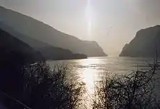 Map of the Iron Gates and the Danube river, which forms the border between Romania and Serbia | |
| Characteristics | |
| Entities | |
| Length | 546.4 kilometres (339.5 mi) |
| History | |
| Established | 1859 (border at the Danube), 1918 (border at Banat) Unification of the Romanian Principalities (1859) Serbian occupation of Banat (1918) |
| Current shape | 1924 Romanian–Yugoslav land swap |
| Treaties | Treaty of Trianon |
Both countries have several border crossing points. Among them are the crossing points of Vrbica–Vălcani, Golubac–Moldova Nouă, Kladovo–Drobeta-Turnu Severin and several others.[3][4] Many of these points were closed in 2020 as a result of the COVID-19 pandemic.[3] The point where the borders of Hungary, Romania and Serbia coincide is known as the "Triplex Confinium". Precisely, the towns that meet each other are Kübekháza (Hungary), Beba Veche (Romania) and Rabe (Serbia).[5]
See also
- Borders of Romania
- Borders of Serbia
- Romanian–Yugoslav land swap
References
- Hitchins, Keith (2014). A concise history of Romania. Cambridge University Press. pp. 1–327. doi:10.1017/CBO9781139033954. ISBN 9780521872386.
- "Romanian Statistical Book" (PDF) (in Romanian). National Institute of Statistics. 2007. pp. 1–879.
- "Serbia a închis mai multe puncte de frontieră cu România". Digi24 (in Romanian). 12 March 2020.
- "Guvernul a decis deschiderea a trei noi puncte de trecere a frontierei între România și Serbia". HotNews (in Romanian). 4 November 2014.
- Iedu, Liliana (17 May 2011). "Sărbătoare în 28 și 29 mai la Triplex Confinium, unde se întâlnesc granițele României, Serbiei și Ungariei!". Opinia Timișoarei (in Romanian).
External links
 Media related to Romania–Serbia border at Wikimedia Commons