Rome, Iowa
Rome is a village in Henry County, Iowa, United States. The population was 117 at the 2010 census.
Rome, Iowa | |
|---|---|
 Rome, Iowa | |
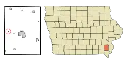 Location of Rome, Iowa | |
| Coordinates: 40°58′59″N 91°40′59″W | |
| Country | |
| State | |
| County | Henry |
| Area | |
| • Total | 0.13 sq mi (0.32 km2) |
| • Land | 0.12 sq mi (0.32 km2) |
| • Water | 0.00 sq mi (0.00 km2) |
| Elevation | 597 ft (182 m) |
| Population | |
| • Total | 117 |
| • Estimate (2019)[3] | 116 |
| • Density | 935.48/sq mi (359.95/km2) |
| Time zone | UTC-6 (Central (CST)) |
| • Summer (DST) | UTC-5 (CDT) |
| ZIP code | 52642 |
| Area code(s) | 319 |
| FIPS code | 19-68565 |
| GNIS feature ID | 0460771 |
History
Rome was first laid out in 1846. In 1866, Rome annexed land across the Skunk River, in order to be connected to the Chicago, Burlington and Quincy Railroad.[4]
Geography
Rome's longitude and latitude coordinates in decimal form are 40.983047, -91.683033.[5]
According to the United States Census Bureau, the village has a total area of 0.13 square miles (0.34 km2), all land.[6] The village is situated on the northwest bank of the Skunk River.
Demographics
| Year | Pop. | ±% |
|---|---|---|
| 1880 | 276 | — |
| 1900 | 255 | −7.6% |
| 1910 | 155 | −39.2% |
| 1920 | 168 | +8.4% |
| 1930 | 144 | −14.3% |
| 1940 | 119 | −17.4% |
| 1950 | 134 | +12.6% |
| 1960 | 117 | −12.7% |
| 1970 | 135 | +15.4% |
| 1980 | 113 | −16.3% |
| 1990 | 124 | +9.7% |
| 2000 | 113 | −8.9% |
| 2010 | 117 | +3.5% |
| 2019 | 116 | −0.9% |
| Source:"U.S. Census website". United States Census Bureau. Retrieved 2020-03-29. and Iowa Data Center Source: | ||
2010 census
At the 2010 census,[2] there were 117 people, 52 households and 26 families living in the village. The population density was 900.0 inhabitants per square mile (347.5/km2). There were 54 housing units at an average density of 415.4 per square mile (160.4/km2). The racial makeup of the village was 97.4% White and 2.6% from other races. Hispanic or Latino of any race were 6.0% of the population.
There were 52 households, of which 23.1% had children under the age of 18 living with them, 34.6% were married couples living together, 5.8% had a female householder with no husband present, 9.6% had a male householder with no wife present, and 50.0% were non-families. 36.5% of all households were made up of individuals, and 13.4% had someone living alone who was 65 years of age or older. The average household size was 2.25 and the average family size was 3.00.
The median age in the village was 42.8 years. 17.1% of residents were under the age of 18; 15.4% were between the ages of 18 and 24; 19.7% were from 25 to 44; 33.4% were from 45 to 64; and 14.5% were 65 years of age or older. The gender makeup of the village was 50.4% male and 49.6% female.
2000 census
At the 2000 census,[8] there were 113 people, 49 households and 27 families living in the village. The population density was 870.5 per square mile (335.6/km2). There were 55 housing units at an average density of 423.7 per square mile (163.4/km2). The racial makeup of the village was 99.12% White, and 0.88% Native American.
There were 49 households, of which 26.5% had children under the age of 18 living with them, 38.8% were married couples living together, 14.3% had a female householder with no husband present, and 42.9% were non-families. 30.6% of all households were made up of individuals, and 4.1% had someone living alone who was 65 years of age or older. The average household size was 2.31 and the average family size was 2.82.
24.8% of the population were under the age of 18, 8.0% from 18 to 24, 34.5% from 25 to 44, 27.4% from 45 to 64, and 5.3% who were 65 years of age or older. The median age was 35 years. For every 100 females, there were 76.6 males. For every 100 females age 18 and over, there were 102.4 males.
The median household income was $22,083 and the median family income was $40,000. Males had a median income of $26,250 compared with $15,625 for females. The per capita income for the village was $12,976. There were 10.0% of families and 27.0% of the population living below the poverty line, including 18.2% of under eighteens and 50.0% of those over 64.
Education
The Mount Pleasant Community School District operates local area public schools.[9]
References
- "2019 U.S. Gazetteer Files". United States Census Bureau. Retrieved July 17, 2020.
- "U.S. Census website". United States Census Bureau. Retrieved 2012-05-11.
- "Population and Housing Unit Estimates". United States Census Bureau. May 24, 2020. Retrieved May 27, 2020.
- The History of Henry County, Iowa: Containing a History of the County, Its Cities, Towns, &c. Western Historical Company. 1879. pp. 549.
- "US Gazetteer files: 2010, 2000, and 1990". United States Census Bureau. 2011-02-12. Retrieved 2011-04-23.
- "US Gazetteer files 2010". United States Census Bureau. Archived from the original on 2012-01-25. Retrieved 2012-05-11.
- "Census of Population and Housing". Census.gov. Retrieved June 4, 2015.
- "U.S. Census website". United States Census Bureau. Retrieved 2008-01-31.
- "Mount Pleasant" (PDF). Iowa Department of Education. Retrieved 2020-07-19.
External links
| Wikimedia Commons has media related to Rome, Iowa. |
- City-Data Comprehensive Statistical Data and more about Rome
Municipalities and communities of Henry County, Iowa, United States | ||
|---|---|---|
| Cities | Map of Iowa highlighting Henry County | |
| Unincorporated community | ||
| Footnotes | ‡This populated place also has portions in an adjacent county or counties | |
| ||
| Authority control |
|---|