Rosneath Peninsula
The Rosneath Peninsula is a peninsula in Argyll and Bute, West of Scotland. Formerly in the historic county of Dunbartonshire, it is formed on its eastern shore from the confluence of the Firth of Clyde with the Gare Loch, and of the Clyde with Loch Long to the west.
| Rosneath Peninsula | |
|---|---|
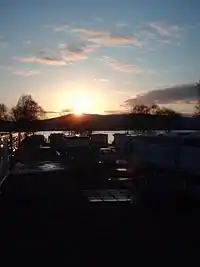
 Sunrise Over Rosneath - geograph.org.uk - 761174 | |
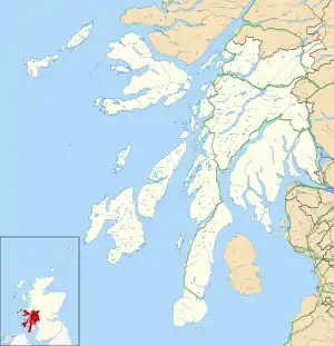
 Rosneath Peninsula Location within Argyll and Bute | |
| OS grid reference | NS 22819 85023 |
| District |
|
| Council area |
|
| Lieutenancy area |
|
| Country | Scotland |
| Sovereign state | United Kingdom |
| Post town | Helensburgh |
| Postcode district | G84 |
| Dialling code | 01436 |
| UK Parliament |
|
| Scottish Parliament |
|
Geography
It is approximately 7 miles (11 kilometres) long (as measured from the head of the Gare Loch) and 3 1⁄2 miles (5.5 kilometres) across at its widest point. The 56th parallel north cuts through the southern end of the peninsula.
Naming
Although named after the small village of Rosneath on its eastern shore, the largest settlements are the contiguous villages of Kilcreggan and Cove at its southernmost tip. During the Victorian era it became a popular destination for wealthy Glasgow businessmen who built luxurious holiday homes along its shore. Rosneath Castle was for a time the residence of Princess Louise, Queen Victoria's daughter. As with many grand houses in the area, it has since been demolished.
Settlements
On the western shore of the peninsula the settlement of Coulport is home to a Royal Navy Armaments Depot, whilst on the eastern shore the hamlet of Rahane overlooks the HMNB Clyde base of the United Kingdom's nuclear weapons.
Transport
Access to the peninsula is either by road (the B833 which runs from Garelochhead to Coulport) or by ferry from Gourock to Kilcreggan, however the ferry is for foot passengers only. During the summer months PS Waverley calls at Kilcreggan pier. The B833 follows the shoreline but two roads cross the peninsula: both un-numbered, one for local traffic from Ardpeaton to Rahane, the other considerably larger and mainly designed for military traffic between Coulport and Faslane.
More recently the area has become a popular destination for cyclists as it is possible to do a circular tour of the peninsula using the military road.[1][2]
