Ruth, North Carolina
Ruth is a town in Rutherford County, North Carolina, United States. The population was 440 at the 2010 census.
Ruth, North Carolina | |
|---|---|
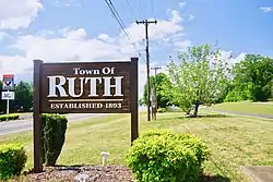 Welcome sign | |
Seal | |
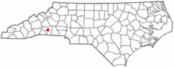 Location of Ruth, North Carolina | |
| Coordinates: 35°23′0″N 81°56′36″W | |
| Country | United States |
| State | North Carolina |
| County | Rutherford |
| Government | |
| • Type | Local-democratically elected |
| • Mayor | David Guy |
| • Commissioners | William Steppe and Nick Goode |
| Area | |
| • Total | 0.42 sq mi (1.10 km2) |
| • Land | 0.42 sq mi (1.10 km2) |
| • Water | 0.00 sq mi (0.00 km2) |
| Elevation | 1,027 ft (313 m) |
| Population (2010) | |
| • Total | 440 |
| • Estimate (2019)[2] | 413 |
| • Density | 974.06/sq mi (375.76/km2) |
| Time zone | UTC-5 (Eastern (EST)) |
| • Summer (DST) | UTC-4 (EDT) |
| ZIP code | 28139 |
| Area code(s) | 828 |
| FIPS code | 37-58420[3] |
| GNIS feature ID | 1022449[4] |
Geography
Ruth is located at 35°22'60" North, 81°56'36" West (35.383224, -81.943365).[5] The town is concentrated around the intersection of the U.S. Route 64 and U.S. Route 74A. Ruth lies immediately northeast of Rutherfordton and northwest of Spindale.
According to the United States Census Bureau, the town has a total area of 0.4 square miles (1.0 km2), all of it land.
Demographics
| Historical population | |||
|---|---|---|---|
| Census | Pop. | %± | |
| 1910 | 205 | — | |
| 1920 | 175 | −14.6% | |
| 1930 | 297 | 69.7% | |
| 1940 | 318 | 7.1% | |
| 1950 | 324 | 1.9% | |
| 1960 | 529 | 63.3% | |
| 1970 | 360 | −31.9% | |
| 1980 | 381 | 5.8% | |
| 1990 | 366 | −3.9% | |
| 2000 | 329 | −10.1% | |
| 2010 | 440 | 33.7% | |
| 2019 (est.) | 413 | [2] | −6.1% |
| U.S. Decennial Census[6] | |||
As of the census[3] of 2000, there were 329 people, 137 households, and 96 families residing in the town. The population density was 749.8 people per square mile (288.7/km2). There were 155 housing units at an average density of 353.2 per square mile (136.0/km2). The racial makeup of the town was 92.10% White, 6.38% Black or African American, 0.61% Native American, no Asian or Pacific Islander, 0.61% from other races, and 0.30% from two or more races. Hispanic or Latino of any race were 1.22% of the population.
There were 137 households, out of which 28.5% had children under the age of 18 living with them, 54.7% were married couples living together, 8.0% had a female householder with no husband present, and 29.2% were non-families. 27.0% of all households were made up of individuals, and 11.7% had someone living alone who was 65 years of age or older. The average household size was 2.40 and the average family size was 2.87.
In the town, the population was spread out, with 20.7% under the age of 18, 10.9% from 18 to 24, 28.3% from 25 to 44, 26.1% from 45 to 64, and 14.0% who were 65 years of age or older. The median age was 39 years. For every 100 females, there were 101.8 males. For every 100 females age 18 and over, there were 91.9 males.
The median income for a household in the town was $32,083, and the median income for a family was $41,500. Males had a median income of $25,688 versus $20,250 for females. The per capita income for the town was $16,402. About 5.8% of families and 7.2% of the population were below the poverty line, including 3.2% of those under age 18 and 14.3% of those age 65 or over.
References
- "2019 U.S. Gazetteer Files". United States Census Bureau. Retrieved July 27, 2020.
- "Population and Housing Unit Estimates". United States Census Bureau. May 24, 2020. Retrieved May 27, 2020.
- "U.S. Census website". United States Census Bureau. Retrieved 2008-01-31.
- "US Board on Geographic Names". United States Geological Survey. 2007-10-25. Retrieved 2008-01-31.
- "US Gazetteer files: 2010, 2000, and 1990". United States Census Bureau. 2011-02-12. Retrieved 2011-04-23.
- "Census of Population and Housing". Census.gov. Retrieved June 4, 2015.
External links
 Media related to Ruth, North Carolina at Wikimedia Commons
Municipalities and communities of Rutherford County, North Carolina, United States | ||
|---|---|---|
| Towns |  | |
| Village | ||
| CDPs | ||
| Unincorporated communities | ||
| ||
| Authority control |
|---|