Sélibaby
Sélibaby is a capital town and department of the Guidimaka Region, Mauritania. It is located at around 15°9′33″N 12°11′00″W. It is divided into a number of "quartiers" which include "College", "Silo", 'Ferlo" , "nezaha" , "saada" , "el jedida" "Bambaradougou" amongst many others. Selibaby also has a regional hospital, funded by the Chinese government and partially staffed by Chinese doctors and is the headquarters of the regional director of health. Selibaby is a centre for NGOs who operate in the region.
Sélibaby | |
|---|---|
Commune and town | |
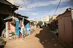 A view from a commercial street in Sélibaby | |
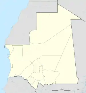 Sélibaby Location in Mauritania | |
| Coordinates: 15°9′33″N 12°11′00″W | |
| Country | |
| Region | Guidimaka Region |
| Area | |
| • Total | 2,000 km2 (800 sq mi) |
| Elevation | 62 m (203 ft) |
| Population (2013 census) | |
| • Total | 26,420 |
Climate
Sélibaby has a hot semi-arid climate (Köppen climate classification BSh). The city is among the wettest in the country, with about 452 mm (17.80 in) of precipitation falling annually. The average annual temperature in Sélibaby is 29.0 °C (84.2 °F).
| Climate data for Selibaby | |||||||||||||
|---|---|---|---|---|---|---|---|---|---|---|---|---|---|
| Month | Jan | Feb | Mar | Apr | May | Jun | Jul | Aug | Sep | Oct | Nov | Dec | Year |
| Average high °C (°F) | 33.5 (92.3) |
36.0 (96.8) |
38.7 (101.7) |
40.7 (105.3) |
41.1 (106.0) |
38.6 (101.5) |
34.7 (94.5) |
33.0 (91.4) |
34.2 (93.6) |
36.9 (98.4) |
36.3 (97.3) |
33.1 (91.6) |
36.4 (97.5) |
| Average low °C (°F) | 15.5 (59.9) |
17.3 (63.1) |
20.6 (69.1) |
24.1 (75.4) |
26.2 (79.2) |
26.2 (79.2) |
24.6 (76.3) |
23.7 (74.7) |
23.5 (74.3) |
22.5 (72.5) |
19.0 (66.2) |
16.5 (61.7) |
21.6 (71.0) |
| Average precipitation mm (inches) | 0 (0) |
1 (0.0) |
0 (0) |
0 (0) |
3 (0.1) |
48 (1.9) |
109 (4.3) |
157 (6.2) |
109 (4.3) |
23 (0.9) |
1 (0.0) |
1 (0.0) |
452 (17.8) |
| Source: Climate-Data.org,Climate data | |||||||||||||