Sablayan
Sablayan (Tagalog pronunciation: [sɐ'blajan]), officially the Municipality of Sablayan (Tagalog: Bayan ng Sablayan), is a 1st class municipality in the province of Occidental Mindoro, Philippines. According to the 2015 census, it has a population of 83,169 people. [3]
Sablayan | |
|---|---|
| Municipality of Sablayan | |
 Barangay Ligaya | |
 Seal | |
| Nickname(s): Heart of Mindoro | |
 Map of Occidental Mindoro with Sablayan highlighted | |
OpenStreetMap 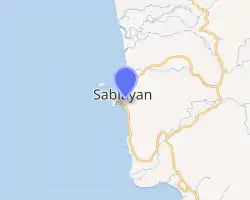
| |
.svg.png.webp) Sablayan Location within the Philippines | |
| Coordinates: 12°50′13″N 120°46′58″E | |
| Country | |
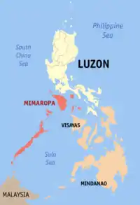
| Region | Mimaropa (Region IV-B) |
| Province | Occidental Mindoro |
| District | Lone District |
| Founded | 1906 |
| Barangays | 22 (see Barangays) |
| Government | |
| • Type | Sangguniang Bayan |
| • Mayor | Andres D. Dangeros |
| • Vice Mayor | Walter B. Marquez |
| • Representative | Josephine R. Sato |
| • Electorate | 45,454 voters (2019) |
| Area | |
| • Total | 2,188.80 km2 (845.10 sq mi) |
| Area rank | 1st |
| Elevation | 150 m (490 ft) |
| Population | |
| • Total | 83,169 |
| • Density | 38/km2 (98/sq mi) |
| • Households | 18,473 |
| Economy | |
| • Income class | 1st municipal income class |
| • Poverty incidence | 28.61% (2015)[4] |
| • Revenue | ₱426,370,654.58 (2016) |
| Time zone | UTC+8 (PST) |
| ZIP code | 5104 |
| PSGC | |
| IDD : area code | +63 (0)43 |
| Climate type | tropical climate |
| Native languages | Alangan Tawbuid language Tagalog |
| Website | www |
It has a total land area of 2,188.80 square kilometers, making it the largest municipality in the Philippines. The Apo Reef, North and South Pandan Islands, and a portion of Mounts Iglit-Baco National Park are part of its jurisdiction. Sablayan Penal Colony, the Philippines' largest penal facility with sprawling lot of 16,190 hectares (40,000 acres) is also located in this municipality.
Geography
Sablayan is located in the central part of Occidental Mindoro. It is bounded to the north by the municipality of Santa Cruz and the municipalities of Baco, Naujan, Victoria and Socorro all in Oriental Mindoro province; to the east by the municipalities of Pinamalayan, Gloria, Bansud, Bongabong and Mansalay also in Oriental Mindoro; to the south by the municipality of Calintaan; and to the west by the Mindoro Strait.
Barangays
Sablayan is politically subdivided into 22 barangays. In 1957 the following barrios were renamed: Batasan to Claudio Salgado, Hinaya to Buhay na Bato (Batong Buhay) and Iriron to San Isidro.[5]
- Batong Buhay
- Buenavista (town proper)
- Burgos
- Claudio Salgado
- General Emilio Aguinaldo
- Ibud
- Ilvita
- Ligaya
- Poblacion (Lumangbayan)
- Paetan
- Pag-Asa
- San Agustin
- San Francisco
- San Nicolas
- San Vicente
- Santa Lucia
- Santo Niño
- Tagumpay
- Victoria
- Lagnas
- Malisbong
- Tuban
Climate
| Climate data for Sablayan, Occidental Mindoro | |||||||||||||
|---|---|---|---|---|---|---|---|---|---|---|---|---|---|
| Month | Jan | Feb | Mar | Apr | May | Jun | Jul | Aug | Sep | Oct | Nov | Dec | Year |
| Average high °C (°F) | 29 (84) |
30 (86) |
31 (88) |
32 (90) |
31 (88) |
30 (86) |
29 (84) |
29 (84) |
29 (84) |
29 (84) |
29 (84) |
29 (84) |
30 (86) |
| Average low °C (°F) | 21 (70) |
21 (70) |
22 (72) |
23 (73) |
25 (77) |
26 (79) |
25 (77) |
25 (77) |
25 (77) |
24 (75) |
23 (73) |
22 (72) |
24 (74) |
| Average precipitation mm (inches) | 42 (1.7) |
31 (1.2) |
49 (1.9) |
71 (2.8) |
249 (9.8) |
368 (14.5) |
426 (16.8) |
350 (13.8) |
381 (15.0) |
292 (11.5) |
144 (5.7) |
80 (3.1) |
2,483 (97.8) |
| Average rainy days | 10.2 | 8.3 | 11.7 | 15.9 | 25.2 | 27.5 | 28.9 | 27.0 | 27.5 | 26.0 | 18.2 | 13.0 | 239.4 |
| Source: Meteoblue [6] | |||||||||||||
History

The town used to be called Dongon, a coastal village located currently at Barangay San Nicolas. The first accounts of the baptism of the locals under the Recollects were recorded in 1670. By 1749, Dongon became the biggest pueblo in the whole island of Mindoro in terms of population.
In 1754, the Moro pirates started attacking the town, and almost every year thereafter, until in 1791 when the Moros effectively wiped out the whole population from more than 600 inhabitants to less than 98 souls.
In 1814, the inhabitants of Dongon gradually transferred to the village of Sablayan, until Dongon ceased to become a village in 1829.[7] In 1832, the missionary friar Simeon Mendoza de la V. de Ibernalo[8] requested the Spanish government for the exemption of the town's inhabitants from paying taxes so that they could build a stone church, convent and fort at a hilly part of the village. The church that stands today at the town may have been built from 1832–1835, and its advocacy was placed under San Sebastian.
Demographics
| Year | Pop. | ±% p.a. |
|---|---|---|
| 1918 | 3,078 | — |
| 1939 | 2,861 | −0.35% |
| 1948 | 3,332 | +1.71% |
| 1960 | 12,685 | +11.78% |
| 1970 | 18,256 | +3.70% |
| 1975 | 31,117 | +11.29% |
| 1980 | 36,699 | +3.35% |
| 1990 | 46,546 | +2.41% |
| 1995 | 55,573 | +3.38% |
| 2000 | 63,685 | +2.96% |
| 2007 | 70,506 | +1.41% |
| 2010 | 76,153 | +2.84% |
| 2015 | 83,169 | +1.69% |
| Source: Philippine Statistics Authority [3] [9] [10][11] | ||
List of former mayors
- Juan Daño (1907—1910)
- Santiago Dangeros (1913–1918)
- Policarpio Urieta (1919–1921)
- Benigno Lontoc (1922–1924)
- Maximo Papa (1925–1927, 1938–1940)
- Hermogenes Daño (1928–1930)
- Lucas Fernandez (1931–1933)
- Primitovo Zamora (1934–1937)
- Pedro Gonzales (1941–1947, 1972–1986)
- Paulino Legaspi Sr. (1948–1951)
- Loreto Urieta (1952–1959, 1964–1971)
- Floresto Cariaga Sr. (1959–1960)
- Leoncio Ordenes Sr. (1960–1963)
- Godofredo B. Mintu (1986–1998, 2001–2010)
- Andres D. Dangeros (1998–2001, 2019–present)
- Eduardo B. Gadiano (2010–2019)
Culture
Held once a year the Dugoy Festival is a celebration of the Mangyan culture.
References
- Municipality of Sablayan | (DILG)
- "Province: Occidental Mindoro". PSGC Interactive. Quezon City, Philippines: Philippine Statistics Authority. Retrieved 12 November 2016.
- Census of Population (2015). "Region IV-B (Mimaropa)". Total Population by Province, City, Municipality and Barangay. PSA. Retrieved 20 June 2016.
- "PSA releases the 2015 Municipal and City Level Poverty Estimates". Quezon City, Philippines. Retrieved 12 October 2019.
- "An Act Changing the Names of Certain Barrios in the Municipality of Sablayan, Province of Occidental Mindoro". Retrieved 2011-04-12 – via LawPH.com.
- "Sablayan: Average Temperatures and Rainfall". Meteoblue. Retrieved 26 April 2020.
- Candelario, Rudy. "History of the Town of Sablayan". sites.google.com/site/occidentalmindorohistory.
- Provincia de San Nicolas de Tolentino de Agustinos Descalzos de la Congregacion de España e Indias (in Spanish). Manila: Imprenta del Colegio de Santo Tomas. 1879. pp. 118–119 – via bne.es.
- Census of Population and Housing (2010). "Region IV-B (Mimaropa)". Total Population by Province, City, Municipality and Barangay. NSO. Retrieved 29 June 2016.
- Censuses of Population (1903–2007). "Region IV-B (Mimaropa)". Table 1. Population Enumerated in Various Censuses by Province/Highly Urbanized City: 1903 to 2007. NSO.
- "Province of Occidental Mindoro". Municipality Population Data. Local Water Utilities Administration Research Division. Retrieved 17 December 2016.
External links
| Wikimedia Commons has media related to Sablayan. |
- Sablayan Profile at PhilAtlas.com
- Philippine Standard Geographic Code
- Philippine Census Information
- Local Governance Performance Management System
Places adjacent to Sablayan | |
|---|---|