Saguache County Road T
Saguache County Road T is a county road in Saguache County, Colorado in the San Luis Valley of Colorado. It is "T" in a series of alphabetically named east-west roads which begin at State Highway 112, the south boundary of Saguache County, which would be Road A, if it were not a state highway. Road T is a through road across the valley, crossing U.S. Highway 285 at Swede's Corners about 6 miles south of Saguache, Colorado but is paved only from Moffat, Colorado east 12.5 miles to Crestone, Colorado.[1] The eastern portion of Road T forms the north boundary of the Baca National Wildlife Refuge.
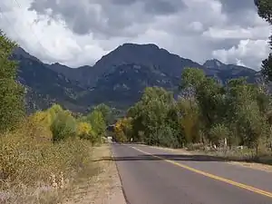
Approach to Crestone at the east end of Road T. The square topped mountain is Kit Carson Mountain, the peak on the right is Crestone Peak.
Notes
- Directions to Crestone Music Festival Archived 2010-09-25 at the Wayback Machine
Gallery
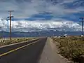 Road T east from Moffat
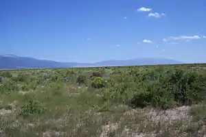 View of rangeland on the Baca National Wildlife Refuge
External links
This article is issued from Wikipedia. The text is licensed under Creative Commons - Attribution - Sharealike. Additional terms may apply for the media files.
