Salavat, Russia
Salavat (Russian: Салава́т; Bashkir: Салауат) is a city in the Republic of Bashkortostan, Russia. Population: 156,095 (2010 Census);[1] 158,600 (2002 Census);[7] 149,627 (1989 Census).[8]
Salavat
Салават | |
|---|---|
City | |
| Other transcription(s) | |
| • Bashkir | Салауат |
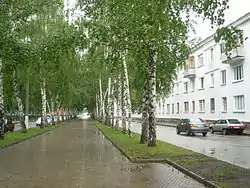 Neftyanikov Street | |
 Flag 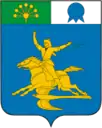 Coat of arms | |
Location of Salavat 
| |
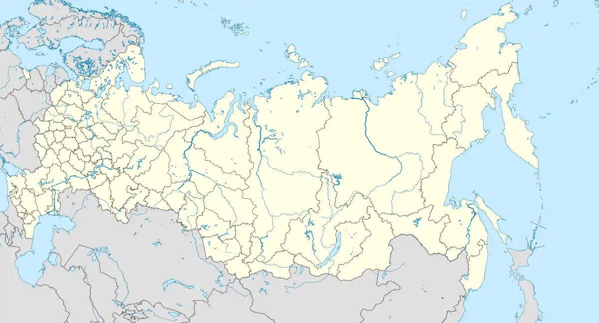 Salavat Location of Salavat 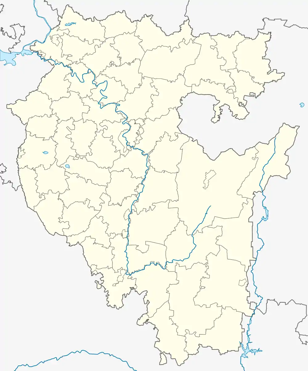 Salavat Salavat (Bashkortostan) | |
| Coordinates: 53°22′N 55°56′E | |
| Country | Russia |
| Federal subject | Bashkortostan |
| Founded | 1948 |
| City status since | 1954 |
| Government | |
| • Body | City Duma |
| • Head | Farid Gilmanov |
| Elevation | 150 m (490 ft) |
| Population | |
| • Total | 156,095 |
| • Estimate (2018)[2] | 152,354 (−2.4%) |
| • Rank | 113th in 2010 |
| • Subordinated to | city of republic significance of Salavat[3] |
| • Capital of | city of republic significance of Salavat[3] |
| • Urban okrug | Salavat Urban Okrug[4] |
| • Capital of | Salavat Urban Okrug[4] |
| Time zone | UTC+5 (MSK+2 |
| Postal code(s)[6] | 453250 |
| Dialing code(s) | +7 3476 |
| OKTMO ID | 80739000001 |
| Website | archive |
History
The city is named after the Bashkir national hero Salawat Yulayev. It was founded in 1948 and granted town status in 1954.
Administrative and municipal status
Within the framework of administrative divisions, it is incorporated as the city of republic significance of Salavat—an administrative unit with the status equal to that of the districts.[3] As a municipal division, the city of republic significance of Salavat is incorporated as Salavat Urban Okrug.[4]
Economy
The city was founded to provide accommodation for the Gazprom Neftekhim Salavat petrochemical plant which is the local main employer. There are also other factories including a glass factory and textile and clothing factories.
Major center of oil refining and petrochemical industries (Salavatnefteorgsintez, produces liquid fuels, alcohols, butyl, polyethylene of high pressure, nitrogen fertilizers, etc.), the processing capacity of the complex - 11.7 million tons a year.
Oil refinery complex near pipelines associated with oil fields Ishimbay, Shkapova, Arlan, with gas fields (Kargaly, Orenburg region), condensate (Karachaganak, Kazakhstan), as well as chemical enterprises Sterlitimak.
Also in town there are the plants "Salavatneftemash, car repair and experimental prototype for the production of steel structures. In addition, operating a large plant for the production of technical glass (JSC Salavatsteklo "), enterprises for the production of concrete and mineral wool products, garment factory, factories, hunting equipment and jerseys. There are foods and woodworking production.
Government
The Head of the Administration is Farit Farrakhovich Gilmanov. Larisa Vladimirovna Davydova serves as the Head of Salavat Urban Okrug and the Chairman of Salavatsky Municipal District.
Education and culture
The city has twenty-six secondary educational institutions, including three high schools, three lyceums, one boarding school, and nineteen secondary schools. Music and arts schools are also present.
A branch of the Ufa State Petroleum Technical University operates in the city.
Cultural facilities include the Bashkir Drama Theater, four palaces of culture, a movie theater, a museum, and an art gallery.
References
Notes
- Russian Federal State Statistics Service (2011). "Всероссийская перепись населения 2010 года. Том 1" [2010 All-Russian Population Census, vol. 1]. Всероссийская перепись населения 2010 года [2010 All-Russia Population Census] (in Russian). Federal State Statistics Service.
- "26. Численность постоянного населения Российской Федерации по муниципальным образованиям на 1 января 2018 года". Federal State Statistics Service. Retrieved January 23, 2019.
- Resolution #391
- Law #162-z
- "Об исчислении времени". Официальный интернет-портал правовой информации (in Russian). June 3, 2011. Retrieved January 19, 2019.
- Почта России. Информационно-вычислительный центр ОАСУ РПО. (Russian Post). Поиск объектов почтовой связи (Postal Objects Search) (in Russian)
- Russian Federal State Statistics Service (May 21, 2004). "Численность населения России, субъектов Российской Федерации в составе федеральных округов, районов, городских поселений, сельских населённых пунктов – районных центров и сельских населённых пунктов с населением 3 тысячи и более человек" [Population of Russia, Its Federal Districts, Federal Subjects, Districts, Urban Localities, Rural Localities—Administrative Centers, and Rural Localities with Population of Over 3,000] (XLS). Всероссийская перепись населения 2002 года [All-Russia Population Census of 2002] (in Russian).
- "Всесоюзная перепись населения 1989 г. Численность наличного населения союзных и автономных республик, автономных областей и округов, краёв, областей, районов, городских поселений и сёл-райцентров" [All Union Population Census of 1989: Present Population of Union and Autonomous Republics, Autonomous Oblasts and Okrugs, Krais, Oblasts, Districts, Urban Settlements, and Villages Serving as District Administrative Centers]. Всесоюзная перепись населения 1989 года [All-Union Population Census of 1989] (in Russian). Институт демографии Национального исследовательского университета: Высшая школа экономики [Institute of Demography at the National Research University: Higher School of Economics]. 1989 – via Demoscope Weekly.
Sources
- Правительство Республики Башкортостан. Постановление №391 от 29 декабря 2006 г. «Об утверждении реестра административно-территориальных единиц и населённых пунктов Республики Башкортостан», в ред. Постановления №61 от 26 февраля 2013 г. «О внесении изменений в реестр административно-территориальных единиц и населённых пунктов Республики Башкортостан». Опубликован: "Ведомости Государственного Собрания – Курултая, Президента и Правительства Республики Башкортостан", №5 (251), ст. 239, 12 марта 2007 г. (Government of the Republic of Bashkortostan. Resolution #391 of December 29, 2006 On Adoption of the Registry of the Administrative-Territorial Entities and Inhabited Localities of the Republic of Bashkortostan, as amended by the Resolution #61 of February 26, 2013 On Amending the Registry of the Administrative-Territorial Entities and Inhabited Localities of the Republic of Bashkortostan. ).
- Государственное Собрание —Курултай Республики Башкортостан. Закон №162-з от 17 декабря 2004 г. «О границах, статусе и административных центрах муниципальных образований в Республике Башкортостан», в ред. Закона №572-з от 17 июля 2012 г. «О внесении изменения в статью 2 Закона Республики Башкортостан "О границах, статусе и административных центрах муниципальных образований в Республике Башкортостан"». Вступил в силу в соответствии со статьёй 33. Опубликован: "Республика Башкортостан", №52 (25785), 22 марта 2005 г. (State Assembly of Bashkortostan—El Kurultai. Law #162-z of December 17, 2004 On the Borders, Status, and Administrative Centers of the Municipal Formations in the Republic of Bashkortostan, as amended by the Law #572-z of July 17, 2012 On Amending Article 2 of the Law of the Republic of Bashkortostan "On the Borders, Status, and Administrative Centers of the Municipal Formations in the Republic of Bashkortostan". Effective as of the date established in accordance with the provisions of Article 33.).
Administrative divisions of the Republic of Bashkortostan | ||
|---|---|---|
| Administrative districts |
| |
| Cities and towns (all levels) | ||
| Urban-type settlements | ||