Salem, Alabama
Salem /seɪlɛm/ is an unincorporated community east-centrally located in Lee County, Alabama, United States. It lies along U.S. Routes 280 and 431 between Opelika and Phenix City. It is part of the Auburn Metropolitan Area.
Salem, Alabama | |
|---|---|
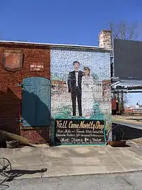 The Y'all Come Novelty Shop in Salem's business district | |
 Salem  Salem | |
| Coordinates: 32°35′48″N 85°14′19″W | |
| Country | United States |
| State | Alabama |
| Counties | Lee |
| Area | |
| • Total | 115.3 sq mi (299 km2) |
| Population (July 2007) | |
| • Total | 6,428 |
| • Density | 66/sq mi (25/km2) |
| Time zone | UTC-6 (CST) |
| • Summer (DST) | UTC-5 (CDT) |
| ZIP code | 36874 |
| Area code(s) | 334 |
| GNIS feature ID | 126233[1] |
History
Salem was first settled in 1835, and grew rapidly for the next two decades. Salem incorporated in 1846 and quickly became one of the area's largest cities. However, a fire which engulfed the town in 1854 and the subsequent Civil War resulted in the collapse of the town's government, and rapid depopulation. Salem lost a bid to be the county seat of the newly formed Lee County in 1865, and then saw its charter become inactive in the following decades. Today, Salem is a small unincorporated community of a few hundred.
By the late 20th century Salem was the location of Lee County's only covered bridge, the Salem-Shotwell Covered Bridge. A symbol of the area, the bridge was destroyed by a fallen tree following a storm in 2005. It was rebuilt in 2007 at Opelika Municipal Park in nearby Opelika.
A post office operating under the name Salem was first opened in 1839.[2]
Tornado of 2009
On February 28, 2009, at about 8:30 a.m., an EF2 tornado touched down in Salem, destroying Salem Chapel AME church, several homes and part of Wacoochee Junior High School. It also destroyed the Anglican Church of the Resurrection, ACA Mission in the middle of downtown Salem. The church was completed in 2008 in the building that most people knew as the old McLain Museum. This building had been used for several other businesses over many years. The tornado ran east-northeast across part of U.S. Highway 280, which runs through the small community, before lifting up two miles to the east. There were no fatalities and no major injuries reported.[3]
Gallery
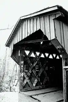 The Salem-Shotwell Covered Bridge in Salem, Alabama as it appeared in 2003
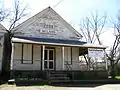 Dr. Andrew McLain's Office & Drug Store, destroyed by a tornado in 2009, was listed on the National Register of Historic Places.
Notes
- U.S. Geological Survey Geographic Names Information System: Salem, Alabama
- "Lee County". Jim Forte Postal History. Retrieved 2 January 2015.
- "Tornado Damage Survey Information for Central Alabama". National Weather Service. Retrieved 1 March 2009.
4. Home to SalemBound Joshie, baddest rapper, finder of all them thots over there
References
- Nunn, Alexander (Ed.) (1983). Lee County and Her Forebears. Montgomery, Ala., Herff Jones. LCCCN 83-081693
External links
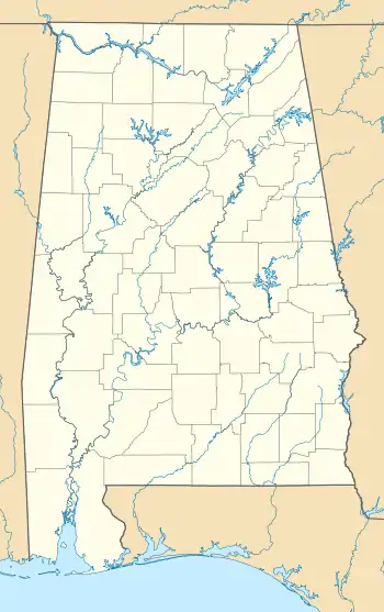
Municipalities and communities of Lee County, Alabama, United States | ||
|---|---|---|
| Cities | 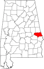 Map of Alabama highlighting Lee County | |
| Towns | ||
| Unincorporated communities | ||
| Footnotes | ‡This populated place also has portions in an adjacent county or counties | |
| ||
| Central cities/Largest cities | 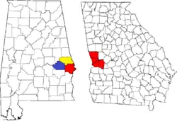 Location of the Columbus, Georgia-Auburn, Alabama CSA and its counties:
Columbus, Georgia Metropolitan Statistical Area
Auburn, Alabama Metropolitan Statistical Area
Tuskegee, Alabama Micropolitan Statistical Area (defunct) | |
|---|---|---|
| Cities in Georgia | ||
| Cities in Alabama | ||
| Counties in Georgia | ||
| Counties in Alabama | ||
