Samar
Samar (/ˈsɑːmɑːr/ SAH-mar) is the third-largest island in the Philippines. It is located in the eastern Visayas, which are in the central Philippines. The island is divided into three provinces: Samar (which consists of the western two-fifths of the island of Samar), Northern Samar, and Eastern Samar. These three provinces, along with the provinces on the nearby islands of Leyte and Biliran, are part of the Eastern Visayas region.
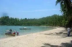 Panapukan Beach on Samar | |
 Location within the Philippines | |
| Geography | |
|---|---|
| Coordinates | 12°00′N 125°00′E |
| Archipelago | Visayas |
| Adjacent bodies of water | |
| Area | 13,428.8 km2 (5,184.9 sq mi)[1] |
| Area rank | 63rd |
| Coastline | 800.6 km (497.47 mi)[2] |
| Highest elevation | 890 m (2920 ft) |
| Highest point | Mount Huraw |
| Administration | |
| Region | Eastern Visayas |
| Provinces | |
| Largest settlement | Calbayog (pop. 183,851) |
| Demographics | |
| Population | 1,751,267 (2010)[3] |
| Pop. density | 130.4/km2 (337.7/sq mi) |
Samar is the easternmost island in the Visayas. It lies to the northeast of Leyte, separated from it only by the San Juanico Strait, which at its narrowest point is only about 2 kilometres (1.2 mi) across; the strait is spanned by the San Juanico Bridge. And it lies to the southeast of the Bicol Peninsula on Luzon, separated from it only by the San Bernardino Strait.
To Samar’s south is the Leyte Gulf, the site of one of the most consequential naval battles of World War II. And to the north and east of Samar lies the Philippine Sea, part of the Pacific Ocean.
About a third of the island of Samar is protected as a natural park, known as the Samar Island Natural Park.
On June 19, 1965, through Republic Act No. 4221, Samar was divided into three provinces: Northern Samar, Western Samar and Eastern Samar. The capitals of the provinces are, respectively, Catarman, Catbalogan City, and Borongan City.[4] In commemoration of the establishment of these provinces, June 19 is celebrated as an annual holiday and many have the day off from work.
Geography
Samar is the third-largest island in the Philippines by area, after the islands of Luzon and Mindanao. Mount Huraw is Samar’s highest point, with an elevation of 2,920 ft (890 m).
Topography
List of the highest peaks on Samar island (in order of elevation).
- Mount Huraw 2,920 ft (890 m)
- Mount Capotoan 2,749 ft (838 m)
- Mount Mactaon 2,208 ft (673 m)
- Mount Pagcem 1,998 ft (609 m)
- Mount Yagcem 1,991 ft (607 m)
- Mount Canyaba 1,936 ft (590 m)
- Mount Bingo 1,798 ft (548 m)
- Mount Saamong 1,686 ft (514 m)
- Mount Bihag 1,486 ft (453 m)
- Mount Capoto-on 1,247 ft (380 m)
River System
List of major rivers on Samar Island (in order of by length).
- Pambujan River 156 km (97 mi)
- Dolores River 105 km (65 mi)
- Catubig River 82.2 km (51.1 mi)
- Oras River 82 km (51 mi)
- Gandara River 77.4 km (48.1 mi)
- Victoria River 40 km (25 mi)
History
Spanish contact
Samar was the first island of the Philippines sighted by the Spanish expedition led by Ferdinand Magellan. He sighted it on 16 March 1521, having sailed there from the Mariana Islands. Realizing he had arrived at an archipelago, he charted the islands, and called them San Lazaro (Saint Lazarus in English) because they were sighted on Lazarus Saturday. The Spaniards later called the island Filipinas, while the Portuguese called it Lequios. Although Samar was the first island of the Philippines sighted by Magellan, he did not land there. He continued south, weighed anchor at Suluan Island, and then finally, on 17 March 1521, he landed on Homonhon Island.[5]
Years later, other Spanish expeditions arrived. The historian William Henry Scott wrote that a "Samar datu by the name of Iberein was rowed out to a Spanish vessel anchored in his harbor in 1543 by oarsmen collared in gold; while wearing on his own person earrings and chains." Scott recounted a local saga, which the inhabitants called siday, about Bingi of Lawan, a prosperous Lakanate in Samar, and he also recorded that Datu Hadi Iberein came from the Lakanate of Lawan.[6]
Philippine-American War
The final campaign of the Philippine–American War (1899-1902) took place in Samar and is one of the best known, and most notorious, of the entire war. A combination of factors resulted in particularly violent clashes.
Balangiga encounter
On September 28, 1901, Eugenio Daza, Area Commander of Southeastern Samar and Valeriano Abanador, the town's police chief, launched an attack on U.S. Army Company C 9th Infantry Regiment who were occupying Balangiga. The Filipino Forces brought one of the only Filipino victories of the war and the worst American defeat in decades.
In 1989, "Balangiga Encounter Day" was established as a provincial holiday in Eastern Samar to celebrate the Balangiga Encounter victory.[7][8]
March across Samar
The Balangiga Encounter resulted in the brutal March across Samar.
"I want no prisoners. I wish you to kill and burn; the more you kill and burn, the better it will please me ... The interior of Samar must be made a howling wilderness ..." — Gen. Jacob H. Smith
Thousands of Filipinos were slaughtered by American Marines.
In his history of the war,[9] Brian McAllister Linn asserts "Samar cast a pall on the army's achievement and, for generations, has been associated in the public mind as typifying the Philippine War."
World War II
The waters off the east side of the island also hosted the Battle off Samar on October 25, 1944, wherein a small, unarmored force of United States Navy escorts fought off the center force of the Imperial Japanese Navy, including the Japanese battleship Yamato.
References
- "2010 Philippine Yearbook" (PDF). Philippine Yearbook (23rd ed.). Manila, Philippines: National Statistics Office. ISSN 0116-1520. Retrieved 2015-12-14.
- "Islands of Philippines". Island Directory. United Nations Environment Programme. Retrieved 18 September 2015.
- "Population and Annual Growth Rates for The Philippines and Its Regions, Provinces, and Highly Urbanized Cities" (PDF). 2010 Census and Housing Population. National Statistics Office. Retrieved 18 September 2015.
- "PHILIPPINE LAWS, STATUTES AND CODES - CHAN ROBLES VIRTUAL LAW LIBRARY". Ronald Echalas Diaz, Chan Robles & Associates Law Firm.
- Parr, Charles McKew So Noble a Captain: The Life and Times of Ferdinand Magellan Thomas Y. Crowell, New York, 1953. p.431
- Scott, William Henry (1985). Cracks in the parchment curtain and other essays in Philippine history. New Day Publishers. p. 93. ISBN 978-971-10-0073-8.
- Ermita, Eduardo R. (September 26, 2008). "Proclamation No. 1629, s. 2008". Official Gazette of the Republic of the Philippines.
- "Republic Act No. 6692". Official Gazette of the Republic of the Philippines. February 10, 1989.
- Linn, Brian McAllister (2000). The Philippine War 1899-1902. Lawrence, Kansas 66049: University Press of Kansas. p. 321. ISBN 0-70061225-4.CS1 maint: location (link)
External links
 Media related to Samar Island at Wikimedia Commons
 Samar Island travel guide from Wikivoyage