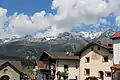
Samnaun Alps
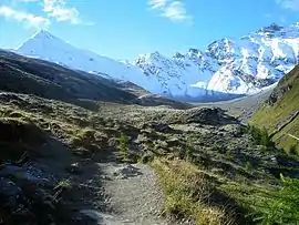
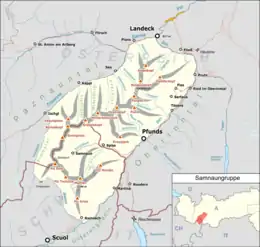
The Samnaun Alps are a mountain range of the Central Eastern Alps, named after the Swiss municipality of Samnaun. They are located at the border of the Austrian state of Tyrol and the Graubünden canton of Switzerland.
| Samnaun Alps | |
|---|---|
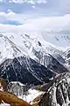
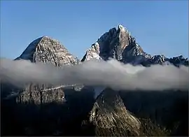
 Muttler (left) and Piz Tschütta (right) | |
| Highest point | |
| Peak | Muttler |
| Elevation | 3,293 m (10,804 ft) |
| Coordinates | 46°54′1″N 10°22′42″E |
| Geography | |
| |
| Countries | Austria and Switzerland |
| States | Tyrol and Graubünden |
| Parent range | Central Eastern Alps |
| Borders on | Verwall Alps, Silvretta, Sesvenna Range and Ötztal Alps |
The Samnaun Alps are separated from the Sesvenna Alps in the south by the Engadine Valley; from the Silvretta Alps in the west by the Fimber Pass; from the Verwall Alps and the Lechtal Alps in the north by the Paznauntal; from the Ötztal Alps in the east by the Inn valley. All the range is drained by the river Inn, through the Trisanna, Schergenbach, Brancla and Fimbabach.
Peaks
The range includes the following peaks:
| Peak | Elevation (m/ft) | |
|---|---|---|
| Muttler | 3293 | 10,804 |
| Piz Tschütta | 3258 | 10,689 |
| Piz Mundin | 3146 | 10,322 |
| Vesilspitze | 3115 | 10,220 |
| Piz Rots | 3097 | 10,161 |
| Vesulspitze | 3092 | 10,145 |
| Hexenkopf | 3038 | 9,968 |
| Piz Malmurainza | 3038 | 9,968 |
| Bürkelkopf | 3033 | 9,951 |
| Gemspleiskopf | 3017 | 9,899 |
| Furgler | 3004 | 9,856 |
| Rothbleiskopf | 2938 | 9,640 |
| Flimspitz | 2929 | 9610 |
| Grübelekopf | 2894 | 9495 |
For a list of passes, see Passes of the Silvretta and Rätikon Ranges.
.jpg.webp)
See also
This article is issued from Wikipedia. The text is licensed under Creative Commons - Attribution - Sharealike. Additional terms may apply for the media files.