San Fernando, Chile
San Fernando is the capital of the province of Colchagua, in central Chile, and the second most populated urban center of the O'Higgins Region. Located close to the Tinguiririca River (a tributary of the Rapel) in a fertile valley, San Fernando sits 339 m (1,112 feet) above sea level. Founded in 1742, it became the provincial capital in 1840.
San Fernando | |
|---|---|
.jpg.webp) San Fernando's central plaza. | |
.svg.png.webp) Coat of arms 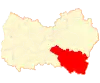 Map of San Fernando commune in O'Higgins Region 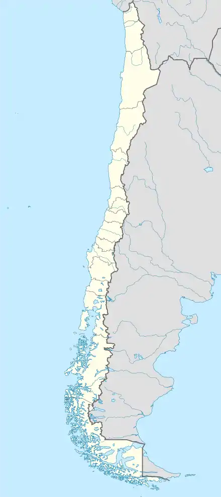 San Fernando Location in Chile | |
| Coordinates (city): 34°35′S 70°59′W | |
| Country | |
| Region | |
| Province | |
| Founded | 1742 |
| Founded by | José Antonio Manso de Velasco |
| Government | |
| • Type | Municipality |
| • Alcalde | Luis Berwart Araya (Independent) |
| Area | |
| • Total | 2,441.3 km2 (942.6 sq mi) |
| Elevation | 89 m (292 ft) |
| Population (2017 Census)[2] | |
| • Total | 73,973 |
| • Density | 30/km2 (78/sq mi) |
| Demonym(s) | Sanfernandian |
| Sex | |
| • Men | 36,077 |
| • Women | 37,896 |
| Time zone | UTC-4 (CLT [3]) |
| • Summer (DST) | UTC-3 (CLST [4]) |
| Postal code | 3070000 |
| Area code(s) | +56 72 |
| Website | Official website (in Spanish) |
Culture
San Fernando is famous for its rodeos, thanks to its location at the heart of the country. The surrounding area yields wheat, forage crops, rice, legumes and grapes. There is also a brand of Chilean wine called San Fernando. Both the Pan-American Highway and Chile's main longitudinal railroad run through San Fernando.
San Fernando is located at the northern tip of Chile's Colchagua Valley. This region is popularly known as the heart of chilean agriculture. Here you can find the "wine route" which will take visitors on a journey from San Fernando to Santa Cruz, visiting some of Chile's most traditional vineyards.
Some major attractions in and around San Fernando include Casa Silva, a hotel, vineyard, and winery. Hacienda Los Lingues, a traditional chilean-style, colonial home of an hacienda "patrón" or owner that has been turned into a hotel and restaurant. The hacienda offers horseback riding adventures into the precordillera of the Andes.
Most major producers of fresh fruit for export are located in and around San Fernando. These include: Frusan, Unifruti, and Agricola Panagro. Within the orchards and farms of the region one can find almost every type of fresh produce; from citrus to premium quality fresh cherries.
San Fernando is also the point of departure to begin a trip to "Las Termas Del Flaco" (The thermal baths of Flaco). Flaco can be reached by travelling east of ruta 5 on the road to Puente Negro. "Las Termas" baths are open from mid-December to April and are located in an area famous for its large populations of Tricahues, a type of native parrot,[5] and fossilized dinosaur footprints.
Demographics
According to the 2017 census of the National Statistics Institute, San Fernando spans an area of 2,441.3 km2 (943 sq mi) and has 73,973 inhabitants (36,077 men and 37,896 women). The population grew by 16.1% (11,881 persons) between the 2002 and 2017 censuses.[2]
Administration
As a commune, San Fernando is a third-level administrative division of Chile administered by a municipal council, headed by an alcalde who is directly elected every four years. The 2013-2017 alcalde is Luis Antonio Berwart Araya (Independent).[1]
Within the electoral divisions of Chile, San Fernando is represented in the Chamber of Deputies by Mr. Javier Macaya (UDI) and Ms. Alejandra Sepúlveda (PDC) as part of the 34th electoral district, (together with San Fernando, Chimbarongo, San Vicente, Peumo, Pichidegua and Las Cabras). The commune is represented in the Senate by Alejandro García-Huidobro (UDI) and Juan Pablo Letelier Morel (PS) as part of the 9th senatorial constituency (O'Higgins Region).
Climate
| Climate data for San Fernando | |||||||||||||
|---|---|---|---|---|---|---|---|---|---|---|---|---|---|
| Month | Jan | Feb | Mar | Apr | May | Jun | Jul | Aug | Sep | Oct | Nov | Dec | Year |
| Average high °C (°F) | 28 (82) |
27 (80) |
24 (76) |
20 (68) |
15 (59) |
12 (54) |
12 (54) |
14 (57) |
16 (61) |
19 (67) |
23 (73) |
26 (79) |
20 (68) |
| Average low °C (°F) | 13 (55) |
12 (54) |
11 (51) |
8 (46) |
6 (43) |
4 (40) |
4 (39) |
4 (40) |
6 (42) |
8 (46) |
9 (49) |
12 (53) |
8 (47) |
| Average precipitation mm (inches) | 7.6 (0.3) |
7.6 (0.3) |
13 (0.5) |
30 (1.2) |
140 (5.5) |
210 (8.2) |
150 (6) |
120 (4.7) |
61 (2.4) |
28 (1.1) |
23 (0.9) |
7.6 (0.3) |
790 (31.2) |
| Source: Weatherbase [6] | |||||||||||||
Gallery
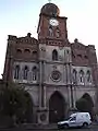 San Francisco Church.
%252C_2005.jpg.webp) Gobernación de Colchagua.
Gobernación de Colchagua.
References
- "Municipality of San Fernando" (in Spanish). Retrieved 13 December 2010.
- "National Statistics Institute" (in Spanish). Retrieved 20 February 2018.
- "Chile Time". WorldTimeZones.org. Archived from the original on 2007-09-11. Retrieved 2010-07-28.
- "Chile Summer Time". WorldTimeZones.org. Archived from the original on 2007-09-11. Retrieved 2010-07-28.
- http://www.turismovillarrica.cl/english/birds.html#loro
- "Weatherbase: Historical Weather for San Fernando, Chile". Weatherbase. 2011. Retrieved on November 24, 2011.
External links
| Wikimedia Commons has media related to San Fernando, Chile. |
- (in Spanish) Municipality of San Fernando
- (in Spanish) Information about San Fernando
- . New International Encyclopedia. 1905.
| Cachapoal |  | |
|---|---|---|
| Cardenal Caro | ||
| Colchagua | ||
Provincial capitals in italics • Regional capital in bold | ||