San Vicente de Tagua Tagua
San Vicente de Tagua Tagua, or just San Vicente, is a Chilean commune and city in Cachapoal Province, O'Higgins Region.
San Vicente de Tagua Tagua | |
|---|---|
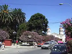 Northeast of "Plaza de San Vicente" in 2005 | |
 Map of the commune of San Vicente in O'Higgins Region 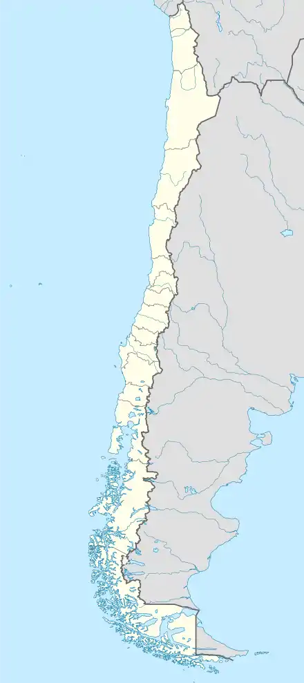 San Vicente de Tagua Tagua Location in Chile | |
| Coordinates: 34°26′22″S 71°04′34″W | |
| Country | Chile |
| Region | O'Higgins |
| Province | Cachapoal |
| Founded | 1845 |
| Founded by | Carmen Gallegos de Robles |
| Government | |
| • Type | Municipality |
| Area | |
| • Total | 475.8 km2 (183.7 sq mi) |
| Elevation | 206 m (676 ft) |
| Population (2012 Census)[3] | |
| • Total | 44,046 |
| • Density | 93/km2 (240/sq mi) |
| • Urban 2002 | 21,965 |
| • Rural 2002 | 18,288 |
| Sex (2002) | |
| • Men | 20,095 |
| • Women | 20,158 |
| Time zone | UTC-4 (CLT [4]) |
| • Summer (DST) | UTC-3 (CLST [5]) |
| Area code(s) | (+56) 72 |
| Website | Official website (in Spanish) |
Demographics
According to the 2002 census of the National Statistics Institute, San Vicente spans an area of 475.8 km2 (184 sq mi) and had 40,253 inhabitants (20,095 men and 20,158 women). Of these, 21,965 (54.6%) lived in urban areas and 18,288 (45.4%) in rural areas. The population grew by 14.5% (5,086 persons) between the 1992 and 2002 censuses.[2] The 2012 census reported 44,046 inhabitants, an increase of 9.4% from 2002 to 2012.[3]
Administration
As a commune, San Vicente is a third-level administrative division administered by a municipal council, headed by an alcalde who is directly elected every four years.
Within the electoral divisions of Chile, San Vicente is represented in the Chamber of Deputies by Mrs. Alejandra Sepúlveda (PRI) and Mr. Javier Macaya (UDI) as part of the 34th electoral district, (together with San Fernando, Chimbarongo, San Vicente, Peumo, Pichidegua and Las Cabras). The commune is represented in the Senate by Andrés Chadwick Piñera (UDI) and Juan Pablo Letelier Morel (PS) as part of the 9th senatorial constituency (O'Higgins Region).
Archaeology
Tagua-Tagua represents a very early Paleo-Indian archaeological site, and it is dated to 11,380 ±380 14C yr BP (before present).[6]
This is an ancient pleistocene site where humans butchered large animals that they hunted. The site was discovered in the 1860s.
An upper, younger stratum is about 1 m below the surface. The older stratum is about 2.4 m below the surface, and contains chipped stone tools. Horse and mastodon remains are represented, as well as smaller animals.[7]
Notes and references
- "Municipality of San Vicente de Tagua Tagua" (in Spanish). Retrieved 5 September 2010.
- "National Statistics Institute" (in Spanish). Retrieved 3 December 2010.
- Codigo 6117, San Vicente, Comisión Externa Revisora del Censo 2012 (August 2013). "Anexo 1. Población Reportada a Nivel Comunal" (PDF). Al Informe Final: Anexos (in Spanish). National Statistics Institute (INE). p. 41. Archived from the original (PDF) on 3 December 2014.
- "Chile Time". WorldTimeZones.org. Archived from the original on 2010-07-13. Retrieved 2010-07-28.
- "Chile Summer Time". WorldTimeZones.org. Archived from the original on 2007-09-11. Retrieved 2010-07-28.
- "53. Relatives in South America". Andaman.org. Archived from the original on March 30, 2013. Retrieved 2011-03-27.CS1 maint: unfit URL (link)
- "53. Relatives in South America". Andaman.org. Archived from the original on March 30, 2013. Retrieved 2011-03-27.CS1 maint: unfit URL (link)
External links
- (in Spanish) Municipality of San Vicente de Tagua Tagua
| Cachapoal | 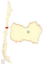 | |
|---|---|---|
| Cardenal Caro | ||
| Colchagua | ||
Provincial capitals in italics • Regional capital in bold | ||