San Pedro District, Sarchí
San Pedro is a district of the Sarchí canton, in the Alajuela province of Costa Rica.[1][2]
San Pedro | |
|---|---|
San Pedro district | |
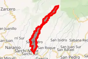
 San Pedro San Pedro district location in Costa Rica | |
| Coordinates: 10.1388267°N 84.3062317°W | |
| Country | |
| Province | Alajuela |
| Canton | Sarchí |
| Creation | 14 December 1964 |
| Area | |
| • Total | 10.92 km2 (4.22 sq mi) |
| Elevation | 1,170 m (3,840 ft) |
| Population (2011) | |
| • Total | 3,408 |
| • Density | 310/km2 (810/sq mi) |
| Time zone | UTC−06:00 |
| Postal code | 21204 |
History
San Pedro was created on 14 December 1964 by Ley 3467. Segregated from Sarchí Sur.[2]
Economy
There is an annual tomato fair in the San Pedro hamlet of Trojas town of this district, in which the local version of La Tomatina occurs.
Demographics
| Historical population | |||
|---|---|---|---|
| Census | Pop. | %± | |
| 1973 | 1,251 | — | |
| 1984 | 1,833 | 46.5% | |
| 2000 | 3,296 | 79.8% | |
| 2011 | 3,408 | 3.4% | |
|
Instituto Nacional de Estadística y Censos[4] |
|||
For the 2011 census, San Pedro had a population of 3,408 inhabitants. [6]
Transportation
Road transportation
The district is covered by the following road routes:
References
- "Declara oficial para efectos administrativos, la aprobación de la División Territorial Administrativa de la República N°41548-MGP". Sistema Costarricense de Información Jurídica (in Spanish). 19 March 2019. Retrieved 26 September 2020.
- División Territorial Administrativa de la República de Costa Rica (PDF) (in Spanish). Editorial Digital de la Imprenta Nacional. 8 March 2017. ISBN 978-9977-58-477-5.
- "Área en kilómetros cuadrados, según provincia, cantón y distrito administrativo". Instituto Nacional de Estadística y Censos (in Spanish). Retrieved 26 September 2020.
- "Instituto Nacional de Estadística y Censos" (in Spanish).
- "Sistema de Consulta de a Bases de Datos Estadísticas". Centro Centroamericano de Población (in Spanish).
- "Censo. 2011. Población total por zona y sexo, según provincia, cantón y distrito". Instituto Nacional de Estadística y Censos (in Spanish). Retrieved 26 September 2020.
This article is issued from Wikipedia. The text is licensed under Creative Commons - Attribution - Sharealike. Additional terms may apply for the media files.