Naranjo (canton)
Naranjo is a canton in the Alajuela province of Costa Rica.[2][3] The head city is located in the homonymous Naranjo district.
Naranjo | |
|---|---|
 Naranjo Church | |
 Seal | |
Naranjo canton | |
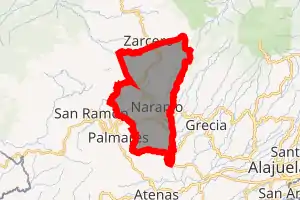
 Naranjo Naranjo canton location in Costa Rica | |
| Coordinates: 10.1052938°N 84.3885279°W | |
| Country | |
| Province | Alajuela |
| Creation | 9 March 1886[1] |
| Head city | Naranjo |
| Districts | Districts
|
| Government | |
| • Type | Municipality |
| • Body | Municipalidad de Naranjo |
| Area | |
| • Total | 126.62 km2 (48.89 sq mi) |
| Elevation | 1,121 m (3,678 ft) |
| Population (2011) | |
| • Total | 42,713 |
| • Density | 340/km2 (870/sq mi) |
| Time zone | UTC−06:00 |
| Canton code | 206 |
| Website | www |
Toponymy
It is named for the citrus plantations found in the area. In Spanish a naranjo refers to an orange tree, while the fruits are naranjas.
History
Naranjo was created on 9 March 1886 by decree 9.[1]
Geography
Naranjo has an area of 126.62 km²[4] and a mean elevation of 1,121 metres.[2]
The Grande River forms the western and southern boundaries of the canton. The Espino River is on the north, and the Colorado and Molino rivers establish the eastern border.
Districts
The canton of Naranjo is subdivided into the following districts:
- Naranjo
- San Miguel
- San José
- Cirrí Sur
- San Jerónimo
- San Juan
- El Rosario
- Palmitos
Demographics
| Historical population | |||
|---|---|---|---|
| Census | Pop. | %± | |
| 1883 | 4,593 | — | |
| 1892 | 6,847 | 49.1% | |
| 1927 | 7,910 | 15.5% | |
| 1950 | 10,839 | 37.0% | |
| 1963 | 16,414 | 51.4% | |
| 1973 | 19,721 | 20.1% | |
| 1984 | 23,588 | 19.6% | |
| 2000 | 37,602 | 59.4% | |
| 2011 | 42,713 | 13.6% | |
|
Instituto Nacional de Estadística y Censos[5] |
|||
For the 2011 census, Naranjo had a population of 42,713 inhabitants. [7]
Transportation
Road transportation
The canton is covered by the following road routes:
References
- Hernández, Hermógenes (1985). Costa Rica: evolución territorial y principales censos de población 1502 - 1984 (in Spanish) (1 ed.). San José: Editorial Universidad Estatal a Distancia. pp. 164–173. ISBN 9977-64-243-5. Retrieved 5 October 2020.
- "Declara oficial para efectos administrativos, la aprobación de la División Territorial Administrativa de la República N°41548-MGP". Sistema Costarricense de Información Jurídica (in Spanish). 19 March 2019. Retrieved 26 September 2020.
- División Territorial Administrativa de la República de Costa Rica (PDF) (in Spanish). Editorial Digital de la Imprenta Nacional. 8 March 2017. ISBN 978-9977-58-477-5.
- "Área en kilómetros cuadrados, según provincia, cantón y distrito administrativo". Instituto Nacional de Estadística y Censos (in Spanish). Retrieved 26 September 2020.
- "Instituto Nacional de Estadística y Censos" (in Spanish).
- "Sistema de Consulta de a Bases de Datos Estadísticas". Centro Centroamericano de Población (in Spanish).
- "Censo. 2011. Población total por zona y sexo, según provincia, cantón y distrito". Instituto Nacional de Estadística y Censos (in Spanish). Retrieved 26 September 2020.