Sank, Missouri
Sank is an unincorporated community in the south-central part of Liberty Township in Bollinger County, Missouri, United States. The community is accessed via a county road, one mile north of Missouri Route 51. The confluence of Clubb and Hawker creeks lies just to the southwest of the location and the Sank State Wildlife Area is located along the south side of Route 51 and Hawker Creek.[1] Zalma lies four miles to the southwest and Dongola is three miles east. Marble Hill is about nine miles to the north-northeast along Route 51.[2]
Sank, Missouri | |
|---|---|
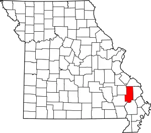 Location of Bollinger County, Missouri | |
| Country | United States |
| State | Missouri |
| County | Bollinger |
| Township | Liberty |
| Time zone | UTC-6 (Central (CST)) |
| • Summer (DST) | UTC-5 (CDT) |
| Area code(s) | 573 |
History
Sank's name was bestowed by Jasper Cooper, who owned a store there and had applied for a post office in 1915. In choosing the post office's and community's name, he decided on the name Sank because it was the nickname of a friend and prominent man in the community, "Sank" Fowler.[3][4] The post office was in operation between 1912–1920, and 1925–1954. [5]
References
- Zalma, MO, 7.5 Minute Topographic Quadrangle, USGS, 1963 (1985 rev.)
- Missouri Atlas & Gazetteer, DeLorme, 1998, First edition, p. 57, ISBN 0-89933-224-2
- State Historical Society of Missouri: Bollinger County Place Names, 1928-1945
- A Directory of Towns, Villages, and Hamlets Past and Present of Bollinger County, Missouri
- Post Offices in Bollinger County, MO "Archived copy". Archived from the original on 2013-10-29. Retrieved 2013-12-08.CS1 maint: archived copy as title (link)
Municipalities and communities of Bollinger County, Missouri, United States | ||
|---|---|---|
| City | Map of Missouri highlighting Bollinger County | |
| Villages | ||
| Townships | ||
| Unincorporated communities | ||
| Abandoned villages | ||
| ||
