Santa Catarina do Fogo, Cape Verde
Santa Catarina do Fogo is a concelho (municipality) of Cape Verde. Situated in the southeastern part of the island of Fogo, it covers 32% of the island area (152.95 km2), and is home to 14% of its population (5,299 at the 2010 census).[2] Its seat is the city Cova Figueira. The Municipality of Santa Catarina do Fogo was created in 2005; before 2005, it was a parish of the Municipality of São Filipe.[3]
Santa Catarina do Fogo | |
|---|---|
Municipality | |
 | |
| Coordinates: 14.90°N 24.33°W | |
| Country | Cape Verde |
| Island | Fogo |
| Area | |
| • Total | 152.95 km2 (59.05 sq mi) |
| Population (2010)[1] | |
| • Total | 5,299 |
| • Density | 35/km2 (90/sq mi) |
| ID | 83 |
Subdivisions
The municipality consists of one freguesia (civil parish), Santa Catarina do Fogo. The freguesia is subdivided into the following settlements, its population was of the 2010 census:
- Achada Furna (pop: 495)
- Achada Poio (pop: 61)
- Baluarte
- Cabeça Fundão (pop: 177)
- Chã das Caldeiras (pop: 697)
- Cova Figueira (pop: 1,230, city)[4]
- Domingo Lobo (pop: 254)
- Estância Roque (pop: 411)
- Figueira Pavão (pop: 320)
- Fonte Aleixo (pop: 401)
- Mãe Joana (pop: 130)
- Monte Vermelho (pop: 221)
- Roçadas (pop: 372)
- Tinteira (pop: 410)
Geography
The municipality of Santa Catarina do Fogo covers the central and southeastern part of the island Fogo. The northwestern part of the municipality (42.4 km2 (16.4 sq mi)) lies within Fogo Natural Park, which includes the Pico do Fogo and its crater.
Demography
| Year | Population |
|---|---|
| 1980[5] | 3,700 |
| 1990[5] | 4,481 |
| 2000[5] | 4,796 |
| 2010[2] | 5,299 |
Politics
Since 2016, the Movement for Democracy (MpD) is the ruling party of the municipality. The results of the latest elections, in 2016:[6]
| Party | Municipal Council | Municipal Assembly | ||
|---|---|---|---|---|
| Votes% | Seats | Votes% | Seats | |
| MpD | 53.05 | 5 | 53.07 | 7 |
| PAICV | 45.66 | 0 | 45.56 | 6 |
Twin towns
Santa Catarina do Fogo is twinned with two Portuguese municipalities:
External links
References
- "2010 Census results". Instituto Nacional de Estatística Cabo Verde (in Portuguese). 24 November 2016.
- 2010 Census Summary
- Lei nº 66/VI/2005, p. 52
- Cabo Verde, Statistical Yearbook 2015, Instituto Nacional de Estatística, p. 32-33
- Santa Catarina do Fogo, opendataforafrica.org
- Official results local elections 2016, Boletim Oficial I Série, Número 53, 23 September 2016
- Geminações de Cidades e Vilas
- Geminações de Cidades e Vilas
The island of Fogo | ||
|---|---|---|
| Mosteiros | 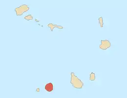 | |
| Santa Catarina do Fogo | ||
| São Filipe | ||
| Other geographical features | ||
| Transportation | ||
| Other topics | ||