Porto Novo, Cape Verde (municipality)
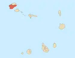
Porto Novo is a concelho (municipality) of Cape Verde. Situated in the southern part of the island of Santo Antão, it covers 72% of the island area (564.3 km2), and is home to 41% of its population. Its population at the 2010 census was 18,028.[2] Its capital is the town Porto Novo. Its highest point, which is also the highest point of the entire island, is Tope de Coroa, elevation 1,979 metres (6,493 feet). The municipality of Porto Novo was created in 1962 when the parishes of São João Baptista and Santo André were separated from the older Municipality of Paul.[3]
Porto Novo | |
|---|---|
Municipality | |
 | |
| Coordinates: 17.04°N 25.16°W | |
| Country | Cape Verde |
| Island | Santo Antão |
| Area | |
| • Total | 564.3 km2 (217.9 sq mi) |
| Population (2010)[1] | |
| • Total | 18,028 |
| • Density | 32/km2 (83/sq mi) |
| ID | 13 |
Subdivisions
The municipality consists of two freguesias (civil parishes):
Demography
| Year | Population |
|---|---|
| 1940[4] | 10,366 |
| 1950[4] | 7,565 |
| 1960[4] | 10,683 |
| 1970[4] | 13,750 |
| 1980[4] | 13,236 |
| 1990[4] | 14,873 |
| 2000[4] | 17,191 |
| 2010[2] | 18,028 |
Politics
Since 2016, the Movement for Democracy (MpD) is the ruling party of the municipality. The results of the latest elections, in 2016:[5]
| Party | Municipal Council | Municipal Assembly | ||
|---|---|---|---|---|
| Votes% | Seats | Votes% | Seats | |
| MpD | 49.79 | 7 | 50.08 | 9 |
| PAICV | 46.78 | 0 | 46.27 | 8 |
Twin towns – sister cities
Porto Novo is twinned with three municipalities in Portugal: Angra do Heroísmo, Estarreja and Tavira.[6]
References
- "2010 Census results". Instituto Nacional de Estatística Cabo Verde (in Portuguese). 24 November 2016.
- 2010 Census Summary
- Inventário dos recursos turísticos do município do Paúl, Direcção Geral do Turismo, p. 16
- Source: Statoids
- Official results local elections 2016, Boletim Oficial I Série, Número 53, 23 September 2016
- Geminações de Cidades e Vilas