Sarangarh
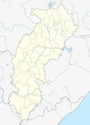
Sarangarh is a town and Nagar Palika in Raigarh District in the Indian state of Chhattisgarh.
Sarangarh | |
|---|---|
city | |
| Nickname(s): SRGH | |
 Sarangarh Location in Chhattisgarh, India  Sarangarh Location in India | |
| Coordinates: 21.6°N 83.08°E | |
| Country | |
| State | Chhattisgarh |
| District | Raigarh District |
| Government | |
| • Body | Nagar Palika Parishad |
| Elevation | 217 m (712 ft) |
| Population (2014) | |
| • Total | 100,000 |
| Languages | |
| • Official | Hindi, Chhattisgarhi |
| Time zone | UTC+5:30 (IST) |
| <Pin Code> | 496445 |
| Vehicle registration | CG-13 |
.pdf.jpg.webp)
History
During the British Raj era, Sarangarh State was one of several princely states governed by the Raj Gond dynasty of Rajputs. It was originally a dependency of the Ratanpur Kingdom and later became one of the eighteen Garhjat states under Sambalpur State.[1]
Demographics
Dist- As of 2001 India census,[2] Sarangarh had a population of 2,14,458. Males constitute 51% of the population and females 49%. Sarangarh has an average literacy rate of 70%, higher than the national average of 59.5%: male literacy is 80%, and female literacy is 60%. In Sarangarh, 13% of the population is under 6 years of age.
Sarangarh is one of the historic and important towns of the state of Chhattisgarh. The town of Sarangarh falls within the jurisdiction of the Raigarh district of Chhattisgarh and comprises the area of the erstwhile Sarangarh Princely State. Sarangarh Town has a "Nagar Palika Parishad" comprising 15 wards. It is the headquarters of the sub-division by the same name. The town is 217 meters (711 feet) above sea level. The global location of Sarangarh falls within north latitude 21 degrees and 6 minutes to east longitude 83 degrees and eight minutes.
In accordance to the census of 2001, the population of Sarangarh is around 14,500. Sarangarh is one of the few Chhattisgarh cities and towns that have an excellent sex ratio. There are 49% females in the town and 51% males. Children under six years of age comprise almost 13% of the total population. Sarangarh has also done a considerable job in the literacy drive. The town authority and the educational department of the state have contributed in its moderate success. The town has achieved seventy percent of literacy, which is at least ten percent more than the national average. About eighty percent of males are literate while sixty percent is the female literacy rate. Some of the nearby villages are:
- Sarsiwa
- Madhuban
- Sapos
- Jaspur
- Baramkela
- Chandarpur
- Ramtek
- Kosir
- BAIGINDIH
The Sarangarh subdivision comprises two development blocks namely Sarangarh and Baramkela. Sarangarh is located on the National Highway number 216 and is 52 km from the district HQ and rail head Raigarh, and 200 km from Raipur, the state capital and the nearest airport. The airstrip of Sarangarh is located 6 km towards Raigarh and was built during the IInd World War.
Town is surrounded by scenic beauty of the nature. Gomarda wildlife sanctuary is located about 15 km from the town in the NH 216.
Education
Sarangarh has eight secondary level schools and two graduate and post-graduate level colleges. For technical education, there is industrial training institute.
Health
The town has a community health centre with three full-time doctors.
Members of Parliament
A new Lok Sabha constituency by the name of SARANGARH came into being after the Census of 1971. The first election for it was in 1977. However after the delimitation of political constituencies following Census 2001, this constituency ceased to exist till the time elections for Loksabha took place in 2009. The area of the Sarangarh Lok Sabha constituency was merged into Raigarh, Janjgir, and Mahasamund constituencies of Chhattisgarh.
- 1977: Govindram Miri, Janata Party
- 1980: Paras Ram Bhardwaj, Indian National Congress
- 1984: Paras Ram Bhardwaj, Indian National Congress
- 1989: Paras Ram Bhardwaj, Indian National Congress
- 1991: Paras Ram Bhardwaj, Indian National Congress
- 1996: Paras Ram Bhardwaj, Indian National Congress
- 1998: Paras Ram Bhardwaj, Indian National Congress
- 1999: P.R. Khute, Bharatiya Janata Party
- 2004: Guharam Ajgalley, Bharatiya Janata Party
References
- Sarangarh (Princely State)
- "Census of India 2001: Data from the 2001 Census, including cities, villages and towns (Provisional)". Census Commission of India. Archived from the original on 16 June 2004. Retrieved 1 November 2008.