Raigarh district
Raigarh district is a district of the state of Chhattisgarh, in India. Raigarh is the district headquarters. The languages spoken in the district are Chhattisgarhi, Odia and Hindi. Due to railway and industrial development, a fair representation from all over India can be seen here. A large population of Schedule Tribes, Odia, Marwari, Bengali, Telugu, Marathi, Christian, Muslim, Gujarati, Punjabi, Bihari and many other community are living here. The city has cosmopolitan nature.
Raigarh district | |
|---|---|
District of Chhattisgarh | |
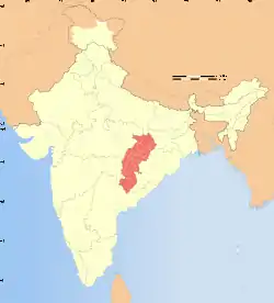
 Location of Raigarh district in Chhattisgarh | |
| Country | India |
| State | Chhattisgarh |
| Headquarters | Raigarh |
| Tehsils | 09 |
| Area | |
| • Total | 7,086 km2 (2,736 sq mi) |
| Population (2011) | |
| • Total | 1,493,984 (2,011 census) |
| • Urban | 246,281 |
| Demographics | |
| • Literacy | 73.7%(959,866) |
| • Sex ratio | 993 |
| Time zone | UTC+05:30 (IST) |
| Major highways | NH-49, NH-153(new numbering after a gazette notification of March 5, 2010) |
| Average annual precipitation | 1584 mm |
| Website | raigarh |
The district was formed by merging the princely states of Raigarh, Sakti, Sarangarh, Udaipur and Jashpur.[1] Jashpur is now a separate district. Sakti is now not a part of Raigarh district.
It is rapidly growing as an industrial district of Chhattisgarh. One of the oldest jute mills of India is situated here, Mohan jute mill; it was the only Jute Mill of the state CG and undivided MP. Raigarh is one of the major producers of steel and power in the country. Here are situated many steel and power plants such as JSPL, MSP, Monnet steel, and many other small and medium producers. The volume can be judged by the statement that Raigarh itself is consuming about 20,000 tons of coal per day.
Tehsils in Raigarh District, Chhattisgarh List of all Tehsils in Raigarh district of Chhattisgarh state.
- Tehsil District
1 Raigarh Raigarh 2 Sarangarh Raigarh 3 Udaipur (Dharamjaigarh) Raigarh 4 Baramkela Raigarh 5 Kharsia Raigarh 6 Pusour Raigarh 7 Lailunga Raigarh 8 Tamnar Raigarh 9 Gharghoda
Demographics
According to the 2011 census Raigarh district has a population of 1,493,984,[2] roughly equal to the nation of Gabon[3] or the US state of Hawaii.[4] This gives it a ranking of 336th in India (out of a total of 640).[2] The district has a population density of 211 inhabitants per square kilometre (550/sq mi) .[2] Its population growth rate over the decade 2001-2011 was 18.02%.[2] Raigarh has a sex ratio of 993 females for every 1000 males,[2] and a literacy rate of 73.7%.[2]
Languages
At the time of the 2011 Census of India, 84.40% of the population in the district spoke Hindi, 9.52% Odia, 4.04% Kurukh and 0.81% Bengali as their first language.[5]
Languages spoken here include Asuri, an Austroasiatic language spoken by approximately 17 000.[6]
References
- Publication by Gokhale Institute of Politics and Economics - 1973- Issue 61 - Page 346
- "District Census 2011". Census2011.co.in. 2011. Retrieved 30 September 2011.
- US Directorate of Intelligence. "Country Comparison:Population". Retrieved 1 October 2011.
Gabon 1,576,665
- "2010 Resident Population Data". U. S. Census Bureau. Retrieved 30 September 2011.
Hawaii 1,360,301
- 2011 Census of India, Population By Mother Tongue
- M. Paul Lewis, ed. (2009). "Asuri: A language of India". Ethnologue: Languages of the World (16th ed.). Dallas, Texas: SIL International. Retrieved 28 September 2011.
External links
| Wikimedia Commons has media related to Raigarh district. |
Places adjacent to Raigarh district | |
|---|---|
| Governance |
|  |
|---|---|---|
| Topics | ||
| Divisions |
| |
| Districts | ||
| Cities | ||
| ||