Sasso Marconi
Sasso Marconi (Bolognese: Al Sâs) is a town and comune of the Metropolitan City of Bologna in northern Italy, 17 kilometres (11 mi) south-southwest of Bologna.
Sasso Marconi | |
|---|---|
| Comune di Sasso Marconi | |
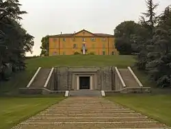
 Villa Marconi. | |
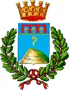
 Coat of arms | |
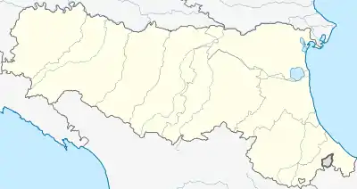
Location of Sasso Marconi 
| |
 Sasso Marconi Location of Sasso Marconi in Italy  Sasso Marconi Sasso Marconi (Emilia-Romagna) | |
| Coordinates: 44°24′N 11°15′E | |
| Country | Italy |
| Region | Emilia-Romagna |
| Metropolitan city | Bologna (BO) |
| Frazioni | Borgonuovo, Pontecchio Marconi, Fontana, Capital, Tignano-Roma, Rasiglio-Scopeto, Iano, Lagune, Cinque Cerri |
| Government | |
| • Mayor | Stefano Mazzetti |
| Area | |
| • Total | 96.45 km2 (37.24 sq mi) |
| Elevation | 128 m (420 ft) |
| Population (31 December 2014)[2] | |
| • Total | 14,612 |
| • Density | 150/km2 (390/sq mi) |
| Demonym(s) | Sassesi |
| Time zone | UTC+1 (CET) |
| • Summer (DST) | UTC+2 (CEST) |
| Postal code | 40037 |
| Dialing code | 051 |
| Patron saint | Sts. Peter and Paul |
| Saint day | 29 June |
| Website | Official website |
Known as Sasso Bolognese until 1938, it is named after Guglielmo Marconi, the radio pioneer, who was born in the nearby city of Bologna. In 1902, Marconi received the first transatlantic radio signal at Poldhu Cove, Cornwall, UK. The name Sasso ("rock") derives from the Pliocenic rock formation called Sasso della Glosina that commands the confluence of the Setta and Reno rivers.
References
- "Superficie di Comuni Province e Regioni italiane al 9 ottobre 2011". Istat. Retrieved 16 March 2019.
- "Popolazione Residente al 1° Gennaio 2018". Istat. Retrieved 16 March 2019.
This article is issued from Wikipedia. The text is licensed under Creative Commons - Attribution - Sharealike. Additional terms may apply for the media files.