Satana, India
Satana is a city and a municipal council in Nashik District in the Indian state of Maharashtra. It is in the taluka of Baglan, which is sometimes called Satana, because of the city's dominance in the taluka.[1] The name "Satana" may be derived from "Śāṭyāyani" one of the minor Upanishads of the Muktika canon.
Satana | |
|---|---|
city | |
 Satana Location in Maharashtra, India | |
| Coordinates: 20.5797°N 74.2160°E | |
| Country | |
| State | Maharashtra |
| District | Nashik |
| Elevation | 544 m (1,785 ft) |
| Population (2001) | |
| • Total | 32,551 |
| Demonym(s) | Satanakar |
| Language | |
| • Official | Marathi |
| Time zone | UTC+5:30 (IST) |
| PIN | 423301 |
| Telephone code | 02555 |
| ISO 3166 code | IN-MH |
| Vehicle registration | MH-41 |
| Website | www |
Geography
Satana is located at 20°35′37″N 74°12′00″E.[2] It has an average elevation of 544 metres (1784 feet).
This tehsil includes historical forts like Tilwan, Pisol, Salher. Forest in Avati is famous in Nashik district.
Demographics
As of 2001 India census,[3] Satana had a population of 32,551. Males constitute 52% of the population and females 48%. Satana has an average literacy rate of 75%, higher than the national average of 59.5%: male literacy is 79%, and female literacy is 70%. In Satana, 12% of the population is under 6 years of age.
People from Satana
- Upasni Maharaj, born Kashinath Govindrao Upasni,[1] (5 May 1870 – 24 December 1941 [2]) was considered by his disciples to be a satguru.
References
- "Block Profile of Baglan (Satana)" Official WebSite of Nashik District Archived 2009-04-10 at the Wayback Machine
- Falling Rain Genomics, Inc - Satana
- "Census of India 2001: Data from the 2001 Census, including cities, villages and towns (Provisional)". Census Commission of India. Archived from the original on 16 June 2004. Retrieved 1 November 2008.
Nashik district topics | ||
|---|---|---|
| Rivers and lakes | 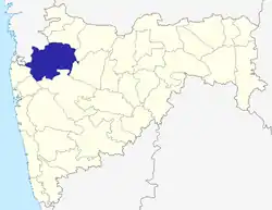 | |
| Cities and towns | ||
| Monuments |
| |
| Education | ||
| Lok Sabha constituencies | ||
| Vidhan Sabha constituencies | ||
| Major Highways | ||