Savanna, Oklahoma
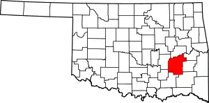
Savanna is a town in Pittsburg County, Oklahoma, United States. The population was 686 at the 2010 census, a decline of 6.0 percent from the figure of 730 recorded in 2000.
Savanna, Oklahoma | |
|---|---|
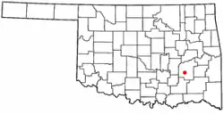
 Location of Savanna, Oklahoma | |
| Coordinates: 34°50′0″N 95°50′20″W | |
| Country | United States |
| State | Oklahoma |
| County | Pittsburg |
| Area | |
| • Total | 1.43 sq mi (3.71 km2) |
| • Land | 1.42 sq mi (3.68 km2) |
| • Water | 0.01 sq mi (0.02 km2) |
| Elevation | 735 ft (224 m) |
| Population (2010) | |
| • Total | 686 |
| • Estimate (2019)[2] | 645 |
| • Density | 453.59/sq mi (175.11/km2) |
| Time zone | UTC-6 (Central (CST)) |
| • Summer (DST) | UTC-5 (CDT) |
| ZIP code | 74565 |
| Area code(s) | 539/918 |
| FIPS code | 40-65600[3] |
| GNIS feature ID | 1097851[4] |
History
Begun as a rural settlement in Tobucksy County, Choctaw Nation during the 1860s, the community's economy was based on agriculture and cattle ranching. Coal mining became the most important economic activity during the 1870s.
A post office was established at Savanna, Indian Territory on May 5, 1876. The town owed its existence to the Missouri, Kansas and Texas Railroad, for which it was a station stop, and the new post office was named for the private railroad car used by Robert Stevens, general manager of the railroad.[5]
As coal mining developed, the community became one of the largest in Indian Territory. The mining companies built rows of 2- and 3- bedroom houses for the families of the miners. In 1887, accidental explosions in Mines #1 and #2 killed 6 miners and 12 rescue personnel. The Savanna Coal Mining and Trading Company closed its mines and moved the houses it owned to Lehigh, Oklahoma. Some growth continued, and Savanna boasted 450 residents in 1911. The Savanna News began publishing in 1915, but went out of business before the end of the decade.
However, the demand for coal fell, as the country began shifting to oil and gas as preferred fuels. Coal mining never regained its former importance to Pittsburg County after WWI. Savanna's boom essentially collapsed until after statehood came in 1907.[6]
During World War II, the U.S. Navy constructed an ammunition production facility at McAlester. Many of Savanna's work force went to work there. In 1960, the census reported a population of 620, which grew to 948 in 1990.[6]
Geography
Savanna is located at 34°50′0″N 95°50′20″W (34.833229, -95.838768).[7] It is 9 miles (14 km) south of McAlester on U.S. Highway 69.[6] According to the United States Census Bureau, the town has a total area of 1.4 square miles (3.6 km2), of which 1.4 square miles (3.6 km2) is land and 0.71% is water.
Demographics
| Historical population | |||
|---|---|---|---|
| Census | Pop. | %± | |
| 1960 | 620 | — | |
| 1970 | 948 | 52.9% | |
| 1980 | 828 | −12.7% | |
| 1990 | 869 | 5.0% | |
| 2000 | 730 | −16.0% | |
| 2010 | 686 | −6.0% | |
| 2019 (est.) | 645 | [2] | −6.0% |
| U.S. Decennial Census[8] | |||
As of the census[3] of 2000, there were 730 people, 294 households, and 211 families residing in the town. The population density was 521.1 people per square mile (201.3/km2). There were 354 housing units at an average density of 252.7 per square mile (97.6/km2). The racial makeup of the town was 82.19% White, 0.68% African American, 11.64% Native American, 0.41% Asian, 0.41% from other races, and 4.66% from two or more races. Hispanic or Latino of any race were 1.37% of the population.
There were 294 households, out of which 32.3% had children under the age of 18 living with them, 54.8% were married couples living together, 12.6% had a female householder with no husband present, and 28.2% were non-families. 25.9% of all households were made up of individuals, and 11.9% had someone living alone who was 65 years of age or older. The average household size was 2.48 and the average family size was 2.94.
In the town, the population was spread out, with 24.5% under the age of 18, 7.7% from 18 to 24, 27.9% from 25 to 44, 24.9% from 45 to 64, and 14.9% who were 65 years of age or older. The median age was 39 years. For every 100 females, there were 100.5 males. For every 100 females age 18 and over, there were 96.1 males.
The median income for a household in the town was $28,015, and the median income for a family was $35,139. Males had a median income of $25,568 versus $21,042 for females. The per capita income for the town was $13,575. About 14.1% of families and 14.9% of the population were below the poverty line, including 14.9% of those under age 18 and 13.5% of those age 65 or over.
Education
Savanna operates a fully equipped pre-K - 12 public school system, which had an enrollment of 513 in 2000.[6]
References
- "2019 U.S. Gazetteer Files". United States Census Bureau. Retrieved July 28, 2020.
- "Population and Housing Unit Estimates". United States Census Bureau. May 24, 2020. Retrieved May 27, 2020.
- "U.S. Census website". United States Census Bureau. Retrieved 2008-01-31.
- "US Board on Geographic Names". United States Geological Survey. 2007-10-25. Retrieved 2008-01-31.
- Shirk, George H. Oklahoma Place Names (Norman: University of Oklahoma Press, 1965), p. 187.
- https://www.okhistory.org/publications/enc/entry.php?entry=SA025.
- "US Gazetteer files: 2010, 2000, and 1990". United States Census Bureau. 2011-02-12. Retrieved 2011-04-23.
- "Census of Population and Housing". Census.gov. Retrieved June 4, 2015.

