Sawang Arom District
Sawang Arom (Thai: สว่างอารมณ์, pronounced [sā.wàːŋ ʔāː.rōm]) is a district (amphoe) in the northern part of Uthai Thani Province, northern Thailand.
Sawang Arom
สว่างอารมณ์ | |
|---|---|
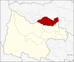 District location in Uthai Thani Province | |
| Coordinates: 15°35′2″N 99°51′39″E | |
| Country | Thailand |
| Province | Uthai Thani |
| Seat | Sawang Arom |
| District established | 1960 |
| Area | |
| • Total | 341.4 km2 (131.8 sq mi) |
| Population (2008) | |
| • Total | 31,092 |
| • Density | 91.1/km2 (236/sq mi) |
| Time zone | UTC+7 (ICT) |
| Postal code | 61150 |
| Geocode | 6103 |
History
This area was originally called Ban Sawang Chaeng Sabai Chai. In a Thai-Burmese war of Ayutthaya era, the troops began fighting in the Lat Yao District area at night and finished at the village in the morning. To commemorate this battle the government renamed the village Sawang Arom in 1961.
The Sawang Arom minor district (king amphoe) was established in 1960 as a subordinate of Thap Than District by splitting off four sub-districts from Thap Than.[1] It was upgraded to a full district in 1963.[2]
Geography
Neighboring districts are (from the east clockwise) Thap Than, Lan Sak of Uthai Thani Province, Lat Yao and Krok Phra of Nakhon Sawan Province.
Administration
The district is divided into five sub-districts (tambons), which are further subdivided into 64 villages (mubans). Sawang Arom is a sub-district municipality (thesaban tambon) which covers parts of tambon Sawang Arom. There are a further five tambon administrative organizations (TAO).
| No. | Name | Thai | Villages | Pop.[3] |
|---|---|---|---|---|
| 1. | Sawang Arom | สว่างอารมณ์ | 10 | 4,967 |
| 2. | Nong Luang | หนองหลวง | 10 | 4,128 |
| 3. | Phluang Song Nang | พลวงสองนาง | 8 | 5,360 |
| 4. | Phai Khiao | ไผ่เขียว | 24 | 11,693 |
| 5. | Bo Yang | บ่อยาง | 12 | 5,236 |
References
- ประกาศกระทรวงมหาดไทย เรื่อง ยกฐานะตำบลขึ้นเป็นกิ่งอำเภอ (PDF). Royal Gazette (in Thai). 77 (108 ง): 2562–2564. 27 December 1960.
- พระราชกฤษฎีกาตั้งอำเภอบ่อพลอย อำเภอไทรโยค อำเภอหนองเรือ อำเภอหนองสองห้อง อำเภอประทาย อำเภอห้วยแถลง อำเภอละหานทราย อำเภอกุยบุรี อำเภอตาพระยา อำเภอหนองไผ่ อำเภอนาเชือก อำเภอวัดเพลง อำเภอพนัสนิคม อำเภอภูกระดึง อำเภอปรางค์กู่ อำเภอท่าช้าง อำเภอบ้านด่านลานหอย อำเภอบ้านดง อำเภอสว่างอารมณ์ และอำเภอกุดชุม พ.ศ. ๒๕๐๖ (PDF). Royal Gazette (in Thai). 80 (72 ก): 362. 16 July 1963.
- "Population statistics 2008". Department of Provincial Administration. Archived from the original on 20 August 2009. Retrieved 5 November 2009.
External links
- amphoe.com (Thai)
