Scurry, Texas
Scurry is a town in Kaufman County, Texas, United States. It was incorporated in 2003.[3] As of the 2010 census, it had a population of 681.[4]
Scurry, Texas | |
|---|---|
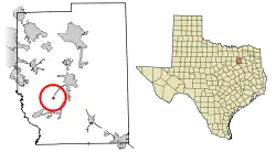
 Location of Scurry in Kaufman County, Texas | |
| Coordinates: 32°31′8″N 96°22′51″W | |
| Country | United States |
| State | Texas |
| Counties | Kaufman |
| Area | |
| • Total | 1.93 sq mi (4.99 km2) |
| • Land | 1.93 sq mi (4.99 km2) |
| • Water | 0.00 sq mi (0.00 km2) |
| Elevation | 440 ft (130 m) |
| Population (2010) | |
| • Total | 681 |
| • Estimate (2019)[2] | 781 |
| • Density | 405.50/sq mi (156.58/km2) |
| Time zone | UTC-6 (Central (CST)) |
| • Summer (DST) | UTC-5 (CDT) |
| ZIP Code | 75158 |
| Area code(s) | 214, 469, 972 |
| FIPS Code | 48-66368 |
| GNIS feature ID | 1379045 |
| Website | tshaonline |
Both Kaufman County and the town of Scurry are part of the Dallas, Texas–Fort Worth–Arlington metropolitan statistical area.
Geography
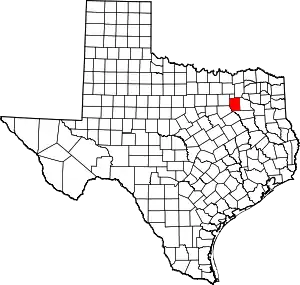
Scurry is located at 32°31′07″N 96°22′51″W (32.518611, -96.380833). It is situated along State Highway 34 in southwestern Kaufman County, 7 miles (11 km) southwest of Kaufman and 34 miles (55 km) southeast of Dallas.[5]
According to the U.S. Census Bureau, the town has an area of 1.9 square miles (5.0 km2), all land.[4]
Climate
The climate in this area is characterized by hot, humid summers and generally mild to cool winters. According to the Köppen climate classification, Scurry has a humid subtropical climate, Cfa on climate maps.[6]
History
The first settlers in the area arrived in the mid-1840s. Over the next quarter century, a church and school community developed and the number of farms increased. The arrival of the Texas and Pacific Railway in the 1870s established the settlement as a shipment point for area farmers. When local residents requested a post office, they submitted the name "Scurry" – in honor of Scurry Dean, who was killed during the Civil War. Postal service began in 1883, and a year later, Scurry had an estimated population of 50.[5] By 1914, the community was home to around 400 people and a number of businesses. The Great Depression caused Scurry to decline, which lasted through the first decade after World War II. Only 250 people remained in the community by the mid-1950s. The trend was reversed during the latter half of the 20th century. In 1990, 9 businesses and about 315 people were living in the community.[7] That figure approached 600 by 2000, and Scurry was officially incorporated as a town three years later.
Demographics
| Historical population | |||
|---|---|---|---|
| Census | Pop. | %± | |
| 1990 | 315 | — | |
| 2000 | 600 | 90.5% | |
| 2010 | 681 | 13.5% | |
| 2019 (est.) | 781 | [2] | 14.7% |
| U.S. Decennial Census[8] | |||
Education
Public education in the town of Scurry is provided by the Scurry-Rosser Independent School District. The district has three campuses and also serves the incorporated communities of Rosser, Cottonwood, and Grays Prairie in southwestern Kaufman County.
References
- "2019 U.S. Gazetteer Files". United States Census Bureau. Retrieved August 7, 2020.
- "Population and Housing Unit Estimates". United States Census Bureau. May 24, 2020. Retrieved May 27, 2020.
- "Boundary Changes". Geographic Change Notes: Texas. Population Division, United States Census Bureau. 2006-05-19. Archived from the original on 2006-02-06. Retrieved 2008-05-27.
- "Geographic Identifiers: 2010 Census Summary File 1 (G001), Scurry town, Texas". American FactFinder. U.S. Census Bureau. Archived from the original on February 13, 2020. Retrieved May 6, 2019.
- "Scurry, Texas". Texas Escapes Online Magazine. Retrieved 2009-08-19.
- Climate Summary for Scurry, Texas
- "Scurry, Texas". The Handbook of Texas online. Retrieved 2009-08-19.
- "Census of Population and Housing". Census.gov. Retrieved June 4, 2015.
