Heath, Texas
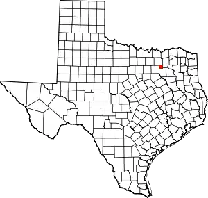
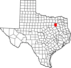
Heath is a city in Rockwall and Kaufman counties, Texas, United States. The population was 6,921 at the 2010 census,[5] up from 4,149 at the 2000 census. It is part of the Dallas-Fort Worth metroplex.
Heath, Texas | |
|---|---|
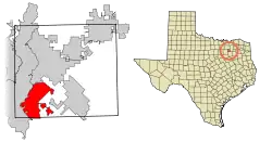
 Location of Heath in Rockwall County, Texas | |
| Coordinates: 32°50′52″N 96°28′42″W | |
| Country | United States |
| State | Texas |
| County | Rockwall, Kaufman |
| Government | |
| • Mayor | Kelson Elam |
| Area | |
| • Total | 12.25 sq mi (31.73 km2) |
| • Land | 12.08 sq mi (31.29 km2) |
| • Water | 0.17 sq mi (0.44 km2) |
| Elevation | 502 ft (153 m) |
| Population (2010) | |
| • Total | 6,921 |
| • Estimate (2019)[2] | 9,331 |
| • Density | 772.50/sq mi (298.25/km2) |
| Time zone | UTC-6 (CST) |
| • Summer (DST) | UTC-5 (CDT) |
| ZIP code | 75032 |
| Area code(s) | 214, 469, 972 |
| FIPS code | 48-32984[3] |
| GNIS feature ID | 1337538[4] |
| Website | heathtx |
History
A proposition was placed on the November 4, 2008, ballot that, if passed, would have changed the name from "City of Heath" to "Village of Heath".[6] Of the 3,511 votes cast, 2,069 (58.9%) voted against the measure while 1,442 (41.1%) voted in favor.[7][8]
Geography
Heath is located in southwestern Rockwall County at 32°50′52″N 96°28′42″W (32.847890, -96.478273).[9] A small portion of the city—0.31 square miles (0.79 km2)—extends south into Kaufman County.[10] According to the United States Census Bureau, the city has a total area of 10.7 square miles (27.7 km2), of which 10.56 square miles (27.36 km2) are land and 0.14 square miles (0.35 km2), or 1.27%, are water.[5]
Heath is bordered to the north by the city of Rockwall and to the west by Lake Ray Hubbard, part of the city of Dallas. By road it is 25 miles (40 km) east of downtown Dallas.
Demographics
| Historical population | |||
|---|---|---|---|
| Census | Pop. | %± | |
| 1970 | 520 | — | |
| 1980 | 1,459 | 180.6% | |
| 1990 | 2,108 | 44.5% | |
| 2000 | 4,149 | 96.8% | |
| 2010 | 6,921 | 66.8% | |
| 2019 (est.) | 9,331 | [2] | 34.8% |
| U.S. Decennial Census[11] | |||
As of the census of 2010, there were 6,921 people, 2,326 households, and 2,040 families residing in the city. The population density was 655 people per square mile (253.0/km2). There were 2,451 housing units, of which 125, or 5.1%, were vacant. The racial makeup of the city was 93.1% White, 1.8% African American, 0.4% Native American, 1.8% Asian, 0.01% Pacific Islander, 1.2% some other race, and 1.7% from two or more races. Hispanic or Latino of any race were 6.2% of the population.[12]
Of the 2,326 households, 44.7% had children under the age of 18 living with them, 79.0% were headed by married couples living together, 5.4% had a female householder with no husband present, and 12.3% were non-families. 9.9% of all households were made up of individuals, and 4.3% were someone living alone who was 65 years of age or older. The average household size was 2.98, and the average family size was 3.18.[12]
29.3% of the population in the city were under the age of 18, 5.3% were from 18 to 24, 19.8% were from 25 to 44, 35.1% were from 45 to 64, and 10.6% were 65 years of age or older. The median age was 42.5 years. For every 100 females, there were 100.2 males. For every 100 females age 18 and over, there were 97.2 males.[12]
For the period 2013–17, the estimated median annual household income was $153,253, compared to $57,051 in the state of Texas. The median income for a family was $158,563, and the per capita income was $64,392. Male full-time workers earned an estimated $124,587 per year, while female full-time workers earned $51,778. About 2.2% of families and 2.6% of the population were below the poverty line, including 2.5% of those under 18 and 1.3% of those over 65.[13]
Between 2013 and 2017 the estimated median value of owner-occupied housing units in Heath was $423,400, compared to $151,500 for the whole state. The median gross monthly rent in Heath was $1,963 during the same time period.[14]
Education
Heath is a part of the Rockwall Independent School District. The city is served by Dorothy Smith Pullen Elementary School, Amy Parks-Heath Elementary School, Linda Lyons Elementary School, Maurine Cain Middle School, and Rockwall Heath High School.
References
- "2019 U.S. Gazetteer Files". United States Census Bureau. Retrieved August 7, 2020.
- "Population and Housing Unit Estimates". United States Census Bureau. May 24, 2020. Retrieved May 27, 2020.
- "U.S. Census website". United States Census Bureau. Retrieved 2008-01-31.
- "US Board on Geographic Names". United States Geological Survey. 2007-10-25. Retrieved 2008-01-31.
- "Geographic Identifiers: 2010 Census Summary File 1 (G001), Heath city, Texas". American FactFinder. U.S. Census Bureau. Archived from the original on February 13, 2020. Retrieved April 19, 2019.
- North Texas city of Heath looks to label itself a village – QuickDFW.com. Retrieved November 8, 2008.
- 2008 General Election Results – Rockwall County Official Website. Retrieved November 8, 2008.
- Heath 'citizens' remain so; allow mayor to vote and add council seat Archived 2012-09-07 at Archive.today – Rockwall Herald-Banner. Retrieved November 8, 2008.
- "US Gazetteer files: 2010, 2000, and 1990". United States Census Bureau. 2011-02-12. Retrieved 2011-04-23.
- "Geographic Identifiers: 2010 Census Summary File 1 (G001), Heath city (part), Kaufman County, Texas". American FactFinder. U.S. Census Bureau. Archived from the original on February 13, 2020. Retrieved April 19, 2019.
- "Census of Population and Housing". Census.gov. Retrieved June 4, 2015.
- "Profile of General Population and Housing Characteristics: 2010 Census Summary File 1 (DP-1), Heath city, Texas". American FactFinder. U.S. Census Bureau. Archived from the original on February 13, 2020. Retrieved April 19, 2019.
- "Selected Economic Characteristics: 2013-2017 American Community Survey 5-Year Estimates (DP03), Heath city, Texas". American FactFinder. U.S. Census Bureau. Archived from the original on February 13, 2020. Retrieved April 19, 2019.
- "Selected Housing Characteristics: 2013-2017 American Community Survey 5-Year Estimates (DP04), Heath city, Texas". American FactFinder. U.S. Census Bureau. Archived from the original on February 13, 2020. Retrieved April 19, 2019.


