Sehore
Sehore is a city and a municipality in Sehore district in the Indian state of Madhya Pradesh. It is the district headquarters of Sehore District and is located on the Bhopal-Indore highway, 38 km from Bhopal.
Sehore | |
|---|---|
City | |
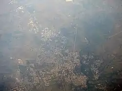 Aerial photo of Sehore | |
 Sehore Location in Madhya Pradesh, India | |
| Coordinates: 23.2°N 77.08°E | |
| Country | |
| State | Madhya Pradesh |
| District | Sehore |
| Government | |
| • Type | Mayor-Council |
| • Body | Sehore Municipal Council |
| • MLA | Sudesh Rai (BJP) |
| Elevation | 502 m (1,647 ft) |
| Population (2011) | |
| • Total | 109,118 |
| Languages | |
| • Official | Hindi |
| Time zone | UTC+5:30 (IST) |
| PIN | 466001 |
| Telephone code | 07562 |
| Vehicle registration | MP-37 |
| Website | sehore |
History
Sehore stands at the foothills of the Vindhya Range in the middle of the Malwa region. It has a long and glorious past. Shaiva, Shakta, Jain, Vaishnav, Buddhists and Nath priests made Sehore a significant seat of meditation/ worship. Sehore was a part of the Bhopal estate. After formation of Madhya Pradesh, it was bifurcated, in 1972 and a new district - Bhopal - was carved out of it.
Ancient lore states that Maharshi Patanjali, the illustrious founder of a Yoga sect, also spent some time here in prayer, penance and worship. Folklore also points to the visits of Lord Rama, Laxman and Sita to different places in and around Sehore. Sehore has many temples, Mutts, Shrines, Mosques and Churches of historical antiquity and religious significance. Sehore, thus, boasts of a glorious tradition of communal harmony and culture.
Sidhhapur is the old name of Sehore. According to a rock-edict found in the Seevan river, it got its name from Sidrapur. According to an old document, Sehore got its name from the Anglo-Indian perversion of Sher or Lion as pronounced by the British, since lions or "Sher"s were in abundance in the nearby jungles.
Sehore has been an integral part of Awanti. Later on, it was under the tutelage of the Magadh dynasty, Chandragupta I, Harshavardhan, Ashoka, Raja Bhoj, Peshwa chiefs, Rani Kamlawati and the Nawabs of the Bhopal dynasty. Sehore remained the headquarters of the political agent and resident of the British empire till Indian independence.
Rivers big and small abound in the landscape of Sehore. Narmada, Parwati, Dudhi, Newaj, Kolar, Papnas, Kulans, Seewan, Lotia and other rivers tell a sad tale of lost splendor in the form of scattered idols found in them. Idols of Lord Vishnu, Ganesha, Shiva, Parvati, Nandi, Garuda, Lord Mahavira, Gautam Buddha, Apsaras and fairies have been found in different forms and postures.
Sehore played a crucial role in the first freedom movement of India (1857). "Nishan-e-Mahaviri" and "Nishan-e-Mohammadi" remained unfurled and flying in the breeze in place of the Union Jack for quite some time. That short phase of independence from the British clutches ended when Sir Hurose and Robert Hamilton crushed the uprising by putting 354 patriots to the gallows and gunning down 149 sepoys. The Nawabs of Bhopal remained forever loyal to the British. That put paid to the efforts of the patriots to flush out the British from Sehore, by way of the Nawabs fighting on the side of the British.
On 15 August 1947 India got its independence. But the estate of Bhopal did not merge with the India state till 1949 and even that after a fierce struggle. Sehore has honorable mention in the fields of academics and literature. Lanciet Likinson, the political agent, got written the first English translation of Abhijñānaśākuntalam in 1835–40.
The High School of Sehore founded in 1835 by political agent Likinson, had to its credit, students like Hidayatullah (former Chief Justice of the Supreme Court and Vice President of India) and Banchu [Ex chief justice] Mirza Faim Begh [chief engineer].
Geography
Sehore is 37 km from the state capital, Bhopal, towards the south-west and on the Bhopal - Indore highway. Its height from mean sea level is between 1500 ft. and 2000 ft. Sehore is situated on the Western Railway line from Bhopal to Ratlam. It is surrounded by 7 districts: Bhopal, Raisen, Harda, Hoshangabad, Dewas, Shajapur and Rajgarh. Sehore district extends between the parallels of Latitude 22'31 to 23'40 North and between the meridians of Longitude 76'22 and 78'08 East. Sehore is located at 23.2°N 77.08°E.[1] It has an average elevation of 502 metres (1646 feet). The only river passing through the Sehore district is the Siven.
Demographics
As of 2001 India census,[2] Sehore had a population of 90,930. Males constituted 52% of the population and females 48%. Sehore had an average literacy rate of 68%, higher than the national average of 59.5%: male literacy was 75% and female literacy was 61%. In Sehore, 14% of the population was under 6 years of age.
According to the 2011 census, Sehore municipality with outgrowth had a population of 109,118.[3]
Transport
Sehore railway station lies on the Ujjain - Bhopal branch line. There are regular trains to Delhi, Kolkata, Chennai, Ahmedabad, Jaipur, Kanpur, Nagpur, Jammu, Puri and other major cities. The nearest airport is in Bhopal.
Notable people
- William Townshend (1849–1923), English cricketer.
References
- "Maps, Weather, and Airports for Sehore, India". www.fallingrain.com. Retrieved 1 February 2021.
- "Census of India 2001: Data from the 2001 Census, including cities, villages and towns (Provisional)". Census Commission of India. Archived from the original on 16 June 2004. Retrieved 1 November 2008.
- "Sehore (District, Madhya Pradesh, India) - Population Statistics, Charts, Map and Location". www.citypopulation.de. Retrieved 7 September 2020.
External links
- . Encyclopædia Britannica. 24 (11th ed.). 1911.