Severe thunderstorm watch
A severe thunderstorm watch (SAME code: SVA) is an alert issued by national weather forecasting agencies when weather conditions are favorable for the development of severe thunderstorms.[1][2] If thunderstorms are expected to be of sufficient strength such that there is a significant risk that they may produce tornadoes, then a tornado watch is issued. A Severe Thunderstorm Watch can also be upgraded to a Tornado Watch if conditions originally forecasted for limited to no tornadic development change to allow possible tornado formation (in which case the existing severe thunderstorm watch, or a portion of it, would be replaced). A watch must not be confused with a severe thunderstorm warning.
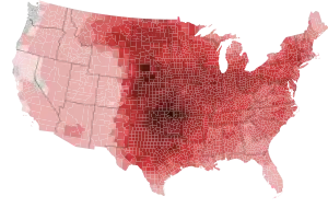
Legend:
|
<0.1
<3
<6
|
<9
<12
<15
|
<18
<21
>21
|
A watch does not necessarily mean that severe weather is actually occurring, only that atmospheric conditions have created a significant risk for severe weather to occur. If severe weather actually does occur, a severe thunderstorm warning will be issued, and urgent action should be taken immediately. While a severe thunderstorm watch does not imply in its name the risk for tornadoes, the risk for tornadoes in such a scenario is not necessarily zero, as severe thunderstorms can and occasionally do spawn tornadoes even after only a severe thunderstorm watch has been issued.
In the United States, the Storm Prediction Center – a national guidance center of the National Weather Service (NWS) – issues watches for areas of the lower 48 states that are likely to produce tornadoes and/or severe thunderstorms. The local NWS forecast offices in Hawaii and Alaska issue their own Severe Thunderstorm and Tornado Watches.[3]
The terms "blue box" and "yellow box" refer to the assigned coloring used for watch box outlines used in Storm Prediction Center and National Weather Service products as well as by television broadcast media (in the case of the latter, the colors assigned to designate severe thunderstorm watches sometimes vary, but very seldom is yellow ever used, as that color is usually reserved for identifying severe thunderstorm warnings; blue is typically assigned to highlight severe thunderstorm watches in severe weather advisory displays).
The watch boxes (or weather watches, WWs) are usually issued in the format of x miles north and south, or east and west, or either side of a line from y miles direction of city, state, to z miles another direction of another city, state. For example: "50 miles either side of a line from 10 miles northeast of Columbia, South Carolina to 15 miles south-southwest of Montgomery, Alabama". ("Either side" means perpendicular to the center line.) When displayed on a map, they are usually shown as either a blue or yellow outline, depending on the source. In addition, a list of all counties included in its area of responsibility is now issued by each local NWS forecast office for each watch.
In the event that a severe thunderstorm watch is likely to lead to very destructive winds or hail (usually from a major derecho event), enhanced wording with the words Particularly Dangerous Situation (PDS) can be added to the watch. This is rare with Severe Thunderstorm Watches since the tornado threat has to remain low enough to only warrant a Severe Thunderstorm Watch, and a higher tornado threat would warrant a normal Tornado Watch despite the extreme wind or hail threat. It is far more common with Tornado Watches.
Similar watches and warnings are issued by Environment Canada's Meteorological Service of Canada[4][5] from their offices in Vancouver, Edmonton, Toronto, Montreal, and Dartmouth, Nova Scotia.
Watch Outline Updates and Status Messages
Watch Outline Updates are relayed (and at the initial watch issuance, issued) by the Storm Prediction Center, however it is the local National Weather Service Weather Forecast Offices that decide what counties (in their warning area) are included or excluded in the watch, via a conference call with the SPC. As a result, watch products will sometimes display counties inside the watch outline that are not included in the counties listed, and vice versa; however the local Weather Forecast Office will need to expand to add these counties into the watch. A Watch Status Message works in a similar fashion; the SPC designates which areas it thinks where a threat still exists (the most common designation for this is on the basis of the location of surface features such as cold fronts and drylines that would delineate where the threat of severe thunderstorms has ended and where it will remain a possibility), and the NWS offices decide what counties to remove from the watch (the local offices will almost always follow the SPC recommendation on the status messages).[6] If conditions are no longer favorable for tornadoes in the watch area, the severe thunderstorm watch may be cancelled outright; if no thunderstorm activity occurs or if thunderstorms that develop remain under severe criteria, this leads to a severe thunderstorm watch "bust", which may also factor into the Storm Prediction Center's decision as to whether to cancel the watch.
Example of a severe thunderstorm watch
Severe Thunderstorm Watch Number 81
NWS Storm Prediction Center Norman OK
355 PM CDT Tue Apr 7 2020
The NWS Storm Prediction Center has issued a
* Severe Thunderstorm Watch for portions of
Northeast Illinois
Western Lower Michigan
Southeast Wisconsin
Lake Michigan
* Effective this Tuesday afternoon and evening from 355 PM until
900 PM CDT.
* Primary threats include...
Scattered damaging winds likely with isolated significant gusts
to 75 mph possible
Scattered large hail likely with isolated very large hail events
to 2.5 inches in diameter possible
A tornado or two possible
SUMMARY...Thunderstorms are expected to rapidly develop this
afternoon along an approaching cold front and move across the watch
area. Large hail and damaging wind gusts will be possible in the
stronger cells. An isolated tornado or two is also possible.
The severe thunderstorm watch area is approximately along and 75
statute miles east and west of a line from 45 miles north northwest
of Traverse City MI to 65 miles southeast of Racine WI. For a
complete depiction of the watch see the associated watch outline
update (WOUS64 KWNS WOU1).
PRECAUTIONARY/PREPAREDNESS ACTIONS...
REMEMBER...A Severe Thunderstorm Watch means conditions are
favorable for severe thunderstorms in and close to the watch area.
Persons in these areas should be on the lookout for threatening
weather conditions and listen for later statements and possible
warnings. Severe thunderstorms can and occasionally do produce
tornadoes.
&&
AVIATION...A few severe thunderstorms with hail surface and aloft to
2.5 inches. Extreme turbulence and surface wind gusts to 65 knots. A
few cumulonimbi with maximum tops to 500. Mean storm motion vector
28035.
...Hart
Example of Severe Thunderstorm Watch with PDS
SEVERE THUNDERSTORM WATCH NUMBER 300
NWS STORM PREDICTION CENTER NORMAN OK
400 PM CDT WED JUN 12 2013
THE NWS STORM PREDICTION CENTER HAS ISSUED A
  * SEVERE THUNDERSTORM WATCH FOR PORTIONS OF
    NORTHEAST ILLINOIS
    NORTHERN INDIANA
    SOUTHERN LOWER MICHIGAN
    NORTHWEST OHIO
    SOUTHEAST WISCONSIN
    LAKE ERIE
    LAKE MICHIGAN
  * EFFECTIVE THIS WEDNESDAY AFTERNOON AND THURSDAY MORNING FROM
    400 PM UNTIL 100 AM CDT.
...THIS IS A PARTICULARLY DANGEROUS SITUATION...
  * PRIMARY THREATS INCLUDE...
    NUMEROUS SIGNIFICANT DAMAGING WIND GUSTS TO 80 MPH LIKELY
    SEVERAL VERY LARGE HAIL EVENTS TO 2 INCHES IN DIAMETER POSSIBLE
    A FEW TORNADOES POSSIBLE
  THE SEVERE THUNDERSTORM WATCH AREA IS APPROXIMATELY ALONG AND 70
  STATUTE MILES EITHER SIDE OF A LINE FROM 40 MILES EAST OF FINDLAY
  OHIO TO 60 MILES SOUTH SOUTHWEST OF RACINE WISCONSIN.  FOR A
  COMPLETE DEPICTION OF THE WATCH SEE THE ASSOCIATED WATCH OUTLINE
  UPDATE (WOUS64 KWNS WOU0).
PRECAUTIONARY/PREPAREDNESS ACTIONS...
  REMEMBER...A SEVERE THUNDERSTORM WATCH MEANS CONDITIONS ARE
  FAVORABLE FOR SEVERE THUNDERSTORMS IN AND CLOSE TO THE WATCH
  AREA. PERSONS IN THESE AREAS SHOULD BE ON THE LOOKOUT FOR
  THREATENING WEATHER CONDITIONS AND LISTEN FOR LATER STATEMENTS
  AND POSSIBLE WARNINGS. SEVERE THUNDERSTORMS CAN AND OCCASIONALLY
  DO PRODUCE TORNADOES.
&&
OTHER WATCH INFORMATION...CONTINUE...WW 298...WW 299...
  DISCUSSION...THUNDERSTORMS ARE EXPECTED TO CONSOLIDATE INTO A
  FORWARD PROPAGATING CONVECTIVE SYSTEM OVER THE NEXT SEVERAL HOURS AS
  A COMPACT BUT PROGRESSIVE SHORTWAVE TROUGH ACTS ON A VERY UNSTABLE
  AIRMASS ACROSS THE UPPER MIDWEST/LOWER GREAT LAKES REGION. ONGOING
  CONVECTION NEAR A SURFACE LOW AND WARM FRONT...FROM IOWA EAST ACROSS
  NORTHERN ILLINOIS...EXISTS WHERE LOW LEVEL SHEAR AND ASCENT WILL
  CONTRIBUTE TO A FEW MORE HOURS OF TORNADO POTENTIAL IN WATCH 298.
  EVENTUALLY STORMS WILL CONGEAL INTO A LARGE MASS OF CONVECTION WITH
  ASCENT AND STRENGTHENING SHEAR SUPPORTING A POSSIBLE DERECHO OR
  WIDESPREAD DAMAGING WIND EVENT. THIS TRANSITION IS LIKELY TO OCCUR
  ACROSS THE CHICAGO AREA AND SRN LAKE MICHIGAN INTO EARLY EVENING.
  PRIOR TO THIS EVOLUTION THE LARGE HAIL AND TORNADO POSSIBILITIES
  WILL BE GREATEST WITHIN THE WESTERN PORTIONS OF WATCH 300. WITH
  TIME...MORE WIDESPREAD DAMAGING WIND POTENTIAL WILL DEVELOP AS THE
  MCS RACES EAST ACROSS SOUTHERN MI/NORTHERN IND...AND INTO NORTHWEST
  OH THROUGH LATE TONIGHT.
  AVIATION...A FEW SEVERE THUNDERSTORMS WITH HAIL SURFACE AND ALOFT
  TO 2 INCHES. EXTREME TURBULENCE AND SURFACE WIND GUSTS TO 70
  KNOTS. A FEW CUMULONIMBI WITH MAXIMUM TOPS TO 550. MEAN STORM
  MOTION VECTOR 28045.
...CARBIN
Example of a Watch Outline Update
  BULLETIN - IMMEDIATE BROADCAST REQUESTED
  SEVERE THUNDERSTORM WATCH OUTLINE UPDATE FOR WS 271
  NWS STORM PREDICTION CENTER NORMAN OK
  1135 AM EDT SUN JUN 2 2013

  SEVERE THUNDERSTORM WATCH 271 IS IN EFFECT UNTIL 800 PM EDT
  FOR THE FOLLOWING LOCATIONS

  CTC003-005-030000-
  /O.NEW.KWNS.SV.A.0271.130602T1535Z-130603T0000Z/

  CT
  .    CONNECTICUT COUNTIES INCLUDED ARE

  HARTFORD             LITCHFIELD

  MAC003-011-013-015-017-027-030000-
  /O.NEW.KWNS.SV.A.0271.130602T1535Z-130603T0000Z/

  MA
  .    MASSACHUSETTS COUNTIES INCLUDED ARE

  BERKSHIRE            FRANKLIN            HAMPDEN
  HAMPSHIRE            MIDDLESEX           WORCESTER


  MEC001-003-005-007-011-017-019-021-025-031-030000-
  /O.NEW.KWNS.SV.A.0271.130602T1535Z-130603T0000Z/

  ME
  .    MAINE COUNTIES INCLUDED ARE

  ANDROSCOGGIN         AROOSTOOK           CUMBERLAND
  FRANKLIN             KENNEBEC            OXFORD
  PENOBSCOT            PISCATAQUIS         SOMERSET
  YORK


  NHC001-003-005-007-009-011-013-015-017-019-030000-
  /O.NEW.KWNS.SV.A.0271.130602T1535Z-130603T0000Z/

  NH
  .    NEW HAMPSHIRE COUNTIES INCLUDED ARE

  BELKNAP              CARROLL             CHESHIRE
  COOS                 GRAFTON             HILLSBOROUGH
  MERRIMACK            ROCKINGHAM          STRAFFORD
  SULLIVAN


  NYC001-019-021-027-031-035-039-057-083-091-093-095-111-113-115-
  030000-
  /O.NEW.KWNS.SV.A.0271.130602T1535Z-130603T0000Z/

  NY
  .    NEW YORK COUNTIES INCLUDED ARE

  ALBANY               CLINTON             COLUMBIA
  DUTCHESS             ESSEX               FULTON
  GREENE               MONTGOMERY          RENSSELAER
  SARATOGA             SCHENECTADY         SCHOHARIE
  ULSTER               WARREN              WASHINGTON


  VTC001-003-005-007-009-011-013-015-017-019-021-023-025-027-
  030000-
  /O.NEW.KWNS.SV.A.0271.130602T1535Z-130603T0000Z/

  VT
  .    VERMONT COUNTIES INCLUDED ARE

  ADDISON              BENNINGTON          CALEDONIA
  CHITTENDEN           ESSEX               FRANKLIN
  GRAND ISLE           LAMOILLE            ORANGE
  ORLEANS              RUTLAND             WASHINGTON
  WINDHAM              WINDSOR


  ATTN...WFO...BOX...BTV...ALY...GYX...CAR...
See also
References
- "Severe Weather Definitions". weather.gov. Retrieved October 23, 2019.
- "Severe Weather Facts". factsjustforkids.com. Retrieved October 23, 2019.
- "3.2.1.1 Geographical responsibilities" (PDF). ofcm.gov. Archived from the original (PDF) on 9 August 2003. Retrieved 3 January 2013.
- "Severe Thunderstorm Watch". ec.gc. 25 February 2013. Retrieved 22 January 2014.
- "Severe Thunderstorm". ec.gc. 9 December 2013. Retrieved 22 January 2014.
- "Current Convective Watches". spc.noaa.gov. Retrieved 23 October 2019.