Shell Knob, Missouri
Shell Knob is a census-designated place (CDP) in White River Township in Barry County and Alpine Township in Stone County in the state of Missouri. The population was 1,379 at the 2010 census.[3]
Shell Knob, Missouri | |
|---|---|
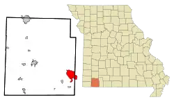 Location of Shell Knob, Missouri | |
| Coordinates: 36°36′9″N 93°35′55″W | |
| Country | United States |
| State | Missouri |
| Counties | Barry, Stone |
| Township | White River, Alpine |
| Area | |
| • Total | 10.9 sq mi (28.2 km2) |
| • Land | 8.2 sq mi (21.3 km2) |
| • Water | 2.6 sq mi (6.8 km2) |
| Elevation | 1,148 ft (350 m) |
| Population (2010) | |
| • Total | 1,379 |
| • Density | 167/sq mi (64.6/km2) |
| Time zone | UTC-6 (Central (CST)) |
| • Summer (DST) | UTC-5 (CDT) |
| ZIP code | 65747 |
| Area code(s) | 417 |
| FIPS code | 29-67232[1] |
| GNIS feature ID | 0752104[2] |
The Stone County portion of Shell Knob is part of the Branson, Missouri Micropolitan Statistical Area.
History
Located in the Ozark Mountains, Shell Knob was established in 1835 on the banks of the White River when Henry and Elizabeth Yoachum Schell built a trading post. The "c" was somehow left off the name when the post office was established in 1872. The Schells left in 1846 and went on to establish the community of Jacket, Missouri.[4] Most families were self-supporting and the modern world was slow to penetrate the area. In 1959, Table Rock Dam was completed and Table Rock Lake filled, changing the Shell Knob area and community forever.
Today Shell Knob is an active lake resort area. The area population is over 1300,[5] made up of retirees, part-time vacation home residents and young families. It remains very much a small town but is close to the larger cities of Springfield, Branson, Monett and Joplin in Missouri, and the Northwest Arkansas Metropolitan area.
Geography
Shell Knob is located at 36°36′9″N 93°35′55″W (36.602494, -93.598707).[6]
According to the United States Census Bureau, the CDP has a total area of 10.9 square miles (28.2 km2), of which 8.2 square miles (21.3 km2) is land and 2.6 square miles (6.8 km2), or 24.25%, is water.[3]
Shell Knob is located on Missouri Route 39 by Table Rock Lake.
Demographics
As of the census[1] of 2000, there were 1,393 people, 651 households, and 462 families residing in the CDP. The population density was 169.7 people per square mile (65.5/km2). There were 1,022 housing units at an average density of 124.5/sq mi (48.1/km2). The racial makeup of the CDP was 98.21% White, 0.36% Native American, 0.14% Pacific Islander, 0.22% from other races, and 1.08% from two or more races. Hispanic or Latino of any race were 1.44% of the population.
There were 651 households, out of which 14.9% had children under the age of 18 living with them, 63.9% were married couples living together, 4.5% had a female householder with no husband present, and 29.0% were non-families. 25.0% of all households were made up of individuals, and 16.3% had someone living alone who was 65 years of age or older. The average household size was 2.14 and the average family size was 2.51.
In the CDP, the population was spread out, with 14.9% under the age of 18, 3.8% from 18 to 24, 15.9% from 25 to 44, 33.5% from 45 to 64, and 31.9% who were 65 years of age or older. The median age was 55 years. For every 100 females, there were 94.0 males. For every 100 females age 18 and over, there were 92.1 males.
The median income for a household in the CDP was $29,896, and the median income for a family was $36,172. Males had a median income of $29,500 versus $23,438 for females. The per capita income for the CDP was $18,111. About 9.6% of families and 12.1% of the population were below the poverty line, including 24.4% of those under age 18 and 5.2% of those age 65 or over.
Education
Shell Knob 78 School District operates the Shell Knob Elementary School.[7]
Shell Knob has a public library, a branch of the Barry-Lawrence Regional Library.[8]
References
- "U.S. Census website". United States Census Bureau. Retrieved 2008-01-31.
- "US Board on Geographic Names". United States Geological Survey. 2007-10-25. Retrieved 2008-01-31.
- "Geographic Identifiers: 2010 Demographic Profile Data (G001): Shell Knob CDP, Missouri". U.S. Census Bureau, American Factfinder. Archived from the original on February 12, 2020. Retrieved January 23, 2014.
- "Jacket Holds Rich Memories"; The Times of Northeast Benton County; December 28, 2011
- http://censusviewer.com/city/MO/Shell%20Knob/2010
- "US Gazetteer files: 2010, 2000, and 1990". United States Census Bureau. 2011-02-12. Retrieved 2011-04-23.
- "Shell Knob 78 School District". Great Schools. Retrieved 17 March 2018.
- "Locations". Barry-Lawrence Regional Library. Retrieved 17 March 2018.
External links
Municipalities and communities of Barry County, Missouri, United States | ||
|---|---|---|
| Cities | 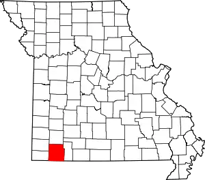 Map of Missouri highlighting Barry County | |
| Villages | ||
| Townships | ||
| CDPs | ||
| Unincorporated communities | ||
| Ghost towns | ||
| Footnotes | ‡This populated place also has portions in an adjacent county or counties | |
| ||
Municipalities and communities of Stone County, Missouri, United States | ||
|---|---|---|
| Cities | 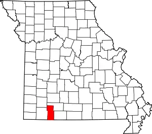 Map of Missouri highlighting Stone County | |
| Villages | ||
| CDP | ||
| Unincorporated communities | ||
| Ghost town | ||
| Footnotes | ‡This populated place also has portions in an adjacent county or counties | |
| ||