Shendam
Shendam is a Local Government Area in Plateau State, Nigeria. Its headquarters are in the town of Shendam. It is bordered by Ibi Taraba State to the south, Qua'an Pan to the east, Pankshin to the north, and Mikang to the west. Shendam town is the second most populous town in Plateau State, after Jos town at 8°53′00″N 9°32′00″E.
Shendam
yil Du'ut Mudu'ut | |
|---|---|
LGA and town | |
 Shendam Location in Nigeria | |
| Coordinates: 8°43′N 9°30′E | |
| Country | |
| State | Plateau State |
| Headquarters | Shendam Town |
| Government | |
| • Type | Democratic |
| • L.G.A | Shendam |
| Area | |
| • Total | 2,477 km2 (956 sq mi) |
| Population (2006 census) | |
| • Total | 205,119 |
| Time zone | UTC+1 (WAT) |
| 3-digit postal code prefix | 940 |
| ISO 3166 code | NG.PL.SH |
It has an area of 2,477 km2 and a population of 208,017 at the 2006 census.
The postal code of the area is 940.[1]
The Goemai language and many other West Chadic languages are spoken in Shendam LGA.[2]
References
- "Post Offices- with map of LGA". NIPOST. Archived from the original on 2009-10-07. Retrieved 2009-10-20.
- Goemai at Ethnologue
State capital: Jos | ||
| Local Government Areas | 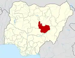 | |
This article is issued from Wikipedia. The text is licensed under Creative Commons - Attribution - Sharealike. Additional terms may apply for the media files.
