Si Chiang Mai District
Si Chiang Mai (Thai: ศรีเชียงใหม่, pronounced [sǐː t͡ɕʰīa̯ŋ màj]) is a district (amphoe) in the western part of Nong Khai Province, northeastern Thailand. It may also be spelled Sri Chiang Mai.
Si Chiang Mai
ศรีเชียงใหม่ | |
|---|---|
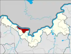 District location in Nong Khai Province | |
| Coordinates: 17°57′23″N 102°35′22″E | |
| Country | Thailand |
| Province | Nong Khai |
| Area | |
| • Total | 198.0 km2 (76.4 sq mi) |
| Population (2014) | |
| • Total | 30,687 |
| • Density | 157.2/km2 (407/sq mi) |
| Time zone | UTC+7 (ICT) |
| Postal code | 43130 |
| Geocode | 4307 |
History
Si Chiang Mai District was established by King Setthathirath of Lan Xang Kingdom. It was named after Chiang Mai, the hometown of his grandmother, the former queen of Chiang Mai (his mother was the princess from Lan Na). It was created as a district of Nong Khai Province on 4 August 1958, when it was split off from Tha Bo District.[1]
Geography
Neighboring districts are (from the southeast clockwise): Tha Bo, Pho Tak, and Sangkhom of Nong Khai Province. To the north across the Mekong river is the Lao province Vientiane Prefecture. A basalt plateau is flanked by the Mekong River to the north.

Administration
Central administration
Si Chiang Mai is divided into four sub-districts (tambons), which are further subdivided into 43 administrative villages (mubans).
| No. | Name | Thai | Villages | Pop.[2] |
|---|---|---|---|---|
| 1. | Phan Phrao | พานพร้าว | 15 | 13,436 |
| 3. | Ban Mo | บ้านหม้อ | 8 | 4,368 |
| 4. | Phra Phutthabat | พระพุทธบาท | 10 | 5,041 |
| 5. | Nong Pla Pak | หนองปลาปาก | 10 | 7,842 |
Missing number is a tambon which now forms Pho Tak District.
Local administration
There are two sub-district municipalities (thesaban tambons) in the district:
- Si Chiang Mai (Thai: เทศบาลตำบลศรีเชียงใหม่) consisting of parts of sub-district Phan Phrao.
- Nong Pla Pak (Thai: เทศบาลตำบลหนองปลาปาก) consisting of sub-district Nong Pla Pak.
There are three sub-district administrative organizations (SAO) in the district:
- Phan Phrao (Thai: องค์การบริหารส่วนตำบลพานพร้าว) consisting of parts of sub-district Phan Phrao.
- Ban Mo (Thai: องค์การบริหารส่วนตำบลบ้านหม้อ) consisting of sub-district Ban Mo.
- Phra Phutthabat (Thai: องค์การบริหารส่วนตำบลพระพุทธบาท) consisting of sub-district Phra Phutthabat.
References
- "พระราชกฤษฎีกาจัดตั้งอำเภอศรีเชียงใหม่ พ.ศ. ๒๕๐๑" (PDF). Royal Gazette (in Thai). 75 (55 ก): 328–330. 1958-07-22.
- "Population statistics 2014" (in Thai). Department of Provincial Administration. Retrieved 2015-02-18.
External links
- amphoe.com on Si Chiang Mai