Nong Khai Province
Nong Khai Province (Thai: หนองคาย, pronounced [nɔ̌ːŋ kʰāːj]) was formerly the northernmost of the northeastern (Isan) provinces (changwat) of Thailand until its eight eastern districts were split off to form Thailand's newest province, Bueng Kan Province, in 2011. Nong Khai Province lies in upper northeastern Thailand. Nearby provinces are (clockwise, from the east): Bueng Kan, Sakon Nakhon, Udon Thani, and Loei. To the north it borders Vientiane Province, Vientiane Prefecture, and Bolikhamsai Province of Laos.
Nong Khai
หนองคาย | |
|---|---|
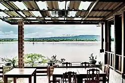 View of Mekong from riverside restaurant in Sangkhom District | |
 Flag  Seal | |
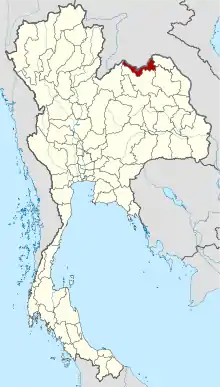 Map of Thailand highlighting Nong Khai Province | |
| Country | Thailand |
| Capital | Nong Khai |
| Government | |
| • Governor | Suchat Nopphawan (since November 2014) |
| Area | |
| • Total | 3,027 km2 (1,169 sq mi) |
| Area rank | Ranked 61st |
| Population (2018)[2] | |
| • Total | 522,103 |
| • Rank | Ranked 52nd |
| • Density | 173/km2 (450/sq mi) |
| • Density rank | Ranked 19th |
| Human Achievement Index | |
| • HAI (2017) | 0.5881 "average" Ranked 37th |
| Time zone | UTC+7 (ICT) |
| Postal code | 43xxx |
| Calling code | 042 |
| ISO 3166 code | TH-43 |
| Website | www |
Geography
The province is in the valley of the Mae Nam Kong (Mekong River), which also forms the border with Laos. There are highlands to the south. The Laotian capital, Vientiane, is only 25 kilometers (16 mi) from the provincial capital of Nong Khai. The First Thai–Lao Friendship Bridge, which connects the two countries, was built jointly by the governments of Thailand, Laos, and Australia, and was opened in 1994.[4]
Nong Khai is the smallest province in the northeastern after Bueng Kan and other seven districts became Bueng Kan Province in 2011.
History
Over the centuries, control of the province swung between the Thai Kingdom Ayutthaya, and the Laotian kingdom Lan Xang, as their respective powers ebbed and flowed in the region.[5]
The Prap Ho Monument in front of the historic city hall (now a museum and cultural center) memorializes the war dead of the Haw wars.[6]
In more recent years, Nong Khai has become a popular destination during the Buddhist Lent festival when mysterious balls of light, or Naga fireballs, rise from the Mekong River. The balls resemble an orange sun. They rise out of the river approximately 6–9 meters (20 to 30 feet) and disappear after three to five seconds. Although the fireballs can be seen at other times, most Thais travel to see them during the full moon in October when the incidence of them is considered to be much higher.[7]
Nong Khai's main sight is Sala Keoku (alternatively spelled as Sala Kaew Ku, also known as Wat Khaek), a park of colossal sculptures, some over 20 m tall. The park is the handiwork of the mystic Luang Pu Bunleua Sulilat, who bought the land in 1978 when he was exiled from his native Laos, where he had built a similar park in Vientiane in the 1950s. Synthesizing Buddhist and Hinduist ideologies, Buddhas, many-armed goddesses, a seven-headed Naga snake, and various human-animal hybrids dominate the site.[8]
Symbols
| The provincial seal shows a pond with a bamboo clump close to it. The bamboo symbolizes stability, glory, and continuity for the peaceful and fertile land.[9]
The provincial tree is the tamalan or Burma pallisander (Dalbergia oliveri). |
Administrative divisions

Provincial government
As of 23 March 2011, the province is divided into nine districts (amphoes). The districts are further divided into 62 subdistricts (tambons) and 705 villages (mubans). The eight districts of Bueng Kan were districts of Nong Khai before they were split off to form Bueng Kan Province.
|
1.Mueang Nong Khai |
Local government
As of 26 November 2019 there are:[10] one Nong Khai Provincial Administration Organisation (ongkan borihan suan changwat) and 19 municipal (thesaban) areas in the province. Nong Khai and Tha Bo have town (thesaban mueang) status. Further 17 subdistrict municipalities (thesaban tambon). The non-municipal areas are administered by 48 Subdistrict Administrative Organisations - SAO (ongkan borihan suan tambon).[2]
Transport
Air
The nearest airport is Udon Thani International Airport, 56 km from Nong Khai.
Rail
The main railway station in Nong Khai is Nong Khai Railway Station. This station can be considered the destination of the Upper Northeastern Railway Line (only in Thailand's area).
Road
The Thai–Lao Friendship Bridge was largely funded by a gift to the Lao government from the Australian government.[11] It is the road and railway gateway to Laos's capital, Vientiane (25 kilometers (16 mi) upriver), on the north bank opposite the Thai town of Si Chiang Mai District. Construction of a rail spur to Thanaleng outside of Vientiane was begun early-2007 and officially opened 5 March 2009.[12]
Nong Khai is 626 km north of Bangkok[13] and 60 km north of Udon Thani.[14]
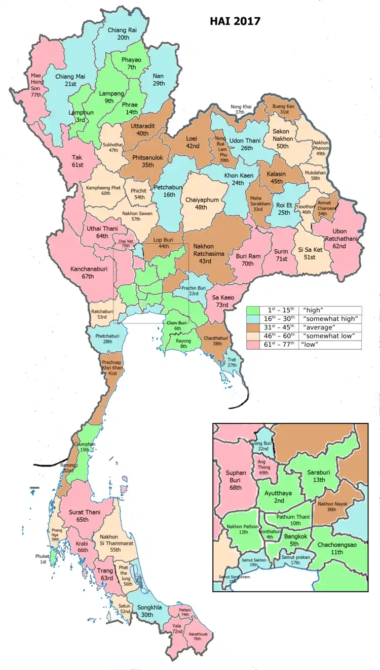
Human achievement index 2017
| Health | Education | Employment | Income |
| 48 | 37 | 57 | 31 |
| Housing | Family | Transport | Participation |
 |
 |
||
| 7 | 26 | 58 | 58 |
| Province Nong Khai, with an HAI 2017 value of 0.5881 is "average", occupies place 37 in the ranking. | |||
Since 2003, United Nations Development Programme (UNDP) in Thailand has tracked progress on human development at sub-national level using the Human achievement index (HAI), a composite index covering all the eight key areas of human development. National Economic and Social Development Board (NESDB) has taken over this task since 2017.[3]
| Rank | Classification |
| 1 - 15 | "high" |
| 16 - 30 | "somewhat high" |
| 31 - 45 | "average" |
| 45 - 60 | "somewhat low" |
| 61 - 77 | "low" |
| Map with provinces and HAI 2017 rankings |
 |
Gallery
 Phrathat Nong Khai
 Nong Khai Aquarium
 Nong Khai Aquarium
 Dragon Human Tower
Notes
Reports (data) from Thai government are "not copyrightable" (Public Domain), Copyright Act 2537 (1994), section 7.
References
- Advancing Human Development through the ASEAN Community, Thailand Human Development Report 2014, table 0:Basic Data (PDF) (Report). United Nations Development Programme (UNDP) Thailand. pp. 134–135. ISBN 978-974-680-368-7. Retrieved 17 January 2016, Data has been supplied by Land Development Department, Ministry of Agriculture and Cooperatives, at Wayback Machine.
- "รายงานสถิติจำนวนประชากรและบ้านประจำปี พ.ศ.2561" [Statistics, population and house statistics for the year 2018]. Registration Office Department of the Interior, Ministry of the Interior (in Thai). 31 December 2018. Retrieved 20 June 2019.
- Human achievement index 2017 by National Economic and Social Development Board (NESDB), pages 1-40, maps 1-9, retrieved 14 September 2019, ISBN 978-974-9769-33-1
- "Thai-Lao Friendship Bridge". Tourism Authority of Thailand (TAT). Retrieved 22 May 2015.
- "Nong Khai". Tourism Authority of Thailand (TAT). Retrieved 22 May 2015.
- "Prap Ho Monument". Tourism Authority of Thailand (TAT). Archived from the original on 22 May 2015. Retrieved 22 May 2015.
- "The Naga fireballs, Nong Khai". Tourism Authority of Thailand (TAT). Archived from the original on 22 May 2015. Retrieved 22 May 2015.
- "Sala Kaeo Ku or Wat Khaek". Tourism Authority of Thailand (TAT). Archived from the original on 22 May 2015. Retrieved 22 May 2015.
- Masure, Yves. "Nong Khai". THAILEX Travel Encyclopedia. Retrieved 22 May 2015.
- "Number of local government organizations by province". dla.go.th. Department of Local Administration (DLA). 26 November 2019. Retrieved 10 December 2019.
69 Nong Khai: 1 PAO, 2 Town mun., 17 Subdistrict mun., 48 SAO.
- Australian Govt Dept of Foreign Trade, Feb 9 2008, "Archived copy" (PDF). Archived from the original (PDF) on 2014-07-31. Retrieved 2014-11-11.CS1 maint: archived copy as title (link),
- Spooner, Andrew (2009-02-27). "First Train to Laos". The Guardian. Retrieved 22 May 2015.
- "Distance: Bangkok to Nong Khai". Google Maps. Retrieved 22 May 2015.
- "Distance: Udon Thani to Nong Khai". Google Maps. Retrieved 22 May 2015.
External links
 Nong Khai travel guide from Wikivoyage
- Provincial website (in Thai)
- Nong Khai Travel Guide
Places adjacent to Nong Khai Province | |
|---|---|