Smackover, Arkansas
Smackover is a small city in northern Union County, Arkansas, United States. According to the 2010 census, the population was at 1,865. It had a large oil boom in the 1920s, with production continuing for some time.
Smackover, Arkansas | |
|---|---|
 Central Smackover | |
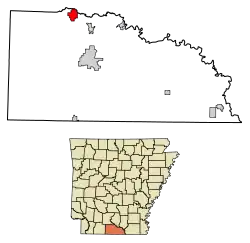 Location of Smackover in Union County, Arkansas. | |
| Coordinates: 33°21′53″N 92°43′30″W[1] | |
| Country | United States |
| State | Arkansas |
| County | Union |
| Area | |
| • Total | 4.35 sq mi (11.26 km2) |
| • Land | 4.35 sq mi (11.26 km2) |
| • Water | 0.00 sq mi (0.00 km2) |
| Elevation | 121 ft (37 m) |
| Population (2010) | |
| • Total | 1,865 |
| • Estimate (2019)[3] | 1,688 |
| • Density | 388.22/sq mi (149.88/km2) |
| Time zone | UTC-6 (Central (CST)) |
| • Summer (DST) | UTC-5 (CDT) |
| ZIP code | 71762 |
| Area code(s) | 870 |
| FIPS code | 05-64730 |
| Website | smackover |
History
In 1686, the French settlers called this area "SUMAC COUVERT", which translates to "covered in sumac bushes". This was transliterated, that is, phonetically Anglicized by the English-speaking settlers of the 19th century and later to the name "SMACKOVER."
The name Bayou de Chemin Couvert (Smackover Creek) first appeared in an April 5, 1789, letter written by the commandant of Fort Miro (Monroe, Louisiana) to the French territorial governor.[4]
Oil was discovered in this area in 1922; it attracted national attention, speculators, and an economic boom. Smackover was incorporated in 1923. In the 1920s there was a large-scale oil industry in Smackover.[5] The industry declined here and across southern Arkansas by the 1960s, at a cost of many jobs and major losses to the area economy.
Smackover Oil Field
The Smackover Oil Field was discovered on April 14, 1922. The J.T. Murphy well drilled by Oil Operators Trust, reached the Upper Cretaceous Nacatoch sand at a depth of 2024 feet, part of the Norphlet dome. Within a year, almost 1,000 wells had produced 25 million barrels of oil.
In October 1922, a lighter oil was produced further west, from the Meakin sand, at depths between 2230 and 2350 feet. Oil was discovered in the Blossom sand at a depth of 2610 feet in March 1923. The Graves sand was exploited for oil at a depth of 2501 feet in January 1925.
On 8 May 1936, oil was discovered in the Jurassic Smackover Formation limestone at a depth of 4800 feet by the Phillips Petroleum Company. Oil and gas were produced from the porous Reynolds oolite at a depth of 4897 feet.[6]
Geography
The city is in northern Union County along Smackover Creek. El Dorado lies about ten miles to the south-southeast along Arkansas Route 7.[7] According to the United States Census Bureau, the city has a total area of 4.2 square miles (11 km2), all land.
Climate
The climate in this area is characterized by hot, humid summers and generally mild to cool winters. According to the Köppen Climate Classification system, Smackover has a humid subtropical climate, abbreviated "Cfa" on climate maps.[8]
Demographics
| Historical population | |||
|---|---|---|---|
| Census | Pop. | %± | |
| 1930 | 2,544 | — | |
| 1940 | 2,235 | −12.1% | |
| 1950 | 2,495 | 11.6% | |
| 1960 | 2,434 | −2.4% | |
| 1970 | 2,058 | −15.4% | |
| 1980 | 2,453 | 19.2% | |
| 1990 | 2,232 | −9.0% | |
| 2000 | 2,005 | −10.2% | |
| 2010 | 1,865 | −7.0% | |
| 2019 (est.) | 1,688 | [3] | −9.5% |
| U.S. Decennial Census[9] | |||
As of the census[10] of 2000, there were 2,005 people, 794 households, and 565 families residing in the city. The population density was 471.9 people per square mile (182.1/km2). There were 915 housing units at an average density of 215.3 per square mile (83.1/km2). The racial makeup of the city was 72.57% White, 26.28% Black or African American, 0.10% Native American, 0.05% Asian, 0.05% Pacific Islander, and 0.95% from two or more races. 0.25% of the population were Hispanic or Latino of any race.
There were 794 households, out of which 31.1% had children under the age of 18 living with them, 52.9% were married couples living together, 15.1% had a female householder with no husband present, and 28.8% were non-families. 27.3% of all households were made up of individuals, and 17.8% had someone living alone who was 65 years of age or older. The average household size was 2.46 and the average family size was 2.99.
In the city, the population was spread out, with 24.7% under the age of 18, 7.8% from 18 to 24, 24.7% from 25 to 44, 21.7% from 45 to 64, and 21.1% who were 65 years of age or older. The median age was 39 years. For every 100 females, there were 92.2 males. For every 100 females age 18 and over, there were 81.3 males.
The median income for a household in the city was $28,807, and the median income for a family was $36,875. Males had a median income of $31,081 versus $19,536 for females. The per capita income for the city was $14,461. About 9.1% of families and 14.7% of the population were below the poverty line, including 18.8% of those under age 18 and 13.0% of those age 65 or over.
Education
Public education for early childhood, elementary and secondary school students is primarily provided by the Smackover School District, which includes:
- Smackover Elementary School, serving prekindergarten through grade 6.
- Smackover High School, serving grades 7 through 12.
The school district's athletic emblem is the Battlin' Buckaroos with black and white as the school colors.
Culture
The little oil town of Smackover is steeped in pure Americana. A street-mounted antique stop light is located in the center of town and western-style store fronts line Main Street. It is home to the Arkansas Museum of Natural Resources. The Museum depicts the history and culture of Smackover and the surrounding area with an indoor reconstruction of the city's downtown, an Oil Field Park, and numerous exhibits illustrating South Arkansas's oil industry. Smackover hosts an annual four-day Oil Town Festival held in June.[11]
Longtime college coaching legend Wayne Hardin, a former Smackover resident, was inducted into the NFF College Hall of Fame in 2013. The city has two natives in the College Football Hall of Fame.
Notable people
- Wayne Hardin (1926–2017), college football player
- Nathan Fletcher (born 1976), California politician
- Sleepy LaBeef (1935–2019), roots musician
- Clyde Scott (1924–2018), football player
References
- U.S. Geological Survey Geographic Names Information System: Smackover, Arkansas
- "2019 U.S. Gazetteer Files". United States Census Bureau. Retrieved June 30, 2020.
- "Population and Housing Unit Estimates". United States Census Bureau. May 24, 2020. Retrieved May 27, 2020.
- "Encyclopedia of Arkansas". Encyclopedia of Arkansas. Retrieved Dec 28, 2019.
- Gallant, Frank K. (May 17, 2012). A Place Called Peculiar: Stories About Unusual American Place-Names. Courier Dover Publications. p. 20. Retrieved 2013-04-19.
- "Archived copy" (PDF). Archived from the original (PDF) on 2015-09-23. Retrieved 2015-06-01.CS1 maint: archived copy as title (link), AOGC, State of Arkansas
- Arkansas Atlas & Gazetteer, DeLorme, 2nd ed., 2004, p.62 ISBN 0899333451
- "Smackover, Arkansas Köppen Climate Classification (Weatherbase)". Weatherbase. Retrieved Dec 28, 2019.
- "Census of Population and Housing". Census.gov. Retrieved June 4, 2015.
- "U.S. Census website". United States Census Bureau. Retrieved 2008-01-31.
- "South Arkansas Before The Boom". Dec 12, 2003. Archived from the original on December 12, 2003. Retrieved Dec 28, 2019.
Municipalities and communities of Union County, Arkansas, United States | ||
|---|---|---|
| Cities | 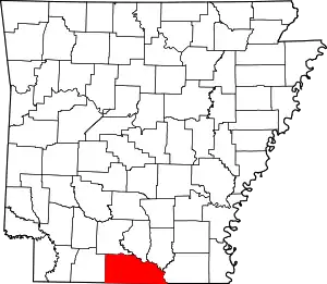 Map of Arkansas highlighting Union County | |
| Town | ||
| Unincorporated communities | ||
| ||
| Authority control |
|---|