Sonoma County Historical Society list of landmarks
The Sonoma County Historical Society (SCHS) has established a master list of historical landmarks in Sonoma County.[1]
This list is intended to provide a complete listing of all landmarks established by federal, state, county city/town governments in the county and independent organizations.[1]
Five cities have historical landmark programs: Santa Rosa,[2] Sonoma,[3] Petaluma,[4] Healdsburg[5] and Windsor.[6] Four cities do not have a program: Sebastopol, Cotati, Cloverdale and Rohnert Park. The County of Sonoma's official designated landmarks are numbered from 1 to 192, but some landmarks have been removed from the list and those numbers are not active.[7]
Sonoma County Historical Society Historical Landmarks
- Note: Click the "Map all coordinates" link to the right to view a Google map of all properties and districts with latitude and longitude coordinates in the table below.
| Name[8] | Image | Type | Nat'l Historic Landmark | Cal Historical Landmark | National Register | County or City Landmark | Lat/Long | City or Town | Address | APN | Notes | References | |||||||||||||
|---|---|---|---|---|---|---|---|---|---|---|---|---|---|---|---|---|---|---|---|---|---|---|---|---|---|
| Baker House[9] | Landmark | December 12, 2018(#100003234) | 38.6916°N 123.4203°W | Sea Ranch | 35292 Timber Ridge Rd. | [10] | |||||||||||||||||||
| Bodega Bay |  Ocean View | Landmark | December 18, 1973(#73000461) | general vicinigy 38.333°N 123.047°W | Bodega Bay | Address Restricted | |||||||||||||||||||
| Buena Vista Winery | 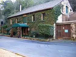 Buena Vista Winery, Sonoma, CA | Landmark | July 24, 1986(#86001902) | Sonoma County #18 | 38.299444°N 122.423056°W | Sonoma | 18000 Old Winery Rd. | Also known as Buena Vista Vineyards-Buena Vista Vinicultural Society | |||||||||||||||||
| Nicholas Carriger Estate | 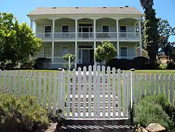 Nicholas Carriger Estate, 18880 Carriger Rd., Sonoma, CA 6-12-2010 2-29-07 PM | Landmark | November 16, 2001(#01001234) | Sonoma County #48 | 38.296767°N 122.511969°W | Sonoma | 18880 Carriger Rd. | 1850 home of early American settler, farmer and gold-mining magnate Nicholas Carriger[6] | |||||||||||||||||
| Cloverdale Railroad Station | Landmark | December 12, 1976(#76000536) | 38.803889°N 123.011389°W | Cloverdale | Railroad Ave. | Destroyed by fire September 25, 1991[7] | |||||||||||||||||||
| Cnopius House | 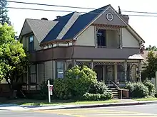 Cnopius House, 726 College Ave., Santa Rosa, CA 7-11-2010 5-15-22 PM | Landmark | April 12, 1982(#82002277) | 38.445556°N 122.7125°W | Santa Rosa | 726 College Ave. | |||||||||||||||||||
| Comstock House | .jpg.webp) Comstock House, Santa Rosa (2012) | Landmark | January 27, 2012(#11001053) | 38.447656°N 122.718111°W | Santa Rosa | 767 Mendocino Ave. | |||||||||||||||||||
| Condominium 1 |  Condominium 1, 110-128 Sea Walk Dr., Sea Ranch, CA 7-5-2010 7-07-18 PM | Landmark | July 29, 2005(#05000731) | Sonoma County #108 | 38.679167°N 123.427778°W | Sea Ranch | 110–128 Sea Walk Dr. | ||||||||||||||||||
| Cunningham-Hembree Estate | Landmark | July 9, 2018(#100002638) | 38.5522°N 122.8111°W | Windsor | 9225 Foxwood Dr. | ||||||||||||||||||||
| De Turk Round Barn | 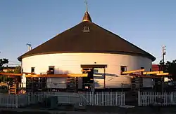 De Turk Round Barn, 819 Donahue St., Santa Rosa, CA 6-12-2010 8-05-53 PM | Landmark | April 21, 2004(#04000334) | Santa Rosa 2 - chb8 11/9/1988 | 38.440844°N 122.7252°W | Santa Rosa | 819 Donahue St. | ||||||||||||||||||
| Dry Creek-Warm Springs Valleys Archeological District | Landmark | December 9, 1977(#77000350) | Healdsburg | Address Restricted | |||||||||||||||||||||
| Duncan's Landing Site |  DuncansPoint3265 | Landmark | November 12, 1971(#71000206) | 38.396°N 123.095°W | Jenner | Address Restricted | |||||||||||||||||||
| Ellis-Martin House | Landmark | October 4, 2006(#06000915) | 38.245186°N 122.630089°W | Petaluma | 1197 E. Washington St. | ||||||||||||||||||||
| Fort Ross | 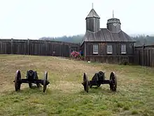 Cannons & Chapel, Fort Ross State Historical Monument, CA 7-5-2010 5-59-11 PM |
Landmark | 41, November 5, 1961(#66000239) | 5 | October 15, 1966(#66000239) | Sonoma County #114 | 38.514167°N 123.242778°W | Fort Ross | Fort Ross State Historic Park | Established by Ivan Kuskov of the Russian-American Company in 1812; thriving settlement from 1812 to 1841 | |||||||||||||||
| Free Public Library of Petaluma | 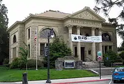 Free Public Library of Petaluma | Landmark | June 23, 1988(#88000925) | Petaluma 21 | 38.232572°N 122.639992°W | Petaluma | 20 Fourth St. | ||||||||||||||||||
| The Gables | 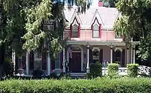 The Gables | Landmark | September 20, 1984(#84001206) | Sonoma County #131 | 38.393544°N 122.693003°W | Santa Rosa | 4257 Petaluma Hill Rd. | ||||||||||||||||||
| Geyserville Union School | Landmark | Sonoma County #32 | October 24, 1979(#79000558) | 38.707778°N 122.906389°W | Geyserville | Main St. | Demolished in 1994[8] | ||||||||||||||||||
| Glen Oaks Ranch |  Glen Oaks Ranch | Landmark | October 21, 1994(#94001223) | 38.370561°N 122.513178°W | Glen Ellen | 13255 Sonoma Hwy. | |||||||||||||||||||
| Luther Burbank's Experimental Farm & Cottage (Gold Ridge Farm) | Luther Burbank's Experimental Farm & Cottage (Gold Ridge Farm) | Landmark | December 14, 1978(#78000803) | 38.3975°N 122.833611°W | Sebastopol | W of Sebastopol | |||||||||||||||||||
| Gould-Shaw House | 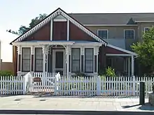 Gould-Shaw House, 215 N Cloverdale Blvd., Cloverdale, CA 7-3-2010 5-44-18 PM | Landmark | September 10, 1992(#92001244) | 38.806944°N 123.0175°W | Cloverdale | 215 N. Cloverdale Blvd. | |||||||||||||||||||
| Guerneville Bridge |  Guerneville Bridge | Landmark | August 4, 1989(#89000945) | Sonoma County #173 | 38.501111°N 122.994444°W | Guerneville | Rt. 116 over Russian River | ||||||||||||||||||
| Healdsburg Carnegie Library |  Healdsburg Carnegie Library | Landmark | July 6, 1988(#88000924) | 38.620278°N 122.866111°W | Healdsburg | 221 Matheson St. | Now known as the Healdsburg Museum | ||||||||||||||||||
| Healdsburg Memorial Bridge | .jpg.webp) Healdsburg Memorial Bridge (full) | Landmark | April 14, 2011(#11000214) | 38.603889°N 122.86°W | Healdsburg | Healdsburg Ave., junction of Front St. | Highway Bridges of California MPS | ||||||||||||||||||
| Hicks House |  Hicks House | Landmark | July 21, 1987(#87001157) | Sonoma County #45 | 38.437222°N 122.865°W | Graton | 3160 Hicks Rd. | ||||||||||||||||||
| Hinds Hotel | 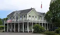 Hinds Hotel | Landmark | January 31, 1979(#79000557) | 38.372222°N 122.914722°W | Freestone | 306 Bohemian Hwy. | |||||||||||||||||||
| William Hood House | 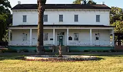 William Hood House | Landmark | February 6, 1998(#97001658) | 38.442456°N 122.577953°W | Santa Rosa | 7501 Sonoma Hwy 38 | |||||||||||||||||||
| Hotel Chauvet |  Hotel Chauvet | Landmark | February 15, 1990(#90000117) | Sonoma County #86 | 38.362256°N 122.526136°W | Glen Ellen | 13756 Arnold Dr. | ||||||||||||||||||
| Hotel La Rose |  Hotel La Rose | Landmark | August 3, 1978(#78000802) | 38.438056°N 122.719444°W | Santa Rosa | 5th and Wilson Sts. | |||||||||||||||||||
| Knipp and Stengel Ranch Barn | 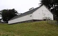 Knipp and Stengel Ranch Barn | Landmark | January 29, 1987(#87000005) | 38.715833°N 123.454722°W | Sea Ranch | CA 1 | |||||||||||||||||||
| James H. and Frances E. Laughlin House | Landmark | April 26, 1979(#79000563) | Sonoma County #142 | 38.512778°N 122.783889°W | Windsor | SE of Windsor on Lone Redwood Rd. | |||||||||||||||||||
| Llano Road Roadhouse | 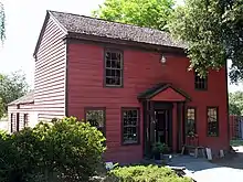 Llano Road Roadhouse | Landmark | May 22, 1978(#78000804) | Sonoma County #42 | 38.358056°N 122.767778°W | Sebastopol | 4353 Gravenstein Hwy., S | ||||||||||||||||||
| Jack London Ranch | 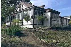 Jack London Ranch | Landmark | October 15, 1966(#66000240) | 38.350556°N 122.543056°W | Glen Ellen | 0.4 mi. W of Glen Ellen in Jack London Historical State Park | |||||||||||||||||||
| W. H. Lumsden House | 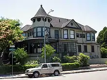 W. H. Lumsden House | Landmark | August 11, 1983(#83001245) | 38.446389°N 122.716944°W | Santa Rosa | 727 Mendocino Ave. | |||||||||||||||||||
| Madrona Manor | 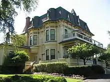 Madrona Manor | Landmark | April 2, 1987(#87000573) | 38.604722°N 122.885278°W | Healdsburg | 1001 Westside Rd. | Also known as Madrona Knoll Rancho District | ||||||||||||||||||
| McDonald Mansion | 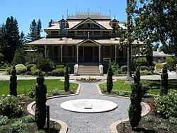 McDonald Mansion | Landmark | March 1, 1974(#74000560) | 38.450278°N 122.704167°W | Santa Rosa | 1015 McDonald Ave. | |||||||||||||||||||
| Old Petaluma Opera House | 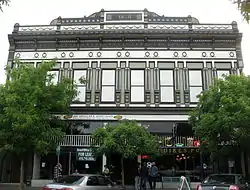 Old Petaluma Opera House | Landmark | December 22, 1978(#78000801) | 38.235017°N 122.641844°W | Petaluma | 149 Kentucky St. | |||||||||||||||||||
| Old Post Office | 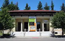 Old Post Office | Landmark | November 16, 1979(#79000559) | 38.441944°N 122.716944°W | Santa Rosa | 425 7th St. | Now home of the Sonoma County Museum | ||||||||||||||||||
| Orange Lawn | 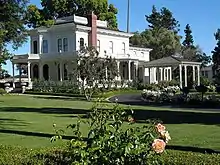 Orange Lawn | Landmark | June 9, 2008(#08000529) | 38.289478°N 122.446133°W | Sonoma | 645 Charles Van Damme Way | |||||||||||||||||||
| Park Apartments | 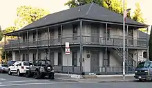 Park Apartments | Landmark | April 26, 1979(#79000560) | 38.435261°N 122.711478°W | Santa Rosa | 300 Santa Rosa Ave. | |||||||||||||||||||
| Petaluma Adobe | 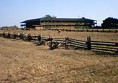 Petaluma Adobe | Landmark | April 15, 1970(#70000151) | 38.255425°N 122.584253°W | Petaluma | 4 mi. E of Petaluma on Casa Grande Rd. | |||||||||||||||||||
| Petaluma and Santa Rosa Railway Powerhouse |  Petaluma and Santa Rosa Railway Powerhouse | Landmark | July 23, 1991(#91000918) | 38.401389°N 122.82194°W | Sebastopol | 258 Petaluma Ave. | |||||||||||||||||||
| Petaluma Historic Commercial District |  Petaluma Historic Commercial District | Landmark | March 31, 1995(#95000354) | 38.234058°N 122.640272°W | Petaluma | Along Petaluma Blvd., between B and Prospect Sts. | |||||||||||||||||||
| Petaluma Silk Mill | 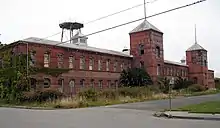 Petaluma Silk Mill | Landmark | March 6, 1986(#86000386) | 38.236114°N 122.630847°W | Petaluma | 420 Jefferson St. | |||||||||||||||||||
| Simon Pinschower House | 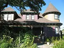 Simon Pinschower House | Landmark | February 25, 1982(#82002276) | 38.808611°N 123.016389°W | Cloverdale | 302 N. Main St. | |||||||||||||||||||
| Pond Farm Pottery Historic District | 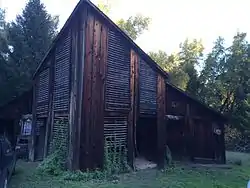 Pond Farm Pottery Historic District | Landmark | June 17, 2014(#14000307) | 38.552171°N 122.999991°W | Guerneville | 17000 Armstrong Woods Road | |||||||||||||||||||
| Railroad Square District |  Railroad Square District | Landmark | April 20, 1979(#79000561) | 38.437222°N 122.720278°W | Santa Rosa | Roughly bounded by 3rd, Davis, Wilson, and 6th Sts. and Santa Rosa Creek | |||||||||||||||||||
| The Ranch Site | Landmark | July 14, 1971(#71000205) | Bodega Bay | Address Restricted | |||||||||||||||||||||
| Rosenberg's Department Store | 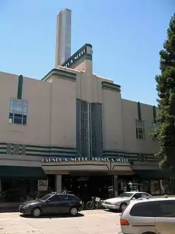 Rosenberg's Department Store | Landmark | December 29, 1994(#94001497) | 38.441111°N 122.711111°W | Santa Rosa | 700 Fourth St. | |||||||||||||||||||
| Salt Point State Park Archeological District | Landmark | March 24, 1971(#71000207) | general region 38.57°N 123.33°W | Salt Point State Park | Address Restricted | ||||||||||||||||||||
| Sebastopol Depot of the Petaluma and Santa Rosa Railway | 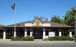 Sebastopol Depot of the Petaluma and Santa Rosa Railway | Landmark | February 16, 1996(#96000109) | 38.400833°N 122.821944°W | Sebastopol | 261 S. Main St. | |||||||||||||||||||
| Isaac E. Shaw Building |  Isaac E. Shaw Building | Landmark | January 25, 1991(#90002155) | 38.806667°N 123.018333°W | Colverda;e | 219 N. Cloverdale Blvd. | |||||||||||||||||||
| Sonoma Depot |  Sonoma Depot | Landmark | April 3, 1975(#75000488) | 38.296161°N 122.457461°W | Sonoma | 284 1st St., W | |||||||||||||||||||
| Sonoma Grammar School |  Sonoma Grammar School | Landmark | November 28, 1980(#80000871) | 38.291664°N 122.452711°W | Sonoma | 276 E. Napa St. | |||||||||||||||||||
| Sonoma Plaza | 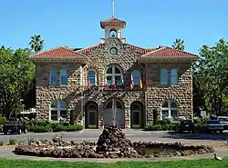 Sonoma Plaza | Landmark | April 3, 1975(#75000489) | 38.293611°N 122.453333°W | Sonoma | Center of Sonoma; also the area south and east of the town plaza, along Broadway and the northern side of E. Napa St. | Second set of boundaries represents a boundary increase of May 6, 1992 | ||||||||||||||||||
| Sonoma State Home-Main Building | 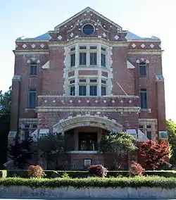 Sonoma State Home-Main Building | Landmark | October 6, 2000(#00001180) | 38.347472°N 122.518325°W | Eldridge | 15000 Arnold Dr. | Also known as Sonoma Developmental Center | ||||||||||||||||||
| Sonoma Valley Woman's Club | Landmark | January 7, 2015(#14001115) | 38.2905°N 122.4569°W | Sonoma | 574 1st St., E. | ||||||||||||||||||||
| SS POMONA (Shipwreck) | 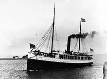 SS POMONA (Shipwreck) | Landmark | January 31, 2008(#07000306) | 38.510278°N 123.245556°W | Jenner | Fort Ross Cove, off Fort Ross Historic State Park | |||||||||||||||||||
| George A. Strout House |  George A. Strout House | Landmark | June 17, 1980(#80000870) | 38.403056°N 122.827778°W | Sebastopol | 253 Florence Ave. | |||||||||||||||||||
| Philip Sweed House | 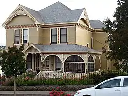 Philip Sweed House | Landmark | June 18, 1992(#92000787) | 38.2363°N 122.646253°W | Petaluma | 301 Keokuk St. | |||||||||||||||||||
| Sweet House | Philip Sweed House | Landmark | January 14, 1988(#87002415) | 38.445°N 122.715556°W | Santa Rosa | 607 Cherry St. | |||||||||||||||||||
| Temelec |  Temelec | Landmark | April 19, 2006(#06000312) | Sonoma County #50 | 38.265836°N 122.499647°W | Temelec | 220 and 221 Temelec Circle | ||||||||||||||||||
| US Post Office-Petaluma | Landmark | January 11, 1985(#85000140) | 38.231814°N 122.6377°W | Petaluma | 120 4th St. | ||||||||||||||||||||
| Vallejo Estate / General Vallejo's Home "Lachryma Montis" | 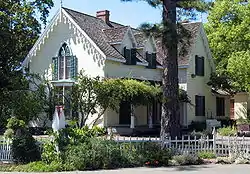 Vallejo Estate | Landmark | 4 | June 29, 1972(#72000262) | Sonoma 81 | 38.298867°N 122.462647°W | Sonoma | Corner of Spain and W. 3rd Sts./300 W. Spain St. | 018-061-002 | 1851 Gothic Revival | |||||||||||||||
| Walters Ranch | 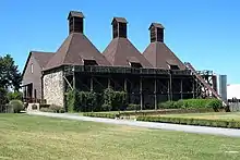 Walters Ranch | Landmark | October 7, 1977(#77000351) | 38.537778°N 122.868056°W | Healdsburg | 6 mi. S of Healdsburg at 6050 Westside Rd. | |||||||||||||||||||
| Wasserman House | 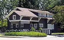 Wasserman House | Landmark | January 31, 1979(#79000562) | 38.450556°N 122.716389°W | Santa Rosa | 930 Mendocino Ave. | |||||||||||||||||||
| Watson School | 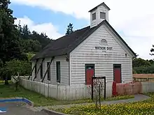 Watson School | Landmark | August 18, 1978(#78000800) | Sonoma County 23 | 38.355833°N 122.937778°W | Bodega | 15000 Bodega Hwy. | ||||||||||||||||||
| Luther Burbank House and Garden |  Luther Burbank House and Garden, 200 Santa Rosa Ave., Santa Rosa, CA 6-12-2010 7-45-52 PM |
Landmark | 20, June 19, 1964(#66000241) | 234 | October 15, 1966(#66000241) | Santa Rosa 7 - chb29 1/23/1991 | 38.436°N 122.712°W | Santa Rosa | Southeast corner of Santa Rosa and Sonoma Avenues | 009-265-15, 009-265-28 | City park containing the former home, greenhouse, gardens, and grave of noted American horticulturist Luther Burbank. | ||||||||||||||
| Fort Ross Commander's House | 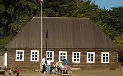 Fort Ross Commander's House | Landmark | 29, May 15, 1970(#70000150) | April 15, 1970(#70000150) | 38.512424°N 123.242709°W | Fort Ross | Only original structure at Fort Ross, built 1812 by Russians; also known as Rotchev House. | ||||||||||||||||||
| Jack London Ranch | Landmark | 67, December 29, 1962(#66000240) | 38.350556°N 122.543056°W | Glen Ellen | Home of Jack London from 1905 until his death. | ||||||||||||||||||||
| Petaluma Adobe | Petaluma Adobe | Landmark | 98, April 15, 1970(#70000151) | 38.255425°N 122.584253°W | Petaluma | The largest example of Monterey Colonial architecture in the United States, this adobe structure was the ranch house of General Mariano Guadalupe Vallejo, commandant of the Sonoma Pueblo. It is now the centerpiece of Petaluma Adobe State Historic Park, which is threatened with closure. | |||||||||||||||||||
| Sonoma Plaza | Sonoma Plaza | Landmark | 125, December 19, 1960(#75000489) | 38.293611°N 122.453333°W | Sonoma | The largest plaza in California, this was the location of the Bear Flag Revolt in 1846 which led to the Mexican–American War | |||||||||||||||||||
| Bear Flag Monument | Landmark | 7 | 38.293175°N 122.453790°W | Sonoma | Sonoma Plaza | ||||||||||||||||||||
| Blue Wing Inn | Landmark | 17 | 38.2934°N 122.4556°W | Sonoma | Sonoma State Historic Park | ||||||||||||||||||||
| Bodega Bay & Harbor | Landmark | 833 | 38.333°N 123.047°W | Bodega Bay | Doran Park | ||||||||||||||||||||
| Buena Vista Winery | Landmark | 392 | 38.299444°N 122.423056°W | Sonoma | 18000 Old Winery Rd. | Also on the NRHP list as NPS-86001902 | |||||||||||||||||||
| Cooper's Sawmill | Landmark | 835 | 38.493447°N 122.895804°W | Santa Rosa | Mirabel and River Rds. | ||||||||||||||||||||
| Cotati Downtown Plaza | Landmark | 879 | 38.328753°N 122.702009°W | Cotati | Downtown plaza | ||||||||||||||||||||
| Haraszthy Villa | Landmark | 392-1 | Sonoma County #19 | Sonoma | Castle Rd. near Buena Vista Winery | ||||||||||||||||||||
| Icaria-Speranza Commune | Landmark | 981 | Cloverdale | W side of Asti Rd. | |||||||||||||||||||||
| Italian Swiss Colony | Landmark | 621 | 38.762014°N 122.973245°W | Asti | |||||||||||||||||||||
| Jack London State Historic Park | Landmark | 743 | 38.356684°N 122.540967°W | Glen Ellen | Jack London State Historic Park | Also on the NRHP list as NPS-66000240 | |||||||||||||||||||
| John Medica Gardens | Landmark | 939 | 38.450492°N 122.665122°W | Santa Rosa | 5000 Medica Rd. | Twentieth Century Folk Art | |||||||||||||||||||
| Mission San Francisco de Solano | Landmark | 3 | Sonoma | Sonoma State Historic Park | |||||||||||||||||||||
| Nash-Patton Adobe | Landmark | 667 | 38.290429°N 122.457116°W | Sonoma | 579 1st St. E. | ||||||||||||||||||||
| Petrified Forest | Landmark | 915 | 38.555859°N 122.639033°W | Calistoga | 4100 Petrified Forest Rd. | ||||||||||||||||||||
| Presidio of Sonoma | Landmark | 316 | Sonoma | Sonoma State Historic Park | |||||||||||||||||||||
| Rancho Petaluma Adobe | Petaluma Adobe | Landmark | 18 | 38.255425°N 122.584253°W | Petaluma | Petaluma Adobe State Historic Park, 3325 Adobe Rd. | Also on the NRHP list as NPS-70000151 | ||||||||||||||||||
| Saint Teresa of Avila Church, Bodega | Landmark | 820 | 38.346232°N 122.972316°W | Bodega | Bodega Hwy near Bodega Ln. | ||||||||||||||||||||
| Salvador Vallejo Adobe | Landmark | 501 | Sonoma | 421 1st St. | BUilt in 1846 home of Captain Salvador Vallejo[2] | ||||||||||||||||||||
| Sebastiani Vineyards and Winery | Landmark | 739 | 38.292944°N 122.449073°W | Sonoma | 394 4th St E | ||||||||||||||||||||
| Swiss Hotel | Landmark | 496 | 38.293816°N 122.457935°W | Sonoma | 18 W. Spain St. | ||||||||||||||||||||
| Temelec Hall | Temelec | Landmark | 237 | 38.265836°N 122.499647°W | Temelec | 220 Temelec Circle | |||||||||||||||||||
| Union Hotel & Union Hall | Landmark | 627 | 38.291696°N 122.458854°W | Sonoma | 35 Napa and 1st St. | ||||||||||||||||||||
| Walters Ranch Hop Kiln | Walters Ranch | Landmark | 893 | Healdsburg | 7501 Sonoma Hwy. | ||||||||||||||||||||
| William Hood House | Landmark | 692 | Santa Rosa | 7501 Sonoma Hwy. | Also on the NRHP list as NPS-97001658 | ||||||||||||||||||||
| Johnson Street | Landmark | Healdsburg 1 | 38.617402°N 122.869673°W | Healdsburg | Piper Street to Powell Avenue | ||||||||||||||||||||
| Matheson Street | Landmark | Healdsburg 2 | 38.610879°N 122.864855°W | Healdsburg | East Street to First Street | ||||||||||||||||||||
| Gobbi Building | Landmark | Healdsburg 3 | 38.611092°N 122.869398°W | Healdsburg | 310-316 Center Street | ||||||||||||||||||||
| Carnegie Library Building | Healdsburg Carnegie Library | Landmark | Healdsburg 4 | 38.611181°N 122.867276°W | Healdsburg | 221 Matheson Street | |||||||||||||||||||
| Ransome Powell House | Landmark | Healdsburg 5 | 38.612707°N 122.868167°W | Healdsburg | 211 North Street | ||||||||||||||||||||
| First Christian Church | Landmark | Healdsburg 6 | 38.611575°N 122.868770°W | Healdsburg | 321 East Street | ||||||||||||||||||||
| George Alexander House | Landmark | Healdsburg 7 | 38.611231°N 122.864043°W | Healdsburg | 423 Matheson Street | ||||||||||||||||||||
| Calderwood Inn | Landmark | Healdsburg 8 | 38.616136°N 122.874483°W | Healdsburg | 25 West Grant Street | ||||||||||||||||||||
| Sunset Manor (Patchett House) | Landmark | Healdsburg 9 | 38.610650°N 122.864656°W | Healdsburg | 410 Matheson Street | ||||||||||||||||||||
| Villa Chanticleer | Landmark | Healdsburg 10 | 38.621614°N 122.849454°W | Healdsburg | 1248 North Fitch Mountain Road | ||||||||||||||||||||
| Swisher Mansion | Landmark | Healdsburg 11 | 38.617362°N 122.869321°W | Healdsburg | 642 Johnson Street | ||||||||||||||||||||
| 726 Fitch Street | Landmark | Healdsburg 12 | 38.618465°N 122.866983°W | Healdsburg | 726 Fitch Street | ||||||||||||||||||||
| Healdsburg Plaza | Landmark | Healdsburg 13 | 38.610756°N 122.870091°W | Healdsburg | Healdsburg Ave., Plaza St., Center St., Matheson St. | ||||||||||||||||||||
| Bell Ranch House | 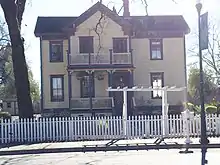 Bell Ranch House at 294 Windsor River Road, Windsor, California | Landmark | Windsor A | 38.547575°N 122.814506°W | Windsor | 294 Windsor River Road | APN 066-090-029 | House reflecting Greek Revival influence, built in 1860.[11] | |||||||||||||||||
| Old Windsor Community Methodist Church | 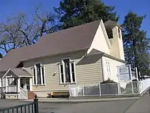 Old Windsor Community Methodist Church at 251 Windsor River Road, Windsor, California | Landmark | Windsor B | 38.547484°N 122.814166°W | Windsor | 251 Windsor River Road | APN 066-090-005 | Church built in 1898 in an adaptation—in wood—of Richardsonian Romanesque style; in use to 1959. | |||||||||||||||||
| Methodist Church Parsonage | 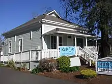 Methodist Church Parsonage, Windsor, California | Landmark | Windsor C | 38.547490°N 122.813869°W | Windsor | 239 Windsor River Road | Parsonage built with the First Methodist Church. Moved to this location when the first church burned. | ||||||||||||||||||
| The David H. DuVander House | 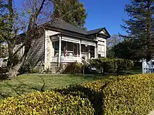 David H. DuVander House at 295 Windsor River Road, Windsor, California | Landmark | Windsor D | 38.547505°N 122.814937°W | Windsor | 295 Windsor River Road | Late 1880s house believed used in the undertaking business. | ||||||||||||||||||
| Gutchell Residence | 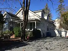 Gutchell Residence at 321 Windsor River Road, Windsor, California | Landmark | Windsor E | 38.547481°N 122.815290°W | Windsor | 321 Windsor River Road | APN 066-081-056 | 1890 home used as the telephone exchange from at least 1918. | |||||||||||||||||
| Odd Fellows Hall | _Hall.jpg.webp) Windsor International Order of Odd Fellows (IOOF) Hall at 337 Windsor River Road | Landmark | Windsor F | 38.54749°N 122.81589°W | Windsor | 215 Windsor River Road | When built in 1933, the most substantial building in Windsor. The lodge is upstairs and a grocery store is located downstairs. | ||||||||||||||||||
| Masonic Temple | 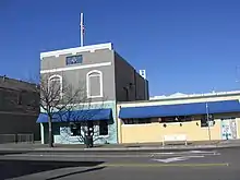 Masonic Lodge, Windsor, California | Landmark | Windsor G | 38.547423°N 122.816315°W | Windsor | 371 Windsor River Road | First constructed in 1898, burned in 1905, then severely damaged by the earthquake of 1906. | ||||||||||||||||||
| James Prewett Wagon Shop | 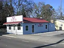 James Prewett Wagon Shop at 8750 Old Redwood Highway, Windsor, California | Landmark | Windsor H | 38.546112°N 122.805668°W | Windsor | 8750 Old Redwood Highway | Built in 1868 by early settlers and organizers of the “Town of Windsor” in 1864. | ||||||||||||||||||
| Mattie Washburn House | 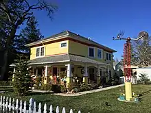 Mattie Washburn House at 8660 Franklin Street, Windsor, California | Landmark | Windsor I | 38.546425°N 122.803559°W | Windsor | 8660 Franklin Street | Long-time home of Mattie Washburn, early school teacher in the Windsor School system. | ||||||||||||||||||
| Cunningham House | 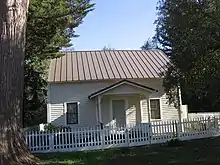 Cunningham House at 9225 Foxwood Drive, Windsor, California | Landmark | Windsor J | 38.552392°N 122.810816°W | Windsor | 9225 Foxwood Drive | Built about 1850, the oldest known structure in Windsor. | ||||||||||||||||||
| Hembree House | 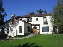 Hembree House, Windsor, California | Landmark | Windsor K | 38.552721°N 122.810604°W | Windsor | 9225 Foxwood Drive | Built in 1931 and Called “Mattapan”, an Indian word meaning “I sit down” according to family members. | ||||||||||||||||||
| Mount Weske Stables | 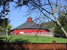 Mount Weske Stables at 1520 Mount Weske Drive, Windsor, California | Landmark | Windsor L | 38.567919°N 122.794434°W | Windsor | 1520 Mount Weske Drive | Built in the 1870s or 1880s, octagon structure used for housing racehorses. | ||||||||||||||||||
| Shiloh Cemetery | 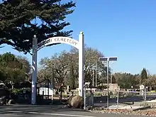 Shiloh Cemetery Entrance at 7100 Windsor Road, Windsor, California | Cemetery & Landmark | Windsor M | 38.525444°N 122.815073°W | Windsor | 7100 Windsor Road | APN 065-260-002 | Originally a Methodist church site, the first burials are believed to have occurred as early as 1836. The church burned in 1867 and the Shiloh Cemetery Association was formed in 1885. | |||||||||||||||||
| Laughlin Home | 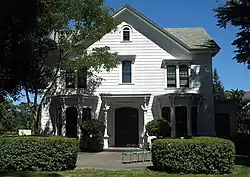 James H. & Frances E. Laughlin House, 414 Aviation Blvd., Windsor, CA 7-3-2010 3-18-53 PM | Landmark | Windsor N | Windsor | The restored home where Fred Wiseman and Jean Peter built their airplane, the first California built airplane in 1910. Later Fred Wiseman flew the first offiial US Airmail flight. | ||||||||||||||||||||
| Miller Ranch (Stone Family Farm) | Landmark | Santa Rosa 1 - chb4 10/26/1988 | 38.425217°N 122.825224°W | Santa Rosa | Occidental & Sanford Roads | 130-250-14, 130-250-49, 130-250-50, 060-330-10 | |||||||||||||||||||
| Carrillo Adobe | Landmark | Santa Rosa 3 - chb11 11/29/1988 | 38.448548°N 122.683604°W | Santa Rosa | Montomery Drive | 013-271-01, 013-274-02 | |||||||||||||||||||
| Rosenberg Building | Landmark | Santa Rosa 4 - chb13 3/22/1989 | 38.440837°N 122.714155°W | Santa Rosa | 306 Mendocino Avenue | 009-011-02 | |||||||||||||||||||
| Bolton House | Landmark | Santa Rosa 5 - chb15 6/14/1989 | 38.439968°N 122.702917°W | Santa Rosa | 966 Sonoma Avenue | 009-211-81 | |||||||||||||||||||
| Tripp House | Landmark | Santa Rosa 6 - chb16 9/14/1989 | 38.444032°N 122.706736°W | Santa Rosa | 1023 Fourth Street | 009-102-34 | |||||||||||||||||||
| Tripp House and Adjacent Structures | Landmark | Santa Rosa 8 - chb41 8/26/1992 | 38.444032°N 122.706736°W | Santa Rosa | 1023 Fourth Street | 009-102-20, 009-102-34 | |||||||||||||||||||
| Coddingtown Revolving sign Tower | Landmark | Santa Rosa 9 - chb44 12/9/1992 | 38.458578°N 122.727114°W | Santa Rosa | 101 Coddingtown Center | ||||||||||||||||||||
| Rosenberg Department Store | Landmark | Santa Rosa 10 - chb47 4/27/1994 | 38.441194°N 122.711698°W | Santa Rosa | 700 Fourth Street | 009-014-12 | |||||||||||||||||||
| Santa Rosa Plaque | Landmark | Santa Rosa 11 - chb49 4/27/1994 | Santa Rosa | Hampton Woods property, at the confluence of Santa Rosa Creek and Brush Creek | |||||||||||||||||||||
| Hoag House | Landmark | Santa Rosa 12 - chb12 8/23/1995 | Santa Rosa | 6102 Sonoma Highway | |||||||||||||||||||||
| Santa Rosa 13 unassigned | Landmark | Santa Rosa 13 | Santa Rosa | unassigned | |||||||||||||||||||||
| Sara Building (Sibbald-Donovan Manor) | Landmark | Santa Rosa 14 - chb62 124/1996 | 38.445736°N 122.713746°W | Santa Rosa | 725 College Avenue | 012-023-011 | |||||||||||||||||||
| Flamingo Resort Sign Tower to include neon-outlined flamingo atop the sign tower | Landmark | Santa Rosa 15 - chb65 10/23/199 | 38.450862°N 122.688564°W | Santa Rosa | 2777 Fourth Street | 032-030-002 | |||||||||||||||||||
| Santa Rosa Rural Cemetery | Landmark | Santa Rosa 16 - chb72 6/11/1997 | 38.455624°N 122.704274°W | Santa Rosa | 1900 Franklin Avenue | 015-281-002, 015-281-004, 015-281-006 | |||||||||||||||||||
| Church of One Tree | Landmark | Santa Rosa 17 - chb77 11/12/1997 | 38.436004°N 122.714060°W | Santa Rosa | 492 Sonoma Avenue | 010-208-022 | |||||||||||||||||||
| Rose Park House | Landmark | Santa Rosa 18 - chb79 1/14/1998 | 38.444756°N 122.707066°W | Santa Rosa | 406 Chinn Street | 009-102-023 | |||||||||||||||||||
| Fountaingrove Round Barn | Landmark | Santa Rosa 19 - chb98 2/9/2000 | 38.475700°N 122.727450°W | Santa Rosa | 3535 Round Barn Boulevard | 173-020-004 | Burned in the Tubbs Fire of 2017. | ||||||||||||||||||
| Alexander House | Landmark | Santa Rosa 20 - chb1148 3/26/2003 | 38.442188°N 122.713142°W | Santa Rosa | 412 Humboldt Street | ||||||||||||||||||||
| Community Baptist Church | Landmark | Santa Rosa 21 - chb 216 7/19/2006 | 38.426882°N 122.706669°W | Santa Rosa | 1228 Grand Avenue | ||||||||||||||||||||
| Dutton Avenue Queen Anne | Landmark | Santa Rosa 22-chb244 39512 | 38.427237°N 122.725169°W | Santa Rosa | 895 Dutton Avenue | 125-271-005 | |||||||||||||||||||
| Poultry Production of California Warehouse #2 (at Depot Park) | Landmark | Sonoma 1 | 38.295618°N 122.456213°W | Sonoma | 291 1st St. E | 018-131-006 | 1914 Wood Frame Warehouse | ||||||||||||||||||
| Railroad Depot / Depot Museum | Landmark | Sonoma 2 | 38.296162°N 122.457526°W | Sonoma | 291 1st St. E | 018-131-006 | 1860 Railroad Depot Wood Building | ||||||||||||||||||
| The Barracks (Cuartel de Sonoma) | Landmark | Sonoma 3 | 38.293746°N 122.456626°W | Sonoma | 389 1st St. E | 018-162-014 | 1836 Spanish Colonial | ||||||||||||||||||
| Old Sonoma Creamery / Vella Cheese Factory | Landmark | Sonoma 4 | 38.293430°N 122.456146°W | Sonoma | 400 1st St. E | 018-221-001 | 1930-S, 1926-L Mission Revival | ||||||||||||||||||
| Valentine/Building C | Landmark | Sonoma 5 | 38.295315°N 122.458062°W | Sonoma | 408 1st St. E | 018-221-035 | 1916 Stone Commercial | ||||||||||||||||||
| El Paseo De Sonoma/Buildings A, B and D | Landmark | Sonoma 6 | 38.293250°N 122.456193°W | Sonoma | 414 1st St. E | 018-221-035 | 1891 Brick, stone, wood and stucco | ||||||||||||||||||
| Vasquez House (relocated from 541 1st St. W) | Landmark | Sonoma 7 | 38.293250°N 122.456193°W | Sonoma | 414 1st St. E | 018-221-035 | 1850 | ||||||||||||||||||
| Cantoni's Bakery / Building E | Landmark | Sonoma 8 | 38.293132°N 122.456238°W | Sonoma | 420 1st St. E | 018-221-035 | 1912 Brick Commercial | ||||||||||||||||||
| Carnegie Public Library | Landmark | Sonoma 9 | 38.292733°N 122.457002°W | Sonoma | 453 1st St. E | 018-214-001 | 1913 Neo-classical | ||||||||||||||||||
| Grinstead Building / Parmelee Building | Landmark | Sonoma 10 | 38.291923°N 122.456467°W | Sonoma | 488 1st St. E | 018-221-013 | 1911 Spanish Colonial | -| Italianate Commercial Building | Landmark | Sonoma 11 | 38.292236°N 122.456432°W | Sonoma | 482 1st St. E | 018-221-042 | 1933 Italianate style | ||||||||||
| Italianate Commercial Building | Landmark | Sonoma 12 | [[coord | 38.292042 | -122.456117 | name=Italianate Commercial Building}} | Sonoma | 484 1st St. E | 018-221-029 | 1900 Italianate style | ||||||||||||||||||
| Duhring General Store | Landmark | Sonoma 13 | 38.291942°N 122.456462°W | Sonoma | 498 1st St. E | 018-221-015 | 1870/1891-S, 1891-L Italianate False Front | ||||||||||||||||||
| First Library | Landmark | Sonoma 14 | 38.291140°N 122.456144°W | Sonoma | 525 1st St. E | 015-212-025 | 1900 Gabled Roof | ||||||||||||||||||
| First Methodist Episcopal Church | Landmark | Sonoma 15 | 38.291058°N 122.456596°W | Sonoma | 542 1st St. E | 018-261-031 | 1850 Gothic Revival | ||||||||||||||||||
| Julius Poppe House | Landmark | Sonoma 16 | 38.290635°N 122.456671°W | Sonoma | 564 1st St. E | 018-261-013 | 1850 Carpenter Gothic Cottage | ||||||||||||||||||
| 567 1st. E | Landmark | Sonoma 17 | 38.290679°N 122.457247°W | Sonoma | 567 1st St. E | 018-212-026 | 1915-S, 1910-L Hip Roof | ||||||||||||||||||
| Nash-Patten Adobe | Landmark | Sonoma 18 | 38.290429°N 122.457116°W | Sonoma | 579 1st St. E | 018-212-020 | 1847 Adobe}} | ||||||||||||||||||
| Salvadore Vallejo Adobe | Landmark | Sonoma 19 | 38.293427°N 122.458921°W | Sonoma | 415 1st St. W | 018-202-069 | 1836 Mexican Colonical | ||||||||||||||||||
| Camille Aguillon Building / Ruggles | Landmark | Sonoma 20 | 38.293381°N 122.461291°W | Sonoma | 437 2nd St. W | 018-202-072 | 1875 False Front building | ||||||||||||||||||
| Camille Aquillon building / Chinese Laundry | Landmark | Sonoma 21 | 38.293422°N 122.463063°W | Sonoma | 447 3rd St. W | 018-202-073 | 1860 2-Story Gabled Roof | ||||||||||||||||||
| Batto Building | Landmark | Sonoma 22 | 38.293558°N 122.465886°W | Sonoma | 453 4th St. W | 018-202-070 | 1912 Classic Revival | ||||||||||||||||||
| Masonic Building, Temple No. 14 | Landmark | Sonoma 23 | 38.293302°N 122.468364°W | Sonoma | 467-469(465) 5th St. W | 081-202-075 | 1909 Italian Renaissance | ||||||||||||||||||
| Bear Flag Realty | Landmark | Sonoma 24 | 38.293160°N 122.470381°W | Sonoma | 481 6th St. W | 018-202-059 | 1890 Italianate False Front | ||||||||||||||||||
| Italianate-False Front Commercial Building | Landmark | Sonoma 25 | 38.294496°N 122.474450°W | Sonoma | 483 7th St. W | 018-202-015 | 1890 Italianate False Front | ||||||||||||||||||
| Leeese-Fitch Adobe | Landmark | Sonoma 26 | Sonoma | 487 8th St. W | 018-202-015 | 1836 Monterey Colonical | |||||||||||||||||||
| Stone Brige at Nathanson Creek | Landmark | Sonoma 27 | Sonoma | unk 2nd St. E & E. Napa St. south of intersection | 018-261-008 | 1909 Street Feature | |||||||||||||||||||
| William Clewe Residence | Landmark | Sonoma 28 | 38.291017°N 122.454916°W | Sonoma | 531 2nd. St. E | 018-261-008 | 1876 Italianate | ||||||||||||||||||
| Duhring Home / Pine Lodge | Landmark | Sonoma 29 | 38.290760°N 122.453802°W | Sonoma | 532 2nd. St. E | 018-262-014 | 1859 Colonial Revival | ||||||||||||||||||
| William Clewe House | Landmark | Sonoma 30 | 38.290663°N 122.454853°W | Sonoma | 553 2nd. St. E | 018-261-012 | 1915 Shingled Bungalow | ||||||||||||||||||
| Lutgens House | Landmark | Sonoma 31 | 38.290521°N 122.454277°W | Sonoma | 558 2nd. St. E | 018-262-002 | 1910 Shingled Bungalow | ||||||||||||||||||
| I.O.O.F. Building | Landmark | Sonoma 32 | 38.291451°N 122.458222°W | Sonoma | 521 Broadway | 018-211-003 | 1911-S, 1900-L 2-Story Brick Building | ||||||||||||||||||
| Marcy & Clark Building | Landmark | Sonoma 33 | 38.291307°N 122.457658°W | Sonoma | 526 Broadway | 018-810-016 | 1870 Italianate False Front | ||||||||||||||||||
| Marcy & Clark Building | Landmark | Sonoma 34 | 38.291241°N 122.457685°W | Sonoma | 530 Broadway | 018-810-017 | 1880 Italianate False Front | ||||||||||||||||||
| Dunbar Hardware Store / Sonoma Service Building | Landmark | Sonoma 35 | 38.291130°N 122.457677°W | Sonoma | 536 Broadway | 018-810-018 | 1910 Two-Story Commercial | ||||||||||||||||||
| One-story shiplap siding residence | Landmark | Sonoma 36 | 38.290948°N 122.457723°W | Sonoma | 548 Broadway | 018-810-021 | 1870 Greek Revival | ||||||||||||||||||
| Harold Holz Residence | Landmark | Sonoma 37 | 38.290429°N 122.457730°W | Sonoma | 578 Broadway | 018-212-019 | 1880 Queen Anne | ||||||||||||||||||
| One-story bungalow | Landmark | Sonoma 38 | 38.293451°N 122.459387°W | Sonoma | 124 Church St. | 018-202-076 | unk Stucco walls / Mission tile cross-gable roof | ||||||||||||||||||
| One-story commercial building | Landmark | Sonoma 39 | 38.291685°N 122.457333°W | Sonoma | 15 E. Napa St. | 018-212-004 | 1917-S, 1915-1920-N | ||||||||||||||||||
| One-story commercial building | Landmark | Sonoma 40 | 38.291643°N 122.457235°W | Sonoma | 25 E. Napa St. | 018-810-032 | 1910-S,1910-1915-N Glazed brtick building with Mission tile pent roof | ||||||||||||||||||
| Simmons Pharmacy | Landmark | Sonoma 41 | 38.291699°N 122.457103°W | Sonoma | 29 E. Napa St. | 018-810-037 | 1900 Spanish | ||||||||||||||||||
| Post Office / General Store / Boccoli Building | Landmark | Sonoma 42 | 38.291594°N 122.456602°W | Sonoma | 101 E. Napa St. | 018-261-001 | 1896 Basalt stone building, built from local quarries in an Italian commercial theme; faced with metal, embossed to resemble stone | ||||||||||||||||||
| C. Dal Paggetto Building | Landmark | Sonoma 43 | 38.291566°N 122.456547°W | Sonoma | 107 E. Napa St. | 018-261-002 | 1908 Italianate style with rusticated ashlar basalt façade | ||||||||||||||||||
| C. Dal Paggetto Building-1908 | Landmark | Sonoma 44 | 38.291594°N 122.456216°W | Sonoma | 111-A & B E. Napa St. | 018-261-002 | 1908-S Italianate commercial building built of locally quarried basalt | ||||||||||||||||||
| C. Dal Paggetto Building | Landmark | Sonoma 45 | 38.291596°N 122.456379°W | Sonoma | 113 E. Napa St. | 018-261-002 | 1908 Italianate | ||||||||||||||||||
| A. Castex Building | Landmark | Sonoma 46 | 38.291514°N 122.456059°W | Sonoma | 127 E. Napa St. | 018-261-037 | 1904 italianate | ||||||||||||||||||
| A. Castex Building | Landmark | Sonoma 47 | 38.291535°N 122.456014°W | Sonoma | 129 E. Napa St. | 018-261-037 | 1904 Italianate | ||||||||||||||||||
| Eastlake Style House | Landmark | Sonoma 48 | 38.291540°N 122.455831°W | Sonoma | 139 E. Napa St. | 018-261-005 | 1880 Eastlake style built with clapboard siding and a cross-gable roof | ||||||||||||||||||
| Former garage | Landmark | Sonoma 49 | 38.291867°N 122.455692°W | Sonoma | 146 E. Napa St. | 018-221-017 | 1910 Tin false front | ||||||||||||||||||
| Small's Home | Landmark | Sonoma 50 | 38.291438°N 122.45558°W | Sonoma | 151 E. Napa St. | 018-261-023 | 1900 Gabled roof | ||||||||||||||||||
| La Torres Home | Landmark | Sonoma 51 | 38.291910°N 122.455387°W | Sonoma | 156 E. Napa St. | 018-221-037 | 1910 Hip roof box | ||||||||||||||||||
| Small's Home | Landmark | Sonoma 52 | 38.291466°N 122.455373°W | Sonoma | 161 E. Napa St. | 018-261-024 | 1910 Caifornia bungalow | ||||||||||||||||||
| Granice Home / Morning Glory Villas | Landmark | Sonoma 53 | Sonoma | 168 E. Napa St. | 018-221-039 | 1880 Queen Anne, best example of Stick Eastlake Victorian residence in Sonoma. | |||||||||||||||||||
| Millie Bates Home | Landmark | Sonoma 54 | Sonoma | 180 E. Napa St. | 018-221-020 | 1870 Hip roof rect | |||||||||||||||||||
| Sonoma Grammar School | Landmark | Sonoma 55 | Sonoma | 276 E. Napa St. | 018-222-017 | 1916 Roman Classic | |||||||||||||||||||
| Water Tower | Landmark | Sonoma 56 | Sonoma | 20 E. Spain St. | 018-162-021 | 1900 | |||||||||||||||||||
| Casa Grande Indian Quarters / Servants Quarters | Landmark | Sonoma 57 | Sonoma | 20 E. Spain St. | 018-162-021 | 1835 Spanish Colonial | |||||||||||||||||||
| Toscano Hotel / Captain Leiding Store | Landmark | Sonoma 58 | Sonoma | 20 E. Spain St. | 018-162-021 | 1858 Early Californian | |||||||||||||||||||
| Toscano Hotel Dining Hall & Kitchen | Landmark | Sonoma 59 | Sonoma | 20 E. Spain St. | 018-162-021 | 1902 Early Californian | |||||||||||||||||||
| Toscano Hotel Annex | Landmark | Sonoma 60 | Sonoma | 20 E. Spain St. | 018-162-021 | 1870 Greek revival two-story | |||||||||||||||||||
| Convento Wing | Landmark | Sonoma 61 | Sonoma | 114 E. Spain St. | 018-171-007 | 1824 Mission church | |||||||||||||||||||
| Mission San Francisco De Solano | Landmark | Sonoma 62 | 38.2937164°N 122.45618°W | Sonoma | 114 E. Spain St. | 018-171-007 | 1840 Mission | ||||||||||||||||||
| Solomon Schocken House | Landmark | Sonoma 63 | 38.293967°N 122.455513°W | Sonoma | 130 E. Spain St. | 018-171-008 | 1886 Hip roof cottage | ||||||||||||||||||
| Blue Wing Inn | Landmark | Sonoma 64 | 38.293315°N 122.45551°W | Sonoma | 133 E. Spain St. | 018-221-003 | 1840 Monterey Colonial | ||||||||||||||||||
| Schocken House | Landmark | Sonoma 65 | 38.293749°N 122.455268°W | Sonoma | 146 E. Spain St. | 018-171-010 | 1886 Hip roof cottage | ||||||||||||||||||
| Pinni / Black House | Landmark | Sonoma 66 | 38.293361°N 122.455280°W | Sonoma | 147 E. Spain St. | 018-221-004 | 1906 Rubble cottage | ||||||||||||||||||
| Pinelli Property | Landmark | Sonoma 67 | 38.293270°N 122.454881°W | Sonoma | 165 E. Spain St. | 018-221-005 | 1922 | ||||||||||||||||||
| Castagnasso Farm | Landmark | Sonoma 68 | 38.293937°N 122.454840°W | Sonoma | 150 E. Spain St. | 018-171-011 | 1890 rural property | ||||||||||||||||||
| Castagnasso Farm | Landmark | Sonoma 69 | 38.293607°N 122.454303°W | Sonoma | 196 E. Spain St. | 018-171-012 | 1890 Gambrel roof | ||||||||||||||||||
| John Ray / Adler Adobe | Landmark | Sonoma 70 | 38.293221°N 122.453907°W | Sonoma | 205 E. Spain St. | 018-222-001 | 1848 Spanish Colonial | ||||||||||||||||||
| Winkle Home | Landmark | Sonoma 71 | 38.293566°N 122.453865°W | Sonoma | 206 E. Spain St. | 018-172-004 | 1902 Hop Roof Box | ||||||||||||||||||
| Adam Adler Home | Landmark | Sonoma 72 | 38.293543°N 122.453524°W | Sonoma | 220 E. Spain St. | 018-172-005 | 1910 California bungalow | ||||||||||||||||||
| Gaese / Fowler Residence | Landmark | Sonoma 73 | 38.293122°N 122.453429°W | Sonoma | 227 E. Spain St. | 018-222-019 | 1900 Gabled roof | ||||||||||||||||||
| Cooke / Dr. Clark Taylor House | Landmark | Sonoma 74 | 38.2931031°N 122.453144°W | Sonoma | 245 E. Spain St. | 018-222-013 | 1857 Monterey Colonial | ||||||||||||||||||
| Lewis Adler's First House / Castagnasso House | Landmark | Sonoma 75 | Sonoma | 256 E. Spain St. | 018-560-026 | 1848-S, 1899-C Gabled roof box | |||||||||||||||||||
| The Swiss Hotel / Salvadore Vallejo Adobe (Casa Grande) | Landmark | Sonoma 76 | 38.293875°N 122.458011°W | Sonoma | 18 W. Spain St. | 018-162-020 | 1850-S, 1840-L Spanish Colonial | ||||||||||||||||||
| Cuneo / Sebastiani Apartments | Landmark | Sonoma 77 | 38.293979°N 122.458137°W | Sonoma | 30 W. Spain St. | 018-162-026 | 1938-S, 1937-L Spanish Revival | ||||||||||||||||||
| Sebastiani Depot | Landmark | Sonoma 78 | 38.293928°N 122.438416°W | Sonoma | 38 W. Spain St. | 018-162-028 | 1939 Spanish Colonial | ||||||||||||||||||
| Old Sonoma / Sebastiani Plaza Hotel | Landmark | Sonoma 79 | 38.293989°N 122.458526°W | Sonoma | 110 W. Spain St. | 018-161-040 | 1872, 1979 per newspaper clipping from the era 3-story adobe / stucco | ||||||||||||||||||
| La Casa, Castanada / Jones Adobe | Landmark | Sonoma 80 | 38.293805°N 122.459702°W | Sonoma | 143 W. Spain St. | 018-202-025 | 1836 Adobe | ||||||||||||||||||
| Hanson Hatchery | Landmark | Sonoma 82 | 38.295305°N 122.470689°W | Sonoma | 796 W. Spain St. | 127-204-005 | 1924 Espanda / Mission | ||||||||||||||||||
| Hanson Hatchery Historic District | Landmark | Sonoma 83 | 38.295305°N 122.470689°W | Sonoma | 796 W. Spain St. | 127-204-005 | 1921 | ||||||||||||||||||
| Hanson Hatchery Garage | Landmark | Sonoma 84 | 38.295256°N 122.470948°W | Sonoma | 800 W. Spain St. | 127-204-022 | 1921 | ||||||||||||||||||
| Hanson Hatchery Tank House | Landmark | Sonoma 85 | 38.295245°N 122.470951°W | Sonoma | 800 W. Spain St. | 127-204-022 | 1921 | ||||||||||||||||||
| Hanson Hatchery Residence | Landmark | Sonoma 86 | 38.295245°N 122.470951°W | Sonoma | 800 W. Spain St. | 127-204-022 | 1921 1-story bungalow | ||||||||||||||||||
| Hanson Hatchery (Little Hatchery) | Landmark | Sonoma 87 | 38.295245°N 122.470951°W | Sonoma | 800 W. Spain St. | 127-204-022 | 1921 | ||||||||||||||||||
| Military Parage Grounds / Sonoma Plaza | Landmark | Sonoma 88 | 38.293206°N 122.458167°W | Sonoma | Number 1 The Plaza | 018-214-001 | n/a open space park | ||||||||||||||||||
| Sonoma City Hall | Landmark | Sonoma 89 | 38.292746°N 122.457750°W | Sonoma | Number 1 The Plaza | 018-214-001 | 1906 Mission Revival-stone masonry building | ||||||||||||||||||
| California Bear Flag Monument and Flagstaff | Landmark | Sonoma 90 | 38.293175°N 122.453790°W | Sonoma | Number 1 The Plaza | 018-214-001 | 1913 Stone and brass monument with flagstaff | ||||||||||||||||||
| Warwick Farmstead District | Landmark | Sonoma 91 | 38.301596°N 122.468808°W | Sonoma | 605 Verano Ave. | 127-511-083 | 1910 | ||||||||||||||||||
| Warwick Barn | Landmark | Sonoma 92 | 38.301596°N 122.468808°W | Sonoma | 605 Verano Ave. | 127-511-083 | 1910 | ||||||||||||||||||
| Warwick Water Tankhouse | Landmark | Sonoma 93 | 38.301596°N 122.468808°W | Sonoma | 605 Verano Ave. | 127-511-083 | 1910 | ||||||||||||||||||
| Warwich Farmhands House | Landmark | Sonoma 94 | 38.301596°N 122.468808°W | Sonoma | 605 Verano Ave. | 127-511-083 | 1890 bungalow | ||||||||||||||||||
| Residence | Landmark | Petaluma 1 | 38.2331°N 122.644°W | Petaluma | 119 Howard Street | ||||||||||||||||||||
| Farrell House/River Café Building | Landmark | Petaluma 2 | 38.2355°N 122.636°W | Petaluma | 222 Weller Street | ||||||||||||||||||||
| Green Mill Sign | Landmark | Petaluma 3 | 38.2694°N 122.665°W | Petaluma | Hwy 101 near Hold Road | ||||||||||||||||||||
| Coca-Cola Sign | Landmark | Petaluma 4 | 38.2337°N 122.641°W | Petaluma | Western Ave. & Kentucky St. | ||||||||||||||||||||
| Andresen Building | Landmark | Petaluma 5 | 38.2337°N 122.640°W | Petaluma | 19 Western Ave. | ||||||||||||||||||||
| WCTU Drinking Fountain | Landmark | Petaluma 6 | 38.2339°N 122.640°W | Petaluma | Western Ave. & Petaluma Ave. N | ||||||||||||||||||||
| Great Petaluma Mill | Landmark | Petaluma 7 | 38.2339°N 122.639°W | Petaluma | 6-8 Petaluma Blvd. | ||||||||||||||||||||
| Old Post Office Building |  US Post Office-Petaluma | Landmark | Petaluma 8 | 38.2337°N 122.639°W | Petaluma | 10-22 Petaluma Blvd. | |||||||||||||||||||
| McNear Building | Landmark | Petaluma 9 | 38.2336°N 122.640°W | Petaluma | 15-25 Petaluma Blvd. | ||||||||||||||||||||
| Koby Residence + Carriage House | Landmark | Petaluma 10 | 38.2255°N 122.640°W | Petaluma | 901 D St. | ||||||||||||||||||||
| Hansen House | Landmark | Petaluma 11 | 38.2600°N 122.644°W | Petaluma | 719 North McDowell Blvd | ||||||||||||||||||||
| Residence | Landmark | Petaluma 12 | 38.2412°N 122.646°W | Petaluma | 200 West Street | ||||||||||||||||||||
| Quinn Residence | Landmark | Petaluma 13 | 38.2316°N 122.632°W | Petaluma | 503 2nd Street | ||||||||||||||||||||
| Burdell Building | Landmark | Petaluma 14 | 38.2373°N 122.634°W | Petaluma | 405 East D Street | ||||||||||||||||||||
| Lee Residence | Landmark | Petaluma 15 | 38.2324°N 122.635°W | Petaluma | 206 E Street | ||||||||||||||||||||
| Petaluma Silk Mill | Landmark | 86000386 | Petaluma 16 | 38.2361°N 122.630°W | Petaluma | 450 Jefferson Street | |||||||||||||||||||
| Philip Swede House | Landmark | 92000787 | Petaluma 17 | 38.2362°N 122.646°W | Petaluma | 301 Keokuk Street | |||||||||||||||||||
| Historical Commercial District | Landmark | 95000354 | Petaluma 18 | 38.2352°N 122.640°W | Petaluma | Petaluma Blvd.: B St. to Prospect St. | |||||||||||||||||||
| Ellis-Martin House | Landmark | 6000915 | Petaluma 19 | 38.2451°N 122.630°W | Petaluma | 1197 East Washington Street | |||||||||||||||||||
| Old Petaluma Opera House/The Maclay Building | Old Petaluma Opera House | Landmark | 78000801 | Petaluma 20 | 38.2349°N 122.641°W | Petaluma | 147-149 Kentucky Street | ||||||||||||||||||
| U.S. Post Office | US Post Office-Petaluma | Landmark | 85000140 | Petaluma 22 | 38.2317°N 122.637°W | Petaluma | 120 4th Street | ||||||||||||||||||
| Freestone Historic District Properties | Landmark | Sonoma County #1 | 38.37324°N 122.91531°W | Freestone | |||||||||||||||||||||
| Freestone House | Hinds Hotel, 306 Bohemian Hwy., Freestone, CA 7-5-2010 3-22-41 PM | Landmark | Sonoma County #2 | 38.37203°N 122.91588°W | Freestone | ||||||||||||||||||||
| Morgan Williams Residence | Landmark | Sonoma County #3 | 38.37249°N 122.91614°W | Freestone | |||||||||||||||||||||
| Freestone Schoolhouse | 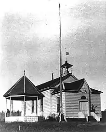 4 Year1911 A - Freestone Schoolhouse | Landmark | Sonoma County #4 | 38.37310°N 122.91365°W | Freestone | ||||||||||||||||||||
| Freestone Country Store | 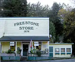 FreestoneStoreEdit2770 | Landmark | Sonoma County #5 | 38.37324°N 122.91821°W | Freestone | ||||||||||||||||||||
| Sweetwater Springs Historic District | %252C_May_2012.jpg.webp) Hop Kiln (Walters Ranch), May 2012 | Landmark | Sonoma County #8 | 38.53565°N 122.86819°W | Healdsburg | ||||||||||||||||||||
| Church of Occidental | 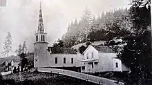 7010617 orig - Church of Occidental | Landmark | Sonoma County #12 | 38.40670°N 122.94655°W | Occidental | ||||||||||||||||||||
| Union Hotel | Landmark | Sonoma County #13 | 38.40723°N 122.94732°W | Occidental | |||||||||||||||||||||
| Taylor Building | Landmark | Sonoma County #14 | 38.40658°N 122.94730°W | Occidental | |||||||||||||||||||||
| C.F. Leiding House | 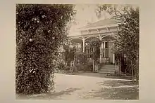 Residence of C. F. Leiding, Sonoma Valley, Showing Ivy-Covered Oak | Landmark | Sonoma County #15 | 38.28404°N 122.43292°W | Sonoma | ||||||||||||||||||||
| Cutter House | Landmark | Sonoma County #16 | 38.28218°N 122.43387°W | Sonoma | |||||||||||||||||||||
| Magnolia Farm | Landmark | Sonoma County #17 | 38.28500°N 122.43728°W | Sonoma | |||||||||||||||||||||
| Fetter’s Hot Springs Depot | Landmark | Sonoma County #20 | 38.31976°N 122.48694°W | Fetters Hot Springs | |||||||||||||||||||||
| Agua Caliente Springs Hotel | Landmark | Sonoma County #21 | 38.32142°N 122.49235°W | Agua Caliente | |||||||||||||||||||||
| Our Lady of Mount Carmel Church | Landmark | Sonoma County #22 | 38.76297°N 122.97794°W | Cloverdale | [12] | ||||||||||||||||||||
| Christo Running Fence | 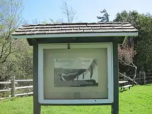 RunningFence1 | Landmark | Sonoma County #24 | 38.35602°N 122.92501°W | Valley Ford | ||||||||||||||||||||
| Fort Ross School | Landmark | Sonoma County #27 | 38.54777°N 123.29488°W | Stewarts Point | |||||||||||||||||||||
| Clemente Inn | Landmark | Sonoma County #28 | 38.32025°N 122.48620°W | Agua Caliente | |||||||||||||||||||||
| Haystack Ranch | Landmark | Sonoma County #29 | 38.22076°N 122.60563°W | Petaluma | |||||||||||||||||||||
| Potter School | _-_panoramio_(1).jpg.webp) Bodega , California, USA - Village of Bodega Bay - Potter School House ( 17110 Bodega Ln Bodega, CA 94922) - panoramio (1) | Landmark | Sonoma County #30 | 38.34587°N 122.97185°W | Bodega | [13] | |||||||||||||||||||
| Saint Phillips Church | Landmark | Sonoma County #31 | 38.40826°N 122.94876°W | Occidental | |||||||||||||||||||||
| Madrona Knolls Rancho | 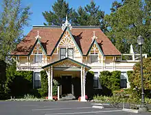 Madrona Manor, Healdsburg, California - Stierch | Landmark | Sonoma County #33 | 38.60440°N 122.88653°W | Healdsburg | [14] | |||||||||||||||||||
| Wegenerville Resort | Landmark | Sonoma County #34 | 38.36037°N 122.54219°W | Glen Ellen | |||||||||||||||||||||
| Massey House | Landmark | Sonoma County #35 | 38.37610°N 122.63930°W | Santa Rosa | |||||||||||||||||||||
| Bennett Valley Grange Hall | Landmark | Sonoma County #36 | 38.39194°N 122.63994°W | Santa Rosa | [15] | ||||||||||||||||||||
| Benjamin Ranch | Landmark | Sonoma County #37 | 38.38940°N 122.63752°W | Santa Rosa | [16] | ||||||||||||||||||||
| Eucalyptus School | Landmark | Sonoma County #40 | 38.34651°N 122.77756°W | Hessel/Sebastopol | [17] | ||||||||||||||||||||
| Witham House | Landmark | Sonoma County #43 | 38.35493°N 122.92226°W | Bodega | |||||||||||||||||||||
| Dry Creek Store | Landmark | Sonoma County #44 | 38.65466°N 122.92176°W | Healdsburg | [18] | ||||||||||||||||||||
| Kenwood Depot | 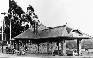 S.P.R.R. Depot, Kenwood, Sonoma Co., California - Cropped | Landmark | Sonoma County #46 | 38.41033°N 122.55015°W | Kenwood | ||||||||||||||||||||
| Nicholas Carriger Grand View | Landmark | Sonoma County #47 | 38.29356°N 122.51781°W | Sonoma | |||||||||||||||||||||
| Cooper House | Landmark | Sonoma County #49 | 38.27676°N 122.47322°W | Sonoma | [19] | ||||||||||||||||||||
| Kiser House | Landmark | Sonoma County #51 | 38.26195°N 122.47459°W | Sonoma | |||||||||||||||||||||
| Rosser Ranch | Landmark | Sonoma County #52 | 38.26450°N 122.46961°W | Sonoma | |||||||||||||||||||||
| Circle Bar Ranch Barn | Landmark | Sonoma County #53 | 38.21447°N 122.45398°W | Sonoma | [20] | ||||||||||||||||||||
| Salt Ranch & Residence | Landmark | Sonoma County #54 | 38.21477°N 122.45859°W | Sonoma | |||||||||||||||||||||
| Laidlaw House | Landmark | Sonoma County #55 | 38.24456°N 122.46879°W | Sonoma | |||||||||||||||||||||
| Kiser Residence | Landmark | Sonoma County #56 | 38.22949°N 122.45819°W | Sonoma | |||||||||||||||||||||
| Harazthy Ranch | Landmark | Sonoma County #57 | 38.22613°N 122.37839°W | Sonoma | |||||||||||||||||||||
| Schellville Baptist Church | Landmark | Sonoma County #58 | 38.24512°N 122.41737°W | Sonoma | |||||||||||||||||||||
| Sonoma Mission Inn | Landmark | Sonoma County #59 | 38.31261°N 122.48296°W | Santa Rosa | |||||||||||||||||||||
| James Kruse House | Landmark | Sonoma County #60 | 38.50324°N 122.75651°W | Santa Rosa | |||||||||||||||||||||
| Jim Voss Commemorative Cottonwood Grove | Landmark | Sonoma County #61 | 38.50221°N 122.75938°W | Santa Rosa | |||||||||||||||||||||
| Maddux Home | Landmark | Sonoma County #62 | 38.50578°N 122.75957°W | Santa Rosa | |||||||||||||||||||||
| John Rosseter Stables | Landmark | Sonoma County #63 | 38.50497°N 122.74409°W | Santa Rosa | |||||||||||||||||||||
| Finley Hop Ranch | Landmark | Sonoma County #64 | 38.50023°N 122.74000°W | Santa Rosa | [21] | ||||||||||||||||||||
| Joshua Chauvet House | Landmark | Sonoma County #65 | 38.36170°N 122.52634°W | Glen Ellen | |||||||||||||||||||||
| Wohler Ranch | Landmark | Sonoma County #66 | 38.49750°N 122.87761°W | Healdsburg | |||||||||||||||||||||
| Gaige House | Landmark | Sonoma County #67 | 38.36678°N 122.52466°W | Glen Ellen | |||||||||||||||||||||
| Calvin H. Holmes House | Landmark | Sonoma County #69 | 38.64152°N 122.70304°W | Calistoga | [22] | ||||||||||||||||||||
| Jackson Place | Landmark | Sonoma County #70 | 38.63203°N 122.67985°W | Santa Rosa | |||||||||||||||||||||
| Franz Valley District School | Landmark | Sonoma County #71 | 38.58127°N 122.64975°W | Calistoga | |||||||||||||||||||||
| Laufenburg Barn & Residence | Landmark | Sonoma County #72 | 38.61910°N 122.65941°W | Calistoga | |||||||||||||||||||||
| Old Horicon School | Landmark | Sonoma County #74 | 38.69091°N 123.31078°W | Annapolis | |||||||||||||||||||||
| Mervyn Hotel Site | Landmark | Sonoma County #75 | 38.36212°N 122.52558°W | Glen Ellen | |||||||||||||||||||||
| Chateau Saint Jean | 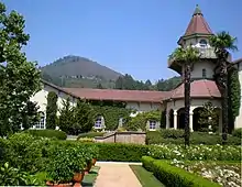 Chateau St. Jean Building - Stierch | Landmark | Sonoma County #76 | 38.42767°N 122.54740°W | Kenwood | [23] | |||||||||||||||||||
| Partis Residence | Landmark | Sonoma County #77 | 38.41735°N 122.55134°W | Kenwood | |||||||||||||||||||||
| Kenwood Winery | 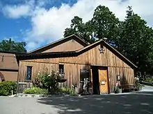 Kenwood Vineyards - Stierch | Landmark | Sonoma County #78 | 38.41696°N 122.54329°W | Kenwood | ||||||||||||||||||||
| Wildwood Vineyards | Landmark | Sonoma County #80 | 38.39860°N 122.53676°W | Kenwood | |||||||||||||||||||||
| Kenwood Community Church | 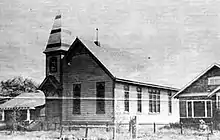 82 Year1910 A - Kenwood Community Church | Landmark | Sonoma County #82 | 38.41234°N 122.54717°W | Kenwood | ||||||||||||||||||||
| Superintendent’s House, Sonoma State Hospital | Landmark | Sonoma County #83 | 38.34838°N 122.51697°W | Glen Ellen | |||||||||||||||||||||
| Shone’s Country Market | Landmark | Sonoma County #84 | 38.36241°N 122.52613°W | Sonoma | |||||||||||||||||||||
| Chauvet Building | Landmark | Sonoma County #85 | 38.36269°N 122.52577°W | Glen Ellen | [24] | ||||||||||||||||||||
| Jack London Village: Stone Winery Building | Landmark | Sonoma County #87 | 38.35421°N 122.52422°W | Glen Ellen | |||||||||||||||||||||
| Calabezas Creek Bridge | Landmark | Sonoma County #88 | 38.36342°N 122.52537°W | Glen Ellen | [25] | ||||||||||||||||||||
| Zane House | Landmark | Sonoma County #89 | 38.37383°N 122.54734°W | Glen Ellen | |||||||||||||||||||||
| Wake Robin Lodge | Landmark | Sonoma County #90 | 38.36852°N 122.53941°W | Glen Ellen | |||||||||||||||||||||
| Ten Oaks Ranch | Landmark | Sonoma County #92 | 38.37461°N 122.51875°W | Glen Ellen | |||||||||||||||||||||
| Cavedale Road Marker | Landmark | Sonoma County #93 | 38.34031°N 122.48942°W | Agua Caliente | [26] | ||||||||||||||||||||
| General Joseph Hooker’s Ranch | Landmark | Sonoma County #94 | 38.32930°N 122.48993°W | Agua Caliente | |||||||||||||||||||||
| Sobre Vista Farm: Main House | Landmark | Sonoma County #96 | 38.33196°N 122.51391°W | Sonoma | |||||||||||||||||||||
| Sobre Vista Farm: Bath/Pool House | Landmark | Sonoma County #97 | 38.33134°N 122.51453°W | Sonoma | |||||||||||||||||||||
| Sobre Vista Farm: Guest House | Landmark | Sonoma County #98 | 38.33237°N 122.51371°W | Sonoma | |||||||||||||||||||||
| Sobre Vista Farm: Tennis Court | Landmark | Sonoma County #99 | 38.33263°N 122.51227°W | Sonoma | |||||||||||||||||||||
| Bosworth Residence | Landmark | Sonoma County #100 | 38.70864°N 122.90713°W | Geyserville | [27] | ||||||||||||||||||||
| Old Geyserville Hotel | Landmark | Sonoma County #101 | 38.70818°N 122.90826°W | Geyserville | |||||||||||||||||||||
| Watson Ranch | Landmark | Sonoma County #102 | 38.28454°N 122.70024°W | Petaluma | |||||||||||||||||||||
| Watmaugh Road Bridge #20C-017 | Landmark | Sonoma County #103 | 38.26451°N 122.45316°W | Sonoma | |||||||||||||||||||||
| Heart’s Desire Nursery - Trentadue Winery | Landmark | Sonoma County #104 | 38.68087°N 122.87982°W | Geyserville | |||||||||||||||||||||
| Kenny Residence | Landmark | Sonoma County #105 | 38.29712°N 122.48216°W | El Verano | |||||||||||||||||||||
| Alexander Valley Community Church | Landmark | Sonoma County #106 | 38.66850°N 122.81787°W | Healdsburg | [28] | ||||||||||||||||||||
| The Sea Ranch Stable & Barn | Landmark | Sonoma County #107 | 38.71514°N 123.45566°W | The Sea Ranch | |||||||||||||||||||||
| Stewarts Point Hotel, School & Store | Landmark | Sonoma County #109 | 38.65199°N 123.39985°W | Stewarts Point | |||||||||||||||||||||
| Saw Mill Teepee | Landmark | Sonoma County #112 | 38.56024°N 123.27113°W | Cazadero | |||||||||||||||||||||
| Bufano Statue | Landmark | Sonoma County #113 | 38.53282°N 123.27747°W | Timber Cove | [29] | ||||||||||||||||||||
| Duncans Mills Depot | Landmark | Sonoma County #116 | 38.45299°N 123.05371°W | Duncans Mills | |||||||||||||||||||||
| Duncans Mills School | Landmark | Sonoma County #117 | 38.45276°N 123.05361°W | Duncans Mills | |||||||||||||||||||||
| Superintendent’s House | Landmark | Sonoma County #118 | 38.45648°N 123.05354°W | Duncans Mills | |||||||||||||||||||||
| Gleason Ranch | Landmark | Sonoma County #119 | 38.38586°N 123.08119°W | Carmet | |||||||||||||||||||||
| Carrington Ranch | Landmark | Sonoma County #120 | 38.36545°N 123.06831°W | Salmon Creek | [30] | ||||||||||||||||||||
| Stage Stop | Landmark | Sonoma County #121 | 38.34994°N 123.06285°W | Bodega | |||||||||||||||||||||
| Greek Revival Cottage | Landmark | Sonoma County #122 | 38.31879°N 122.91991°W | Valley Ford | |||||||||||||||||||||
| James Fowler House | Landmark | Sonoma County #123 | 38.31878°N 122.92166°W | Valley Ford | |||||||||||||||||||||
| Italianate Cottage | Landmark | Sonoma County #124 | 38.31747°N 122.92392°W | Valley Ford | |||||||||||||||||||||
| Kirkland House | Landmark | Sonoma County #125 | 38.31789°N 122.92359°W | Valley Ford | |||||||||||||||||||||
| Valley Ford Hotel | Landmark | Sonoma County #126 | 38.31781°N 122.92441°W | Valley Ford | |||||||||||||||||||||
| Meeker Residence | Landmark | Sonoma County #128 | 38.42673°N 122.95817°W | Camp Meeker | |||||||||||||||||||||
| Belden House | Landmark | Sonoma County #129 | 38.49960°N 122.98909°W | Guerneville | [31] | ||||||||||||||||||||
| Travis House | Landmark | Sonoma County #130 | 38.47531°N 122.88049°W | Forestville | |||||||||||||||||||||
| Denman Creamery | Landmark | Sonoma County #133 | 38.28325°N 122.66885°W | Penngrove | |||||||||||||||||||||
| Coleman Valley Ranch | Landmark | Sonoma County #134 | 38.41108°N 122.98889°W | Occidental | [32] | ||||||||||||||||||||
| Rose Villa | Landmark | Sonoma County #135 | 38.61557°N 122.86343°W | Healdsburg | |||||||||||||||||||||
| Bodega Historic District Properties | 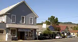 BodegaCA3205 | Landmark | Sonoma County #136 | 38.34578°N 122.97255°W | Bodega | [33] | |||||||||||||||||||
| Occidental Historic District Properties | 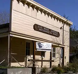 OccidentalCAPOEdit2767 | Landmark | Sonoma County #137 | 38.40728°N 122.94777°W | Occidental | ||||||||||||||||||||
| Penngrove Historic District Properties |  Penngrove2882 | Landmark | Sonoma County #138 | 38.29949°N 122.66651°W | Penngrove | ||||||||||||||||||||
| Duncans Mills Historic District Properties | 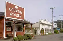 Duncans Mills shops 3506 | Landmark | Sonoma County #139 | 38.45330°N 123.05402°W | Duncans Mills | ||||||||||||||||||||
| Sobre Vista Overview Farm | Landmark | Sonoma County #140 | 38.33443°N 122.51493°W | Sonoma | |||||||||||||||||||||
| Preston Ranch | Landmark | Sonoma County #141 | 38.83452°N 123.01836°W | Cloverdale | |||||||||||||||||||||
| Green Valley School | Landmark | Sonoma County #143 | 38.44086°N 122.89723°W | Sebastopol | |||||||||||||||||||||
| Alexander Valley Community Hall | Landmark | Sonoma County #144 | 38.67634°N 122.83114°W | Geyserville | [34] | ||||||||||||||||||||
| Leveroni Ranch | Landmark | Sonoma County #145 | 38.27725°N 122.47226°W | Sonoma | |||||||||||||||||||||
| James Watson / Hollis Hitchcock Ranch | Landmark | Sonoma County #146 | 38.35583°N 122.92819°W | Bodega | |||||||||||||||||||||
| Sweeney Ranch | Landmark | Sonoma County #147 | 38.18062°N 122.60142°W | Petaluma | |||||||||||||||||||||
| Dunham School | Landmark | Sonoma County #149 | 38.32091°N 122.75656°W | Petaluma | |||||||||||||||||||||
| Bloomfield Masonic Lodge Hall | Landmark | Sonoma County #150 | 38.31304°N 122.85157°W | Petaluma | [35] | ||||||||||||||||||||
| Two Rock Grange Hall | Landmark | Sonoma County #152 | 38.25812°N 122.78012°W | Petaluma | |||||||||||||||||||||
| Kastania Ranch | Landmark | Sonoma County #153 | 38.21226°N 122.60365°W | Petaluma | [36] | ||||||||||||||||||||
| Mills-Stump Ranch | Landmark | Sonoma County #154 | 38.31778°N 122.86861°W | Valley Ford | |||||||||||||||||||||
| Octagon House | Landmark | Sonoma County #155 | 38.24223°N 122.75276°W | Petaluma | |||||||||||||||||||||
| Bloomfield IOOF Hall | Landmark | Sonoma County #156 | 38.31364°N 122.85157°W | Petaluma | [37] | ||||||||||||||||||||
| Bloomfield School | Landmark | Sonoma County #157 | 38.31145°N 122.84985°W | Petaluma | [38] | ||||||||||||||||||||
| Triniti School | Landmark | Sonoma County #159 | 38.38704°N 122.52614°W | Glen Ellen | |||||||||||||||||||||
| Holy Ghost Hall | Landmark | Sonoma County #163 | 38.25367°N 122.70307°W | Petaluma | [39] | ||||||||||||||||||||
| Del Mar Ranch | Landmark | Sonoma County #164 | 38.74141°N 123.49661°W | The Sea Ranch | [40] | ||||||||||||||||||||
| Walker / Case House | Landmark | Sonoma County #165 | 38.48207°N 122.90005°W | Forestville | |||||||||||||||||||||
| Kee Ranch House | Landmark | Sonoma County #166 | 38.32903°N 123.05972°W | Bodega Bay | |||||||||||||||||||||
| Highland Dell Resort | Landmark | Sonoma County #167 | 38.46626°N 123.00824°W | Monte Rio | |||||||||||||||||||||
| Sanders House | Landmark | Sonoma County #168 | 38.372452°N 122.84126°W | Sebastopol | |||||||||||||||||||||
| Arnold Drive | Landmark | Sonoma County #169 | 38.35749°N 122.52574°W | Arnold | [41] | ||||||||||||||||||||
| Geysers Road Over Big Sulphur Creek Bridge #20C-05 | Landmark | Sonoma County #170 | 38.82325°N 122.88363°W | Cloverdale | |||||||||||||||||||||
| Chalk Hill Road Over Maacama Creek Bridge #20C-242 | Landmark | Sonoma County #171 | 38.62176°N 122.77401°W | Healdsburg | [42] | ||||||||||||||||||||
| Clarks Crossing Bridge #20C-141 | Landmark | Sonoma County #172 | 38.66549°N 123.31330°W | Annapolis | [43] | ||||||||||||||||||||
| Hacienda Bridge | Landmark | Sonoma County #174 | 38.50849°N 122.92739°W | Guerneville | |||||||||||||||||||||
| Haupt Creek Bridge #20C-224 | Landmark | Sonoma County #175 | 38.66143°N 123.32171°W | Annapolis | |||||||||||||||||||||
| Lambert Bridge #20-248 | Landmark | Sonoma County #176 | 38.65387°N 122.92759°W | Healdsburg | |||||||||||||||||||||
| North Fork Bridge #10C-46 | Landmark | Sonoma County #177 | 38.75962°N 123.51883°W | Gualala | |||||||||||||||||||||
| Wohler Bridge | Landmark | Sonoma County #178 | 38.50735°N 122.88356°W | Forestville | |||||||||||||||||||||
| Valley of the Moon Winery | Landmark | Sonoma County #180 | 38.34075°N 122.50629°W | Glen Ellen | |||||||||||||||||||||
| Niemela Ranch | Landmark | Sonoma County #181 | 38.17863°N 122.53012°W | Petaluma | |||||||||||||||||||||
| Jack London Barn | Landmark | Sonoma County #182 | 38.35625°N 122.53179°W | Glen Ellen | |||||||||||||||||||||
| Martinelli Ranch | Landmark | Sonoma County #183 | 38.48631°N 122.80613°W | Windsor | |||||||||||||||||||||
| Mark West Lodge | Landmark | Sonoma County #184 | 38.54836°N 122.72061°W | Santa Rosa | |||||||||||||||||||||
| Jimtown Store | Landmark | Sonoma County #185 | 38.66880°N 122.81725°W | Geyserville | |||||||||||||||||||||
| Daniels School | Landmark | Sonoma County #186 | 38.60251°N 122.98626°W | Healdsburg | [44] | ||||||||||||||||||||
| Skillman House | Landmark | Sonoma County #187 | 38.25912°N 122.66229°W | Petaluma | |||||||||||||||||||||
| Monte Rio Bridge #20C-18 | Landmark | Sonoma County #188 | 38.46574°N 123.01001°W | Monte Rio | |||||||||||||||||||||
| Austin Creek Bridge #20C-94 | Landmark | Sonoma County #189 | 38.47100°N 123.04630°W | Cazadero | [45] | ||||||||||||||||||||
| Wharff-Aggesen House | Landmark | Sonoma County #190 | 38.29004°N 122.67943°W | Penngrove | |||||||||||||||||||||
| Asti Villa Pompeii | Landmark | Sonoma County #191 | 38.75740°N 122.97151°W | Cloverdale | [46] | ||||||||||||||||||||
| Soda Rock Winery | Landmark | Sonoma County #192 | 38.66059°N 122.79988°W | Healdsburg |
See also
- California Historical Landmarks in Sonoma County, California
- List of historic landmarks in Petaluma
- List of cemeteries in Sonoma County, California
- List of historical landmarks in Healdsburg, California
- List of National Historic Landmarks in California
- National Register of Historic Places listings in Sonoma County, California
- Santa Rosa historic landmarks
- Sonoma County Historic Landmarks and Districts
- Sonoma County landmarks
- Sonoma (city) historic landmarks
- Windsor historical landmarks
References
- Resolution: Board of Directors: Sonoma County Historical Society (Report). Sonoma County Historical Society. 2021-01-19. p. 1.
- "Cultural Heritage Board". City of Santa Rosa. Retrieved 2021-01-18.
- Resolution 18-2006: A Resolution of the City Council Establishing an Inventory of Historic Sites and Structures (Report). City of Sonoma. 2006-04-05.
- "Historic Landmarks". City of Petaluma. Retrieved 2021-01-19.
- "City Council Briefs". Healdsburg Tribune, Enterprise and Scimitar. 1985-11-15. p. B8. Retrieved 2021-01-19.
- "Resolution 1343-03: A Resolution of the Town Council of the Town of Windsor Establishing a Town of Windsor Historic Register". Town of Windsor. 2003. Retrieved 2021-01-18.
- "County of Sonoma: Historic Landmarks". Retrieved 2021-01-23.
- Highest designation color coded: red, National Historic Landmark; California Historical Landmark, dark yellow; National Register of Historic Places, yellow.
- "National Register of Historic Places; Notification of Pending Nominations and Related Actions". United State National Archives. 2018-11-27. Retrieved 2021-01-18.
- "National Register of Historic Places Registration Form: Baker House" (PDF). 2018-10-31. Retrieved 2021-01-24.
- "Resolution 1343-03: A Resolution of the Town Council of the Town of Windsor Establishing a Town of Windsor Historic Register". Town of Windsor. 2003. pp. 16–17. Retrieved 2021-01-18.
- "Our Lady of Mount Carmel Church". Sonoma County. Retrieved 2021-01-21.
- "Potter School". Sonoma County. Retrieved 2021-01-21.
- "Madrona Knolls Rancho". Sonoma County. Retrieved 2021-01-21.
- "Bennett Valley Grange Hall". Sonoma County. Retrieved 2021-01-21.
- "Benjamin Ranch". Sonoma County. Retrieved 2021-01-21.
- "Eucalyptus School". Sonoma County. Retrieved 2021-01-21.
- "Dry Creek Store". Sonoma County. Retrieved 2021-01-21.
- "Cooper House". Sonoma County. Retrieved 2021-01-21.
- "Circle Bar Ranch Barn". Sonoma County. Retrieved 2021-01-21.
- "Finley Hop Ranch". Sonoma County. Retrieved 2021-01-21.
- "Calvin H. Holmes House". Sonoma County. Retrieved 2021-01-21.
- "Chateau Saint Jean". Sonoma County. Retrieved 2021-01-21.
- "Chauvet Building". Sonoma County. Retrieved 2021-01-21.
- "Calabezas Creek Bridge". Sonoma County. Retrieved 2021-01-21.
- "Cavedale Road Marker". Sonoma County. Retrieved 2021-01-21.
- "Bosworth Residence". Sonoma County. Retrieved 2021-01-21.
- "Alexander Valley Community Church". Sonoma County. Retrieved 2021-01-21.
- "Bufano Statue". Sonoma County. Retrieved 2021-01-21.
- "Carrington Ranch". Sonoma County. Retrieved 2021-01-21.
- "Belden House". Sonoma County. Retrieved 2021-01-21.
- "Coleman Valley Ranch". Sonoma County. Retrieved 2021-01-21.
- "Bodega Historic District Properties". Sonoma County. Retrieved 2021-01-21.
- "Alexander Valley Community Hall". Sonoma County. Retrieved 2021-01-21.
- "Bloomfield Masonic Lodge Hall". Sonoma County. Retrieved 2021-01-21.
- "Kastania Ranch". Sonoma County. Retrieved 2021-01-21.
- "Bloomfield IOOF Hall". Sonoma County. Retrieved 2021-01-21.
- "Bloomfield School". Sonoma County. Retrieved 2021-01-21.
- "Holy Ghost Hall". Sonoma County. Retrieved 2021-01-21.
- "Del Mar Ranch". Sonoma County. Retrieved 2021-01-21.
- "Arnold Drive". Sonoma County. Retrieved 2021-01-21.
- "Chalk Hill Road Over Maacama Creek Bridge #20C-242". Sonoma County. Retrieved 2021-01-21.
- "Clarks Crossing Bridge #20C-141". Sonoma County. Retrieved 2021-01-21.
- "Daniels School". Sonoma County. Retrieved 2021-01-21.
- "Austin Creek Bridge #20C-94". Sonoma County. Retrieved 2021-01-21.
- "Asti Villa Pompeii". Sonoma County. Retrieved 2021-01-21.
This article is issued from Wikipedia. The text is licensed under Creative Commons - Attribution - Sharealike. Additional terms may apply for the media files.