California Historical Landmarks in Sonoma County, California
This is a list of the properties and districts — listed as California Historical Landmarks — within Sonoma County, California.
- Note: Click the "Map of all coordinates" link to the right to view a Google map of all properties and districts with latitude and longitude coordinates in the table below.
Listings
| Image | [1] | Landmark name | Location | City or town | Summary |
|---|---|---|---|---|---|
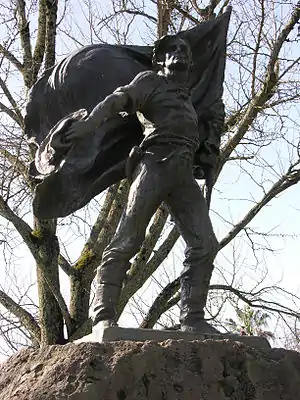 Bear Flag Monument |
7 | Bear Flag Monument | Sonoma Plaza 38°17′36″N 122°27′24″W |
Sonoma | |
 Blue Wing Inn |
17 | Blue Wing Inn | Sonoma State Historic Park 38°17′36″N 122°27′20″W |
Sonoma | |
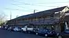
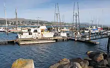 Bodega Bay & Harbor |
833 | Bodega Bay & Harbor | Doran Park 38°19′25″N 123°02′52″W |
Bodega Bay | |
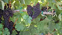
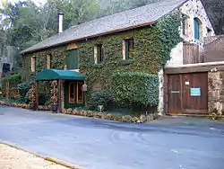 Buena Vista Winery |
392 | Buena Vista Winery | 18000 Old Winery Rd. 38°17′58″N 122°25′23″W |
Sonoma | Also on the NRHP list as NPS-86001902 |
 Cooper's Sawmill |
835 | Cooper's Sawmill | Mirabel and River Rds. 38°29′36″N 122°53′45″W |
Santa Rosa | |
 Cotati Downtown Plaza |
879 | Cotati Downtown Plaza | Downtown plaza 38°19′36″N 122°42′22″W |
Cotati | |
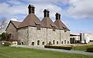
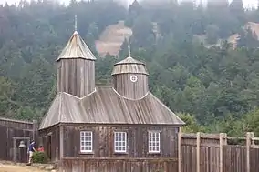 Fort Ross |
5 | Fort Ross | Fort Ross State Historic Park, 19005 Coast Hwy 38°30′51″N 123°14′34″W |
Jenner | |
 Haraszthy Villa |
392-1 | Haraszthy Villa | Castle Rd. near Buena Vista Winery 38°18′02″N 122°25′32″W |
Sonoma | |
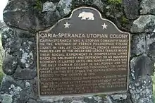 Icaria-Speranza Commune |
981 | Icaria-Speranza Commune | W side of Asti Rd. 38°46′27″N 122°59′59″W |
Cloverdale | |
 Italian Swiss Colony |
621 | Italian Swiss Colony | 38°45′46″N 122°58′26″W |
Asti | |
 Jack London State Historic Park |
743 | Jack London State Historic Park | Jack London State Historic Park 38°21′02″N 122°32′35″W |
Glen Ellen | Also on the NRHP list as NPS-66000240 |
| 939 | John Medica Gardens | 5000 Medica Rd. 35°34′04″N 121°05′51″W |
Santa Rosa | Twentieth Century Folk Art | |
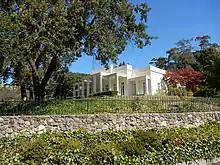
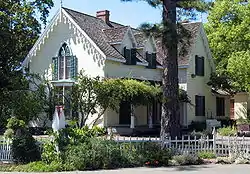
 Luther Burbank Home and Gardens |
234 | Luther Burbank Home and Gardens | 200 Santa Rosa Ave. 38°26′10″N 122°42′42″W |
Santa Rosa | Also on the NRHP list as NPS-66000241 |
Mission San Francisco de Solano |
3 | Mission San Francisco de Solano | Sonoma State Historic Park 38°17′38″N 122°27′21″W |
Sonoma | |
| 667 | Nash-Patton Adobe | 579 1st St. E. 38°17′25″N 122°27′25″W |
Sonoma | ||
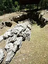 Petrified Forest |
915 | Petrified Forest | 4100 Petrified Forest Rd. 38°33′20″N 122°38′20″W |
Calistoga | |
Presidio of Sonoma |
316 | Presidio of Sonoma | Sonoma State Historic Park 38°17′37″N 122°27′24″W |
Sonoma | |
Rancho Petaluma Adobe |
18 | Rancho Petaluma Adobe | Petaluma Adobe State Historic Park, 3325 Adobe Rd. 38°15′20″N 122°35′04″W |
Petaluma | Also on the NRHP list as NPS-70000151 |
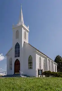 Saint Teresa of Avila Church, Bodega |
820 | Saint Teresa of Avila Church, Bodega | Bodega Hwy near Bodega Ln. 38°20′46″N 122°58′21″W |
Bodega | |
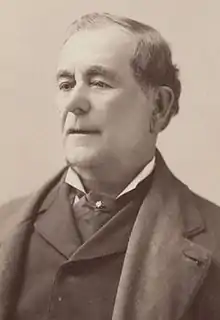
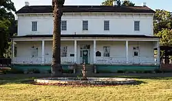
 Salvador Vallejo Adobe |
501 | Salvador Vallejo Adobe | 421 1st St. 38°17′37″N 122°27′32″W |
Sonoma | BUilt in 1846 home of Captain Salvador Vallejo[2] |
 Sebastiani Vineyards and Winery |
739 | Sebastiani Vineyards and Winery | 394 4th St E 38°17′36″N 122°26′58″W |
Sonoma | |
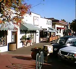
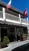 Swiss Hotel |
496 | Swiss Hotel | 18 W. Spain St. 38°17′38″N 122°27′29″W |
Sonoma | |
 Temelec Hall |
237 | Temelec Hall | 220 Temelec Circle 38°16′00″N 122°29′34″W |
Temelec | |
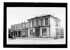 Union Hotel & Union Hall |
627 | Union Hotel & Union Hall | 35 Napa and 1st St. 38°17′31″N 122°27′31″W |
Sonoma | |
 Vallejo Estate |
4 | Vallejo Estate | Corner of Spain and West 3rd Streets 38°17′50″N 122°27′40″W |
Sonoma | Also on the NRHP list as NPS-72000262 |
 Walters Ranch Hop Kiln |
893 | Walters Ranch Hop Kiln | 7501 Sonoma Hwy. 38°32′10″N 122°52′04″W |
Healdsburg | |
 William Hood House |
692 | William Hood House | 7501 Sonoma Hwy. 38°26′37″N 122°34′36″W |
Santa Rosa | Also on the NRHP list as NPS-97001658 |
See also
References
| Wikimedia Commons has media related to California Historical Landmarks in Sonoma County, California. |
- "California Historical Landmarks By County". Ohp.parks.ca.gov. Retrieved 2019-04-03.
- californiahistoricallandmarks.com Landmarks chl-501
This article is issued from Wikipedia. The text is licensed under Creative Commons - Attribution - Sharealike. Additional terms may apply for the media files.