South Carolina Highway 410
South Carolina Highway 410 (SC 410) is a 17.460-mile (28.099 km) state highway in Horry County, in the northeastern part of the U.S. state of South Carolina. It travels from U.S. Route 701 (US 701) in the community of Baxter Forks north of SC 22 to the North Carolina state line.
| ||||
|---|---|---|---|---|
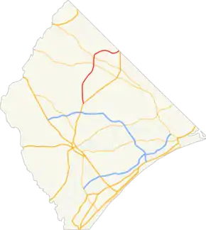 Route of SC 410 highlighted in red | ||||
| Route information | ||||
| Maintained by SCDOT | ||||
| Length | 17.460 mi[1] (28.099 km) | |||
| Existed | 1949–present | |||
| Major junctions | ||||
| South end | ||||
| North end | ||||
| Location | ||||
| Counties | Horry | |||
| Highway system | ||||
| ||||

Route description
SC 410 starts at U.S. Route 701 at Baxter Forks and ends at the North Carolina state line, where the road continues as NC 410 into Tabor City.
History
Major intersections
The entire highway is in Horry County.
| Location | mi[1] | km | Destinations | Notes | |
|---|---|---|---|---|---|
| Baxter Forks | 0.000 | 0.000 | Southern terminus | ||
| Finklea | 9.400 | 15.128 | Northern end of SC 9 Bus. concurrency; southern terminus of SC 917; Deputy Sheriff Timothy Causey Memorial Intersection | ||
| Green Sea | 11.360 | 18.282 | Northern end of SC 9 Bus. concurrency; Lieutenant John Ronald Floyd Intersection | ||
| | 17.460 | 28.099 | Continuation into North Carolina | ||
1.000 mi = 1.609 km; 1.000 km = 0.621 mi
| |||||
See also
 U.S. roads portal
References
- "Highway Logmile Report". South Carolina Department of Transportation. Retrieved December 28, 2020.
External links
 Media related to South Carolina Highway 410 at Wikimedia Commons
This article is issued from Wikipedia. The text is licensed under Creative Commons - Attribution - Sharealike. Additional terms may apply for the media files.