South Carolina Highway 641
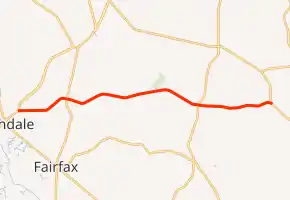
South Carolina Highway 641 (SC 641) is a 21.560-mile (34.697 km) primary state highway in the U.S. state of South Carolina. It provides the city of Allendale with a direct route toward Charleston, via SC 64 and U.S. Route 17 (US 17). It also serves access to Rivers Bridge State Park.[4]
| ||||
|---|---|---|---|---|
| ||||
| Route information | ||||
| Maintained by SCDOT | ||||
| Length | 21.560 mi[1][2][3] (34.697 km) | |||
| Existed | 1932–present | |||
| Major junctions | ||||
| West end | ||||
| East end | ||||
| Location | ||||
| Counties | Allendale, Bamberg, Colleton | |||
| Highway system | ||||
| ||||

History
The highway was established around 1932 as a new primary spur of SC 64 to SC 36 (today US 601). By 1938, SC 641 was extended west on new routing to SC 33/SC 331 (today US 321) in Sycamore. In 1942, its alignment was straightened, leaving Rivers Bridge Road (S-5-31/S-15-37). By 1948, SC 641 was extended west to Allendale, replacing part of SC 73. In 1952, it was extended west again to the southern boundary of the Savannah River Plant, replacing part of SC 28; reaching its apex of over 44 miles (71 km) long. Between 1968-1970, SC 641 was truncated at US 301, its former route replaced by SC 125.
Junction list
| County | Location | mi[1][2][3] | km | Destinations | Notes | |||
|---|---|---|---|---|---|---|---|---|
| Allendale | | 0.000 | 0.000 | Western terminus | ||||
| Sycamore | 4.330 | 6.968 | ||||||
| Bamberg |
No major junctions | |||||||
| Colleton | | 15.530 | 24.993 | |||||
| | 21.560 | 34.697 | Eastern terminus | |||||
| 1.000 mi = 1.609 km; 1.000 km = 0.621 mi | ||||||||
See also
 U.S. roads portal
References
- "Highway Logmile Report". South Carolina Department of Transportation. Retrieved November 25, 2020.
- "Highway Logmile Report". South Carolina Department of Transportation. Retrieved November 25, 2020.
- "Highway Logmile Report". South Carolina Department of Transportation. Retrieved November 25, 2020.
- Google (September 7, 2013). "South Carolina Highway 641" (Map). Google Maps. Google. Retrieved September 7, 2013.
External links
 Media related to South Carolina Highway 641 at Wikimedia Commons
- Mapmikey's South Carolina Highways Page: SC 641