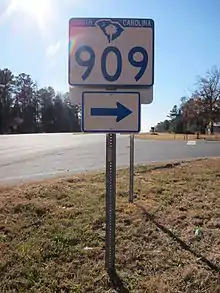
South Carolina Highway 909
South Carolina Highway 909 (SC 909) is a 14.060-mile (22.627 km) primary state highway in the U.S. state of South Carolina. It connects the communities of northern Chester County.
| ||||
|---|---|---|---|---|
 | ||||
| Route information | ||||
| Maintained by SCDOT | ||||
| Length | 14.060 mi[1] (22.627 km) | |||
| Existed | 1940–present | |||
| Major junctions | ||||
| West end | ||||
| East end | ||||
| Location | ||||
| Counties | Chester | |||
| Highway system | ||||
| ||||

Route description
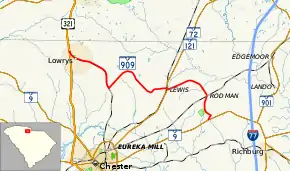
SC 909 is a two-lane rural highway that traverses from U.S. Route 321 (US 321) in Lowrys to SC 9 near Richburg. The route zig-zags in northern Chester County connecting small communities, and provides access to the Chester Catawba Regional Airport.[2][3]
History
Established in 1940 as a new primary routing, it originally traversed from SC 9 to US 21 in Lewis. In 1941 or 1942, SC 909 was extended both directions: south, from SC 9 to the Knox community, and west from US 21 and through Lowrys to Cassels Road. In 1948, SC 909 was reverted to its original 1940 with both extensions becoming secondary roads. Around 1952, it was re-extended west to its current western terminus at US 321.
Major intersections
The entire route is in Chester County.
| Location | mi[1] | km | Destinations | Notes | |
|---|---|---|---|---|---|
| Lowrys | 0.000 | 0.000 | Western terminus | ||
| Lewis | 8.920 | 14.355 | Western end of SC 72/SC 121 concurrency | ||
| 9.020 | 14.516 | Eastern end of SC 72/SC 121 concurrency | |||
| | 14.060 | 22.627 | Eastern terminus | ||
1.000 mi = 1.609 km; 1.000 km = 0.621 mi
| |||||
See also
 U.S. roads portal
References
- "Highway Logmile Report". South Carolina Department of Transportation. Retrieved December 29, 2020.
- General Highway System - Chester County, South Carolina (PDF) (Map). South Carolina Department of Transportation. June 2005. Retrieved September 7, 2013.
- Google (November 25, 2012). "Overview map of SC 909" (Map). Google Maps. Google. Retrieved November 25, 2012.
External links
 Media related to South Carolina Highway 909 at Wikimedia Commons
- SC 909 at Virginia Highways' South Carolina Highways Annex