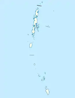
South Sentinel Island
South Sentinel Island is one of the Andaman Islands in the Bay of Bengal. It is 1.6 km (0.99 mi) long northeast to southwest and up to 1 km (0.62 mi) wide. At only 1.61 km2 (0.62 sq mi), it is much smaller than its counterpart North Sentinel Island and is currently uninhabited. The island belongs to the Port Blair tehsil in the South Andaman administrative district, part of the Indian union territory of Andaman and Nicobar Islands,[5] neighbouring North Sentinel Island.
 South Sentinel Island Location of South Sentinel Island | |
| Geography | |
|---|---|
| Location | Bay of Bengal |
| Coordinates | 10.976°N 92.22°E |
| Archipelago | Andaman Islands |
| Adjacent bodies of water | Indian Ocean |
| Area | 1.61 km2 (0.62 sq mi)[1] |
| Length | 1.6 km (0.99 mi) |
| Width | 1.0 km (0.62 mi) |
| Coastline | 4.9 km (3.04 mi) |
| Highest elevation | 2 m (7 ft) |
| Administration | |
| Union territory | Andaman and Nicobar Islands |
| District | South Andaman |
| Demographics | |
| Demonym | South Sentinelese |
| Population | 0 (2019) |
| Pop. density | 0/km2 (0/sq mi) |
| Additional information | |
| Time zone |
|
| PIN | 744202[2] |
| Telephone code | 031927 [3] |
| ISO code | IN-AN-00[4] |
| Official website | www |
| Avg. summer temperature | 30.2 °C (86.4 °F) |
| Avg. winter temperature | 23.0 °C (73.4 °F) |
| Sex ratio | 0.0♂/0.0♀ |
| Census Code | 35.639.0004 |
Geography
South Sentinel is 26.5 kilometres (16.5 mi) west-northwest of Little Andaman Island in the south of the Andaman chain but 59.6 kilometres (37.0 mi) south of its counterpart North Sentinel Island. From the limited information available it can be said that South Sentinel Island is a forested coral reef. From a journal written in the 19th century, a Colonel Alcock who passed the island wrote "[South Sentinel is] raised a few feet and continuous with the corals surrounding it". The island lies 186 km (116 mi) southwest from Port Blair. It lies immediately south of the passage. The island is 44m high to the tops of the trees and level topped. Its appearance is much the same on all bearings. A bank, as defined by the 36m curve, surrounds the island and extends about 6 miles NW from it. Considerable depths exist in the channel between this island and Little Andaman Island.[6][7]
Administration
Politically, South Sentinel Island is part of Little Andaman Taluk.[8]
In 2018, the Government of India excluded 29 islands—including South Sentinel—from the Restricted Area Permit (RAP) regime until 31 December 2022 in an effort to boost tourism.[9] In November 2018, however, the government's Home ministry stated that the relaxation of the prohibition was intended only to allow researchers and anthropologists, with pre-approved clearance, to visit the Sentinel islands. [10]
Demographics
The island is uninhabited but is sometimes used by diving expeditions on account of its remoteness and novelty factor.
Fauna
The South Sentinel Island Sanctuary (established in 1977) is home to coconut crabs.
See also
References
- "Islandwise Area and Population - 2011 Census" (PDF). Government of Andaman.
- "A&N Islands - Pincodes". 22 September 2016. Archived from the original on 23 March 2014. Retrieved 22 September 2016.
- code
- Registration Plate Numbers added to ISO Code
- "Village Code Directory: Andaman & Nicobar Islands" (PDF). Census of India. Retrieved 16 January 2011.
- Sailing Directions (Enroute), Pub. 173: India and the Bay of Bengal (PDF). Sailing Directions. United States National Geospatial-Intelligence Agency. 2017. p. 274.
- map
- Tehsils
- "Sentinelese Tribe: What Headlines Won't Tell You About Eco-Tourism". The Quint. Retrieved 25 November 2018.
- "US National Defied 3-tier Curbs & Caution to Reach Island". Times of India. 23 November 2018. Retrieved 25 November 2018.
External links
- "A Journey to the Edge of the World", janakilenin.blogspot.com
- Geological Survey of India
 Andaman and Nicobar Islands travel guide from Wikivoyage