Stützengrün
Stützengrün is a community in the district of Erzgebirgskreis, Saxony, Germany.
Stützengrün | |
|---|---|
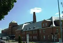
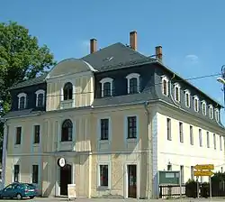 house in baroque style | |
Location of Stützengrün within Erzgebirgskreis district 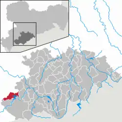 | |
 Stützengrün  Stützengrün | |
| Coordinates: 50°32′4″N 12°31′34″E | |
| Country | Germany |
| State | Saxony |
| District | Erzgebirgskreis |
| Subdivisions | 3 |
| Government | |
| • Mayor | Birgit Reichel (CDU) |
| Area | |
| • Total | 28.36 km2 (10.95 sq mi) |
| Elevation | 584 m (1,916 ft) |
| Population (2019-12-31)[1] | |
| • Total | 3,146 |
| • Density | 110/km2 (290/sq mi) |
| Time zone | UTC+01:00 (CET) |
| • Summer (DST) | UTC+02:00 (CEST) |
| Postal codes | 08328 |
| Dialling codes | 037462 |
| Vehicle registration | ERZ, ANA, ASZ, AU, MAB, MEK, STL, SZB, ZP |
| Website | www.stuetzengruen.de |
Geography
Location
Stützengrün lies in the Ore Mountains right on the boundary with the Vogtland. In Stützengrün is found the Weißbach (stream), which empties directly into the Eibenstock Reservoir.
Geology
The community lies on a hilly plateau of Eibenstock tourmaline-granite and stretches from a height of 570 up to 680 metres above sea level.
Constituent communities
As well as the namesake community of Stützengrün, the municipal area also includes the amalgamated centres of Hundshübel and Lichtenau.
History
Development of population figures (31 December):
|
|
|
- Source as of 1998: Statistisches Landesamt des Freistaates Sachsen
Politics
At the 2005 Bundestag election, the CDU earned the most in the first and second votes. Voting in Stützengrün went thus:
| Party | First Vote | Second Vote |
|---|---|---|
| CDU | 45.6% | 39.4% |
| SPD | 21.4% | 21.1% |
| Die Linke. | 16.5% | 17.1% |
| FDP | 8.3% | 12.2% |
| Greens | 1.4% | 2.3% |
| NPD | 2.9% | 3.7% |
2007 mayoral election
At the mayoral election on 2 September 2007, the Bürgermeisterin Birgit Reichel (CDU) was elected once again with 99.3% of the vote. Voter turnout was 48.3%.
Culture and sightseeing
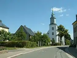
.jpg.webp)
Right on Bundesstraße 169, which runs through the community, is the Bauernbarockkirche (“Baroque Farmers’ Church”), built in 1701 and now a protected monument, with its carved altar and a 130-year-old Jehmlich organ.
A further attraction in the community is the 795-m-high Kuhberg (“Cow Mountain”) with the Prinz-Georg-Turm (tower) which affords an unrivalled view of the neighbouring communities. Moreover, the Bergwiesenerlebnispfad (“Mountain Meadow Experience Path”), which features indigenous vegetation and Scottish Highland cattle, makes for an inviting walk.
Economy and infrastructure
Transport
Stützengrün lies on Bundesstraße 169. Until the 1970s, the community was connected to the railway by the narrow-gauge line that ran from Wilkau-Haßlau to Carlsfeld. In 1997, the stretch to Schönheide was rebuilt and since then has been run as a museum railway.
Established businesses
- Brush industry
- Small and medium-sized businesses
- Sporadic agriculture
- Commercial-industrial area on the B 169
Education
The elementary school at Stützengrün on Schulstraße (“School Street”) serves the local schooling needs.
References
- "Bevölkerung des Freistaates Sachsen nach Gemeinden am 31. Dezember 2019". Statistisches Landesamt des Freistaates Sachsen (in German). July 2020.
See also
 Media related to Stützengrün at Wikimedia Commons
| Authority control |
|---|