St. Gabriel, Louisiana
St. Gabriel is a city in Iberville Parish, Louisiana, United States. The population was 6,677 at the 2010 census. The city of St. Gabriel includes the areas of Sunshine and Carville. It is part of the Baton Rouge Metropolitan Statistical Area.
City of St. Gabriel | |
|---|---|
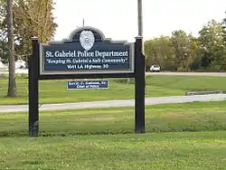 St. Gabriel Police Department | |
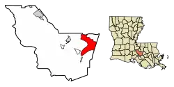 Location of St. Gabriel in Iberville Parish, Louisiana. | |
.svg.png.webp) Location of Louisiana in the United States | |
| Coordinates: 30°15′13″N 91°06′05″W | |
| Country | United States |
| State | Louisiana |
| Parish | Iberville |
| Incorporated | 1994 (town) |
| City Designation | 2001 |
| Government | |
| • Mayor | Lionel Johnson Jr. |
| Area | |
| • Total | 29.88 sq mi (77.39 km2) |
| • Land | 29.66 sq mi (76.81 km2) |
| • Water | 0.22 sq mi (0.58 km2) |
| Elevation | 23 ft (7 m) |
| Population (2010) | |
| • Total | 6,677 |
| • Estimate (2019)[2] | 7,460 |
| • Density | 251.54/sq mi (97.12/km2) |
| Time zone | UTC-6 (CST) |
| • Summer (DST) | UTC-5 (CDT) |
| ZIP Codes | 70721, 70776, 70780 |
| Area code(s) | 225 |
| FIPS code | 22-67250 |
| Website | http://www.cityofstgabriel.us |
St. Gabriel was incorporated as a town in 1994 and received city designation in 2001.[3] It is located on the east bank of the Mississippi River, approximately 12 miles south of Baton Rouge. Bayou Manchac serves as the official boundary between St. Gabriel, Ascension Parish, and East Baton Rouge Parish. Over the years, the area has been transformed from a primarily agricultural economy to one that is now dominated by the petrochemical industry.[4]
Geography
According to the United States Census Bureau, the town has a total area of 29.0 square miles (75.0 km2), of which 28.7 square miles (74.4 km2) is land and 0.2 square mile (0.6 km2) (0.76%) is water.
St. Gabriel sits along the east bank of the Mississippi River, between the boundaries of Ascension Parish and East Baton Rouge Parish.[5]
The city is about 12 miles (19 km) east of Baton Rouge and about 70 miles (110 km) from New Orleans.[6]
The communities of Carville and Sunshine are within the city limits.[6]
Demographics
| Historical population | |||
|---|---|---|---|
| Census | Pop. | %± | |
| 2000 | 5,514 | — | |
| 2010 | 6,677 | 21.1% | |
| 2019 (est.) | 7,460 | [2] | 11.7% |
| U.S. Decennial Census[7] | |||
As of the census[8] of 2000, there were 5,514 people, 898 households, and 639 families residing in the town. The population density was 191.9 people per square mile (74.1/km2). There were 986 housing units at an average density of 34.3 per square mile (13.3/km2). The racial makeup of the town was 27.08% White, 71.98% African American, 0.05% Native American, 0.33% Asian, 0.02% Pacific Islander, 0.22% from other races, and 0.33% from two or more races. Hispanic or Latino of any race were 1.12% of the population.
There were 898 households, out of which 35.6% had children under the age of 18 living with them, 39.0% were married couples living together, 26.9% had a female householder with no husband present, and 28.8% were non-families. 25.2% of all households were made up of individuals, and 7.7% had someone living alone who was 65 years of age or older. The average household size was 2.79 and the average family size was 3.36.
In the town the population was spread out, with 13.8% under the age of 18, 16.0% from 18 to 24, 46.9% from 25 to 44, 18.3% from 45 to 64, and 5.1% who were 65 years of age or older. The median age was 33 years. For every 100 females, there were 147.7 males. For every 100 females age 18 and over, there were 156.8 males.
The median income for a household in the town was $25,352, and the median income for a family was $30,859. Males had a median income of $28,281 versus $19,167 for females. The per capita income for the town was $8,952. About 23.0% of families and 23.9% of the population were below the poverty line, including 29.0% of those under age 18 and 25.3% of those age 65 or over.
History
This area is in a part of Acadiana, which was founded by the Acadians, after their expulsion from Nova Scotia in the mid-18th century.
At the end of 1769 Luis de Unzaga, then governor of New Orleans and from 1770 also of Louisiana, authorized Father Dragobert to create a parish for the Acadians on land near the Mississippi and located between Baton Rouge, Iberville and the town of Gonzales. Between 1771 and 1773, Governor Luis de Unzaga granted the land and the necessary permits for its construction; the construction could be carried out between 1774 and 1776, still within the period of the government of Luis de Unzaga.[9]
Historical sites
St. Gabriel Roman Catholic Church is perhaps one of the oldest churches in the Louisiana Purchase Territory. Tradition sets the date of the formation of the parish in 1769.[10] The church steeple was destroyed by Hurricane Gustav during the 2008 Atlantic Hurricane Season.
Government and infrastructure
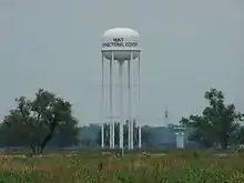
The Louisiana Department of Public Safety and Corrections operates two prisons, Elayn Hunt Correctional Center and Louisiana Correctional Institute for Women (LCIW), in St. Gabriel.[11][12] LCIW houses the female death row.[13][14]
Education
Primary and secondary schools
Iberville Parish School Board operates the East Iberville School, a K–12 school, in St. Gabriel.[15] For a long time it was the only school in St. Gabriel.[5] The Mathematics, Science, and Arts Academy - East opened in St. Gabriel in the fall of 2008.
Some residents send their children to private schools in Greater Baton Rouge and in the Gonzales, Louisiana area.[5]
In 2013 some officials from the City of St. Gabriel announced that they wished to secede from Iberville Parish schools, arguing that their schools were given less attention than warranted.[16]
Public Library
Iberville Parish Library operates the East Iberville Branch Library in St. Gabriel.[17]
Energy
Near St. Gabriel, Louisiana, there is a powerline crossing of Mississippi river, which uses two pylons each 164.59 metres (540 ft) tall. These pylons are the tallest electricity pylons in the Unuted States ,
References
- "2019 U.S. Gazetteer Files". United States Census Bureau. Retrieved July 25, 2020.
- "Population and Housing Unit Estimates". United States Census Bureau. May 24, 2020. Retrieved May 27, 2020.
- "Boundary Changes". Geographic Change Notes: Louisiana. Population Division, United States Census Bureau. 2006-05-19. Archived from the original on 2006-02-06. Retrieved 2008-10-24.
- Baurick, Tristan (Oct 30, 2019). "Welcome to "Cancer Alley," Where Toxic Air Is About to Get Worse". ProPublica. Retrieved 2020-06-23.
- "Background of the City." City of St. Gabriel. Retrieved on November 11, 2010.
- "Welcome!" City of St. Gabriel. Retrieved on November 11, 2010.
- "Census of Population and Housing". Census.gov. Retrieved June 4, 2015.
- "U.S. Census website". United States Census Bureau. Retrieved 2008-01-31.
- Cazorla, Frank, The governor Louis de Unzaga (1717-1793) Pioneer in Birth of the United States of America and the Liberalism. Foundation Malaga, 2019, pages 48-52, 62, 74, 83, 90
- "St. Gabriel Roman Catholic Church". Nps.gov. Retrieved 2013-01-28.
- "Elayn Hunt Correctional Center Archived 2010-09-24 at the Wayback Machine." (Profile) Louisiana Department of Public Safety and Corrections. Retrieved on July 20, 2010.
- "Directions to EHCC Archived 2009-09-16 at the Wayback Machine." Elayn Hunt Correctional Center. Retrieved on July 20, 2010.
- "Louisiana Correctional Institute for Women Archived 2010-09-24 at the Wayback Machine." Louisiana Department of Public Safety & Corrections. 14/40. Retrieved on August 24, 2010.
- "Classification–Where Inmates Serve Their Time." Inside the System: How Inmates Live and Work. Louisiana Department of Public Safety & Corrections. 14/40. Retrieved on June 30, 2010.
- "East Iberville School Archived 2011-06-05 at the Wayback Machine." (Direct image link) Iberville Parish School Board. Retrieved on October 2, 2010. "3285 Highway 75 St. Gabriel, LA 70776"
- Jones, Terry L. (2013-03-26). "Officials want east Iberville to split from parish school system". The Advocate. Retrieved 2016-12-04.
- "Welcome to the Library Catalog Archived 2011-08-13 at the Wayback Machine." Iberville Parish Library. Retrieved on January 29, 2011.
External links
Municipalities and communities of Iberville Parish, Louisiana, United States | ||
|---|---|---|
| Cities | 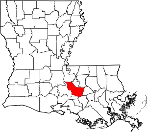 | |
| Towns | ||
| Villages | ||
| CDPs | ||
| Other unincorporated communities | ||
| Ghost towns | ||
| ||