St. Ignace Township, Michigan
St. Ignace Township is a civil township of Mackinac County in the U.S. state of Michigan. As of the 2000 census, the township population was 1,024. The city of St. Ignace is located just to the south and is administered autonomously.
St. Ignace Township, Michigan | |
|---|---|
 Location within Mackinac County | |
 St. Ignace Township Location within the state of Michigan  St. Ignace Township St. Ignace Township (the United States) | |
| Coordinates: 45°59′33″N 84°42′11″W | |
| Country | United States |
| State | Michigan |
| County | Mackinac |
| Government | |
| • Supervisor | Steven Campbell |
| Area | |
| • Total | 142.2 sq mi (368.4 km2) |
| • Land | 97.1 sq mi (251.6 km2) |
| • Water | 45.1 sq mi (116.8 km2) |
| Elevation | 597 ft (182 m) |
| Population (2000) | |
| • Total | 1,024 |
| • Density | 10.5/sq mi (4.1/km2) |
| Time zone | UTC-5 (Eastern (EST)) |
| • Summer (DST) | UTC-4 (EDT) |
| ZIP code(s) | |
| Area code(s) | 906 |
| FIPS code | 26-70860[1] |
| GNIS feature ID | 1627028[2] |
| Website | Official website |
Communities
- Charles was a settlement around a mill of the Sterling Lumber Company. It had a post office beginning in 1905.[3]
Transportation
Interstate 75 passes through this township, with two exits in St. Ignace. Mackinac Trail, or H-63, passes through as well. The western terminus of M-134 and the southern terminus of M-123 are located here.
Geography
According to the United States Census Bureau, the township has a total area of 142.2 square miles (368 km2), of which 97.1 square miles (251 km2) is land and 45.1 square miles (117 km2) (31.70%) is water.
Demographics
As of the census[1] of 2000, there were 1,024 people, 413 households, and 296 families residing in the township. The population density was 10.5 per square mile (4.1/km2). There were 601 housing units at an average density of 6.2 per square mile (2.4/km2). The racial makeup of the township was 67.97% White, 0.59% African American, 26.46% Native American, 0.20% Asian, 0.39% from other races, and 4.39% from two or more races. Hispanic or Latino of any race were 0.39% of the population.
There were 413 households, out of which 33.4% had children under the age of 18 living with them, 55.4% were married couples living together, 11.9% had a female householder with no husband present, and 28.1% were non-families. 24.0% of all households were made up of individuals, and 7.7% had someone living alone who was 65 years of age or older. The average household size was 2.47 and the average family size was 2.89.
In the township the population was spread out, with 25.9% under the age of 18, 4.6% from 18 to 24, 27.6% from 25 to 44, 29.5% from 45 to 64, and 12.4% who were 65 years of age or older. The median age was 40 years. For every 100 females, there were 105.6 males. For every 100 females age 18 and over, there were 105.1 males.
The median income for a household in the township was $35,461, and the median income for a family was $36,023. Males had a median income of $30,750 versus $22,500 for females. The per capita income for the township was $14,768. About 7.6% of families and 11.0% of the population were below the poverty line, including 13.4% of those under age 18 and 4.3% of those age 65 or over.
Notable person
- Edward Fenlon, jurist and legislator
References
- "U.S. Census website". United States Census Bureau. Retrieved 2008-01-31.
- U.S. Geological Survey Geographic Names Information System: St. Ignace Township, Michigan
- Walter Romig, Michigan Place Names, p. 110
Municipalities and communities of Mackinac County, Michigan, United States | ||
|---|---|---|
| Cities | 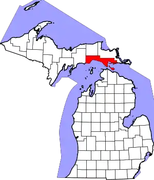 Map of Michigan highlighting Mackinac County.svg | |
| Civil townships | ||
| Unincorporated communities | ||
| Indian reservations | ||
| Footnotes | ‡This populated place also has portions in an adjacent county or counties | |
| ||