Stapylton County

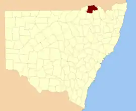
Stapylton County is one of the 141 Cadastral divisions of New South Wales. It is located to the south of the Barwon River and includes part of the Newell Highway.

Stapylton
New South Wales
Location in New South Wales
Lands administrative divisions around Stapylton:
Carnarvon (Qld) Carnarvon (Qld) Marsh (Qld)
Benarba Stapylton Arrawatta
Benarba Courallie Burnett

Stapylton County was named in honour of the geologist Granville William Chetwynd Stapylton (1800-1840).[1]

Parishes

A full list of parishes found within this county; their current LGA and mapping coordinates to the approximate centre of each location is as follows:

ParishLGACoordinates
AdamsMoree Plains Shire29°04′54″S 149°51′04″E
BengerangMoree Plains Shire29°04′54″S 149°31′04″E
BensonMoree Plains Shire29°13′54″S 149°49′04″E
Blue NobbyGwydir Shire29°55′54″S 150°38′04″E
BoggabillaMoree Plains Shire28°34′54″S 150°17′04″E
BooberaMoree Plains Shire28°37′54″S 150°08′04″E
BoonalGwydir Shire29°45′54″S 150°32′04″E
BoonangaGwydir Shire28°50′54″S 150°28′04″E
BoorabaGwydir Shire29°00′54″S 150°23′04″E
BrowneMoree Plains Shire28°42′54″S 150°13′04″E
BryanungraMoree Plains Shire29°05′54″S 149°57′04″E
CanaryMoree Plains Shire28°39′54″S 149°52′04″E
CareungaMoree Plains Shire29°00′54″S 150°00′04″E
Careunga NorthMoree Plains Shire28°54′54″S 149°55′04″E
CarrobyMoree Plains Shire28°38′54″S 150°01′04″E
CookMoree Plains Shire28°46′54″S 150°19′04″E
CoolangaMoree Plains Shire28°49′54″S 150°10′04″E
CoppymurrumbillMoree Plains Shire28°48′54″S 150°17′04″E
CurrumbahMoree Plains Shire28°53′54″S 150°10′04″E
DenebryMoree Plains Shire29°12′54″S 150°01′04″E
DouroMoree Plains Shire29°04′54″S 149°46′04″E
FinleyMoree Plains Shire29°00′54″S 149°46′04″E
Gil GilMoree Plains Shire29°08′54″S 150°12′04″E
GooraraMoree Plains Shire29°04′54″S 149°35′04″E
GunnyannaMoree Plains Shire29°01′54″S 149°41′04″E
HarveyMoree Plains Shire29°16′54″S 150°02′04″E
HolmesGwydir Shire28°59′54″S 150°18′04″E
IllingrammindiMoree Plains Shire28°50′54″S 150°00′04″E
KinnimoMoree Plains Shire28°55′54″S 149°42′04″E
Lay GreenMoree Plains Shire29°03′54″S 150°12′04″E
LimebonMoree Plains Shire28°46′54″S 150°05′04″E
MayneMoree Plains Shire28°40′54″S 150°18′04″E
MelleallinaMoree Plains Shire29°10′54″S 149°54′04″E
MerriwaMoree Plains Shire28°56′54″S 150°24′04″E
MinganGwydir Shire28°51′54″S 150°24′04″E
MobbindryMoree Plains Shire28°47′54″S 150°24′04″E
MoppinMoree Plains Shire29°11′54″S 149°42′04″E
MorellaMoree Plains Shire28°39′54″S 150°15′04″E
Mount PleasantMoree Plains Shire29°03′54″S 150°04′04″E
MungleGwydir Shire28°52′54″S 150°16′04″E
PaineMoree Plains Shire28°59′54″S 150°02′04″E
PalerangaMoree Plains Shire28°40′54″S 149°45′04″E
StapyltonGwydir Shire28°59′54″S 150°30′04″E
TantaranaMoree Plains Shire29°14′54″S 150°06′04″E
ToongcoomaMoree Plains Shire28°59′54″S 150°13′04″E
TrinkeyMoree Plains Shire28°38′54″S 150°02′04″E
Tubble GahGwydir Shire29°51′54″S 150°37′04″E
Tucka TuckaGwydir Shire29°45′54″S 150°37′04″E
TulloonaMoree Plains Shire28°52′54″S 150°04′04″E
Tun CooeyMoree Plains Shire29°08′54″S 150°05′04″E
WallonMoree Plains Shire29°13′54″S 149°55′04″E
Warra WarramaMoree Plains Shire29°00′54″S 150°07′04″E
WelbonMoree Plains Shire29°09′54″S 149°45′04″E
WhalanMoree Plains Shire28°45′54″S 150°24′04″E
WillimillMoree Plains Shire28°48′54″S 149°46′04″E
WongaMoree Plains Shire28°46′54″S 150°13′04″E
YooloobilMoree Plains Shire28°47′54″S 149°54′04″E

References

  1. [acms.sl.nsw.gov.au/item/itemDetailPaged.aspx?itemID=432528 - 58k
This article is issued from Wikipedia. The text is licensed under Creative Commons - Attribution - Sharealike. Additional terms may apply for the media files.