State Line, Vigo County, Indiana
State Line is an unincorporated community in western Sugar Creek Township, Vigo County, in the U.S. state of Indiana.[2]
State Line | |
|---|---|
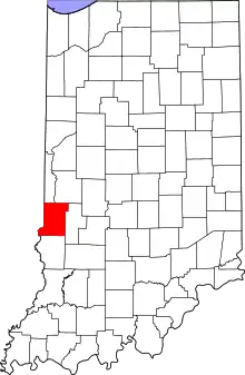 Vigo County's location in Indiana | |
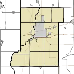 State Line location in Vigo County, Indiana | |
| Coordinates: 39°26′13″N 87°31′46″W | |
| Country | United States |
| State | Indiana |
| County | Vigo |
| Township | Sugar Creek |
| Elevation | 561 ft (171 m) |
| Time zone | UTC-5 (Eastern (EST)) |
| • Summer (DST) | UTC-4 (EDT) |
| ZIP code | 47885 |
| Area code(s) | 812, 930 |
| GNIS feature ID | 444087 |
Named for its proximity to the state border between Indiana and Illinois, it is part of the Terre Haute metropolitan area.
Geography
State Line is located at 39°26′13″N 87°31′46″W at an elevation of 561 feet.
References
- "US Board on Geographic Names". United States Geological Survey. October 25, 2007. Retrieved 2016-07-14.
- "State Line, Vigo County, Indiana". Geographic Names Information System. United States Geological Survey. Retrieved August 7, 2017.
Municipalities and communities of Vigo County, Indiana, United States | ||
|---|---|---|
| City | Map of Indiana highlighting Vigo County | |
| Towns | ||
| Townships | ||
| CDPs | ||
| Other unincorporated communities |
| |
| Footnotes | ‡This populated place also has portions in an adjacent county or counties | |
| ||
This article is issued from Wikipedia. The text is licensed under Creative Commons - Attribution - Sharealike. Additional terms may apply for the media files.