Vigo County, Indiana
Vigo County (/ˈviːɡoʊ/ VEE-goh or /ˈvaɪɡoʊ/ VY-goh) is a county on the western border of the U.S. state of Indiana. According to the 2010 United States Census, the population was 107,848.[1] The county seat is Terre Haute.[2]
Vigo County | |
|---|---|
| County of Vigo | |
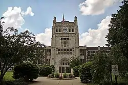
.jpg.webp) Vigo County Courthouse in Terre Haute, Indiana | |
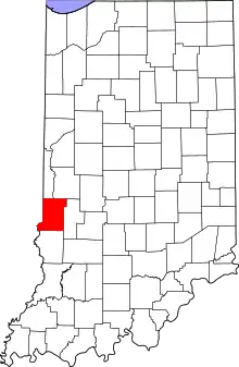 Location within the U.S. state of Indiana | |
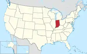 Indiana's location within the U.S. | |
| Coordinates: 39°26′N 87°23′W | |
| Country | |
| State | |
| Founded | February 1, 1818 |
| Named for | Francis Vigo |
| Seat | Terre Haute |
| Largest city | Terre Haute |
| Area | |
| • Total | 410.45 sq mi (1,063.1 km2) |
| • Land | 403.31 sq mi (1,044.6 km2) |
| • Water | 7.14 sq mi (18.5 km2) 1.74%% |
| Population | |
| • Estimate (2019) | 107,038 |
| • Density | 265.4/sq mi (102.5/km2) |
| Time zone | UTC−5 (Eastern) |
| • Summer (DST) | UTC−4 (EDT) |
| Congressional district | 8th |
| Website | www |
| Indiana county number 84 | |
Vigo County is included in the Terre Haute metropolitan area.
The county contains four incorporated settlements with a total population of nearly 63,000, as well as several unincorporated communities. It is divided into twelve townships which provide local services to the residents.[3]
The county is one of the best bellwether regions for voting in U.S. presidential elections; it voted for the winning candidate in every election from 1956 to 2016[4] and in all but three elections since 1888.[5] Until the streak ended in 2020, only one county in the United States, Valencia County, New Mexico, had voted for the winning candidate longer.[6][7]
History
In 1787, the fledgling United States defined the Northwest Territory, which included the area of present-day Indiana. In 1800, Congress separated Ohio from the Northwest Territory, designating the rest of the land as the Indiana Territory.[8] President Thomas Jefferson chose William Henry Harrison as the territory's first governor, and Vincennes was established as the territorial capital.[9] After the Michigan Territory was separated and the Illinois Territory was formed, Indiana was reduced to its current size and geography.[8] By December 1816 the Indiana Territory was admitted to the Union as a state.
Starting in 1794, Native American titles to Indiana lands were extinguished by usurpation, purchase, or war and treaty. The United States acquired land from the Native Americans in the 1809 treaty of Fort Wayne, and by the treaty of St. Mary's in 1818 considerably more territory became property of the government. These two treaties resolved the occupation issue for the future Vigo County. Whites had been living in the area since 1811, when General Harrison erected a fort north of present-day Terre Haute. After the Indian skirmishes were resolved, settlers arrived in significant numbers beginning 1815.[10]
The area in present-day Vigo County was first placed under local jurisdiction in 1790, when Knox County was created. This all-encompassing county was repeatedly subdivided as its lands were occupied − on 30 December 1816 a portion was partitioned to create Sullivan County, and on 21 January 1818 the northern portion of Sullivan was partitioned off to create Vigo County. The first county commissioners organized the government in 1818, including naming Terre Haute as its seat. The county's borders changed several times; in 1821, part of the county was formed into Parke County, and later that year Putnam County was formed which also affected Vigo's borders. The final change came in 1873 when the present boundaries were defined.[11] The county is named for Colonel Francis Vigo, of Italian heritage but a citizen of Spain due to residence in St. Louis. He is credited with assisting George Rogers Clark, both in financing Clark's exploration and American Revolutionary War efforts, and in service as an agent obtaining military information for Clark against British campaigns on the then frontier.[12]
Geography

To the north of Vigo County, the Wabash River defines the boundary between Vermillion and Parke counties; the river then enters Vigo County and winds to the south-southwest, defining the southern portion of the county's western border with Illinois before continuing south along Sullivan County's western border. Vigo County is thus the southernmost county in Indiana on the right bank of the Wabash. The county's low hills are devoted to agriculture or urban development; only the drainages and river-adjacent areas are still wooded.[13] Its highest point (680 feet/207 meters ASL) is Sanford Hill, one mile (1.6 km) west of Paint Mill Lake, south of Terre Haute.[14]
According to the 2010 census, the county has a total area of 410.45 square miles (1,063.1 km2), of which 403.31 square miles (1,044.6 km2) (or 98.26%) is land and 7.14 square miles (18.5 km2) (or 1.74%) is water.[15]
Adjacent counties
- Vermillion County - north
- Parke County - northeast
- Clay County - east
- Sullivan County - south
- Clark County, Illinois - southwest
- Edgar County, Illinois - northwest
Cities
- Terre Haute (county seat)
Towns
- West Terre Haute
- Seelyville
- Riley (or Lockport)
Census-designated places
- Dresser (or Taylorville)
- Fontanet
- New Goshen
- North Terre Haute
- Shepardsville
- Tecumseh
- Toad Hop
Unincorporated communities
- Allendale
- Atherton
- Barnhart Town
- Blackhawk
- Brown Jug Corner
- Burnett
- Cherryvale
- Coal Bluff
- Cobb
- Deming Woods
- Dewey
- Duane Yards
- East Glenn
- Ehrmandale
- Ferguson Hill
- Glenn Ayr
- Gospel Grove
- Grange Corner
- Harrison
- Hickory Island
- Hutton
- Keller
- Larimer Hill
- Lewis
- Libertyville
- Liggett
- Marion Heights
- Markles
- Otter Creek Junction
- Parkview
- Pimento
- Pine Ridge
- Prairie Creek
- Prairieton
- Preston
- St. Mary-of-the-Woods
- Sandcut
- Sandford
- Shirkieville
- Southwood
- Spelterville
- Spring Hill
- State Line
- Swalls
- Tabertown
- Taylorville
- Terre Town
- Twelve Points
- Vigo
- West New Goshen
- Whitcomb Heights
- Woodgate
- Youngstown
Townships
The year after it was authorized, Vigo County was divided into four townships: Honey Creek Wabash, Harrison, and Independence. Prairie Creek Township was formed later that year. Otter Creek, Raccoon, and Sugar Creek townships were created in 1820, and Independence Township was renamed as Paris Township. Raccoon and Wabash townships became part of Parke County when it was partitioned from Vigo County in 1821. Nevins and Riley townships were formed in 1822. In 1824, Paris Township was renamed again to Fayette Township. Pierson Township was created in 1829; Lost Creek in 1831; Linton in 1841; and Prairieton Township in 1857.[16]
Highways
Interstate 70 passes through the southern part of Terre Haute from east to west on its way from Indianapolis to Saint Louis, Missouri;[17] U.S. Route 40 roughly parallels Interstate 70 and passes through the middle of the city.[18] Both highways intersect U.S. Route 41, coming from Chicago to the north;[19] U.S. Route 150 enters from Paris, Illinois to the northwest and joins U.S Route 41 in downtown Terre Haute, and both continue south toward Vincennes.[20]
Rail
Several CSX Transportation railroad lines meet in Terre Haute; one enters from the north, another from the Indianapolis area, and another from Vincennes; and two others enter from Illinois. An Indiana Rail Road line runs southeast from Terre Haute toward Bedford.[21]
Airports
The following public-use airports are located in the county:[22]
- Terre Haute International Airport (HUF) in Terre Haute
- Sky King Airport (3I3) in North Terre Haute
Education
The public schools in the county are part of the Vigo County School Corporation. During the 2009–10 school year, the schools served a total of 16,014 students.[23]
Vigo County is served by the Vigo County Public Library.[24]
Colleges in Vigo County include Indiana State University and Rose-Hulman Institute of Technology. For a fuller list, see the List of schools in metropolitan Terre Haute.
Climate and weather
| Terre Haute, Indiana | ||||||||||||||||||||||||||||||||||||||||||||||||||||||||||||
|---|---|---|---|---|---|---|---|---|---|---|---|---|---|---|---|---|---|---|---|---|---|---|---|---|---|---|---|---|---|---|---|---|---|---|---|---|---|---|---|---|---|---|---|---|---|---|---|---|---|---|---|---|---|---|---|---|---|---|---|---|
| Climate chart (explanation) | ||||||||||||||||||||||||||||||||||||||||||||||||||||||||||||
| ||||||||||||||||||||||||||||||||||||||||||||||||||||||||||||
| ||||||||||||||||||||||||||||||||||||||||||||||||||||||||||||
In recent years, average temperatures in Terre Haute have ranged from a low of 18 °F (−8 °C) in January to a high of 87 °F (31 °C) in July, although a record low of −24 °F (−31 °C) was recorded in January 1977 and a record high of 104 °F (40 °C) was recorded in September 1954. Average monthly precipitation ranged from 2.13 inches (54 mm) in January to 4.46 inches (113 mm) in May.[25]
Government
The county government is a constitutional body, and is granted specific powers by the Constitution of Indiana, and by the Indiana Code. The county council is the fiscal body of the county government and controls spending and revenue collection in the county. Representatives, elected to four-year terms from county districts, are responsible for setting salaries, the annual budget, and special spending. The council has limited authority to impose local taxes, in the form of an income and property tax that is subject to state level approval, excise taxes, and service taxes.[26][27]
A board of commissioners is the executive and legislative body of the county. Commissioners are elected county-wide to staggered four-year terms. One commissioner serves as president. The commissioners execute the acts of the county council, and manage the county government.[26][27]
The county maintains a small claims court that handles civil cases. The judge on the court is elected to a term of four years and must be a member of the Indiana Bar Association. The judge is assisted by a constable who is also elected to a four-year term. In some cases, court decisions can be appealed to the state level circuit court.[27]
The county has other elected offices, including sheriff, coroner, auditor, treasurer, recorder, surveyor, and circuit court clerk. These officers are elected to four-year terms. Members elected to county government positions are required to declare party affiliations and to be residents of the county.[27]
Politics
The county is one of the best bellwether regions for voting U.S. presidential elections.[28] Since 1888, it has voted for the winning candidate in every election in all but three instances: 1908, 1952, and 2020.[4][5][29]
The results in the county have often mirrored the nationwide popular vote. In every presidential election from 1960 to 2012, the county voted less than five percentage points from the national result. This changed in 2016, when the county voted 17 percentage points more Republican than the nation as a whole—a trend which persisted in 2020, when it voted 19 percentage points more Republican.
In statewide races for governor and the U.S. Senate, Vigo County has in recent years become more receptive to candidates from the Democratic Party, even when the county had simultaneously voted for a Republican presidential victor in question. The county has gone Democratic in 9 of the last 10 gubernatorial races since 1980, and in 8 of the last 13 Senate races since that timeframe also.
Vigo is part of Indiana's 8th congressional district, which is held by Republican Larry Bucshon.
| Year | Republican | Democratic | Third parties |
|---|---|---|---|
| 2020 | 56.3% 24,545 | 41.6% 18,123 | 2.1% 926 |
| 2016 | 54.7% 21,937 | 39.7% 15,931 | 5.6% 2,259 |
| 2012 | 48.4% 19,369 | 49.3% 19,712 | 2.3% 924 |
| 2008 | 41.3% 18,121 | 57.1% 25,040 | 1.7% 723 |
| 2004 | 52.8% 20,988 | 46.4% 18,426 | 0.8% 330 |
| 2000 | 49.7% 18,021 | 48.5% 17,570 | 1.8% 637 |
| 1996 | 40.9% 15,751 | 46.7% 17,974 | 12.4% 4,774 |
| 1992 | 37.6% 15,834 | 42.8% 18,050 | 19.6% 8,277 |
| 1988 | 53.1% 21,929 | 46.5% 19,192 | 0.4% 172 |
| 1984 | 58.4% 26,259 | 41.0% 18,429 | 0.6% 285 |
| 1980 | 51.9% 24,133 | 41.4% 19,261 | 6.7% 3,133 |
| 1976 | 48.5% 23,555 | 50.8% 24,684 | 0.8% 371 |
| 1972 | 60.7% 29,730 | 38.6% 18,898 | 0.7% 329 |
| 1968 | 44.6% 20,814 | 43.6% 20,328 | 11.8% 5,522 |
| 1964 | 40.6% 19,001 | 59.1% 27,606 | 0.3% 144 |
| 1960 | 49.7% 24,940 | 50.0% 25,105 | 0.3% 133 |
| 1956 | 50.4% 25,253 | 49.3% 24,680 | 0.3% 135 |
| 1952 | 49.7% 25,806 | 49.8% 25,841 | 0.5% 231 |
| 1948 | 41.8% 19,049 | 56.9% 25,906 | 1.3% 609 |
| 1944 | 46.5% 21,493 | 53.3% 24,649 | 0.2% 81 |
| 1940 | 44.0% 23,177 | 55.6% 29,308 | 0.4% 199 |
| 1936 | 34.1% 17,278 | 65.1% 33,018 | 0.9% 442 |
| 1932 | 40.5% 18,310 | 57.3% 25,886 | 2.2% 991 |
| 1928 | 54.7% 22,962 | 44.1% 18,509 | 1.2% 497 |
| 1924 | 52.7% 19,545 | 35.1% 12,999 | 12.2% 4,515 |
| 1920 | 50.3% 18,668 | 42.4% 15,739 | 7.3% 2,707 |
| 1916 | 39.7% 8,934 | 49.6% 11,165 | 10.7% 2,397 |
| 1912 | 17.2% 3,103 | 40.2% 7,256 | 42.6% 7,701[31] |
| 1908 | 45.8% 10,223 | 47.8% 10,685 | 6.4% 1,434 |
| 1904 | 56.3% 10,327 | 36.1% 6,625 | 7.5% 1,380 |
| 1900 | 49.9% 7,992 | 46.6% 7,472 | 3.5% 559 |
| 1896 | 51.2% 8,020 | 48.2% 7,558 | 0.6% 94 |
| 1892 | 47.6% 6,159 | 51.0% 6,599 | 1.3% 170 |
| 1888 | 49.8% 6,273 | 48.5% 6,102 | 1.7% 212 |
Demographics
| Historical population | |||
|---|---|---|---|
| Census | Pop. | %± | |
| 1820 | 3,390 | — | |
| 1830 | 5,766 | 70.1% | |
| 1840 | 12,076 | 109.4% | |
| 1850 | 15,289 | 26.6% | |
| 1860 | 22,517 | 47.3% | |
| 1870 | 33,549 | 49.0% | |
| 1880 | 45,658 | 36.1% | |
| 1890 | 50,195 | 9.9% | |
| 1900 | 62,035 | 23.6% | |
| 1910 | 87,930 | 41.7% | |
| 1920 | 100,212 | 14.0% | |
| 1930 | 98,861 | −1.3% | |
| 1940 | 99,709 | 0.9% | |
| 1950 | 105,160 | 5.5% | |
| 1960 | 108,458 | 3.1% | |
| 1970 | 114,528 | 5.6% | |
| 1980 | 112,385 | −1.9% | |
| 1990 | 106,107 | −5.6% | |
| 2000 | 105,848 | −0.2% | |
| 2010 | 107,848 | 1.9% | |
| 2019 (est.) | 107,038 | [32] | −0.8% |
| US Decennial Census[33] | |||
2010 census
As of the 2010 United States Census, there were 107,848 people, 41,361 households, and 25,607 families in the county.[34] The population density was 267.4 inhabitants per square mile (103.2/km2). There were 46,006 housing units at an average density of 114.1 per square mile (44.1/km2).[15] The racial makeup of the county was 88.3% white, 6.9% black or African American, 1.7% Asian, 0.3% American Indian, 0.6% from other races, and 2.2% from two or more races. Those of Hispanic or Latino origin made up 2.3% of the population.[34] In terms of ancestry, 22.6% were German, 20.2% were American, 12.2% were Irish, and 10.3% were English.[35]
Of the 41,361 households, 30.2% had children under the age of 18 living with them, 43.9% were married couples living together, 13.1% had a female householder with no husband present, 38.1% were non-families, and 30.6% of all households were made up of individuals. The average household size was 2.38 and the average family size was 2.95. The median age was 36.1 years.[34]
The median income for a household in the county was $47,697 and the median income for a family was $50,413. Males had a median income of $42,014 versus $30,217 for females. The per capita income for the county was $20,398. About 13.3% of families and 19.5% of the population were below the poverty line, including 27.5% of those under age 18 and 9.5% of those age 65 or over.[36]
See also
References
- "Vigo County QuickFacts". US Census Bureau. Retrieved 25 September 2011.
- "Find a County". National Association of Counties. Archived from the original on 31 May 2011. Retrieved 7 June 2011.
- "Indiana Township Association". Retrieved 12 September 2010.
- David Leip (2003). "Bellwether States and Counties". Retrieved 17 May 2008.
- David Leip (2013). "Vigo County Extends Bellwether Streak". Retrieved 26 October 2015.
- "Indiana Election Results". 2020. Retrieved 8 November 2020.
- "Vigo County loses its bellwether status after 16 presidential elections". MyWabashValley.com. November 8, 2020. Retrieved November 9, 2020.
- "Government at Crossroads: An Indiana chronology". The Herald Bulletin. 5 January 2008. Retrieved 22 July 2009.
- Brill, Marlene Targ (2005). Indiana. Marshall Cavendish. p. 35. ISBN 978-0-7614-2020-0.
- "Vigo County Indiana County and Court Records". Indiana Genealogy Trails. 2020. Retrieved 19 September 2020.
- Bradsby (1891). pp. 285–289.
- Baker, Ronald L.; Carmony, Marvin (1975). Indiana Place Names. Bloomington, Indiana: Indiana University Press. p. 173.
- Vigo County IN (Google Maps, accessed 19 September 2020)
- Sanford Hill, Indiana (PeakBagger.com, accessed 19 September 2020)
- "Population, Housing Units, Area, and Density: 2010 - County". US Census Bureau. Archived from the original on 10 February 2020. Retrieved 10 July 2015.
- Bradsby (1891). pp. 647–649.
- "Interstate 70". Highway Explorer. Archived from the original on 9 March 2012. Retrieved 22 December 2010.
- "U.S. Route 40". Highway Explorer. Archived from the original on 7 October 2011. Retrieved 22 December 2010.
- "U.S. Route 41". Highway Explorer. Archived from the original on 7 December 2010. Retrieved 22 December 2010.
- "U.S. Route 150". Highway Explorer. Archived from the original on 5 June 2010. Retrieved 22 December 2010.
- "Indiana Railroads" (PDF). Indiana Department of Transportation. 2008. Archived from the original (PDF) on 18 November 2009. Retrieved 22 December 2010.
- Public and Private Airports, Vigo County, Indiana
- "Enrollment by Grade, Vigo County School Corp". Indiana Department of Education. Archived from the original on 3 April 2012. Retrieved 23 December 2010.
- "Homepage". Vigo County Public Library. Retrieved 27 July 2014.
- "Monthly Averages for Terre Haute IN". The Weather Channel. Retrieved 27 January 2011.
- Indiana Code. "Title 36, Article 2, Section 3". IN.gov. Retrieved 16 September 2008.
- Indiana Code. "Title 2, Article 10, Section 2" (PDF). IN.gov. Retrieved 16 September 2008.
- David Wasserman (October 6, 2020), "The 10 Bellwether Counties That Show How Trump Is in Serious Trouble", Nytimes.com
- McCormick, John (2020-11-13). "Bellwether Counties Nearly Wiped Out by 2020 Election". Wall Street Journal. ISSN 0099-9660. Retrieved 2020-11-17.
- Leip, David. "Atlas of US Presidential Elections". uselectionatlas.org. Retrieved 20 May 2018.
- The leading "other" candidate, Progressive Theodore Roosevelt, received 4,988 votes, while Socialist candidate Eugene Debs received 1,862 votes, Prohibition candidate Eugene Chafin received 707 votes, and Socialist Labor candidate Arthur Reimer received 144 votes.
- "Population and Housing Unit Estimates". Retrieved March 26, 2020.
- "US Decennial Census". Census.gov. Retrieved July 31, 2013.
- "Profile of General Population and Housing Characteristics: 2010 Demographic Profile Data". US Census Bureau. Archived from the original on 13 February 2020. Retrieved 10 July 2015.
- "Selected Social Characteristics in the US – 2006-2010 American Community Survey 5-Year Estimates". US Census Bureau. Archived from the original on 14 February 2020. Retrieved 10 July 2015.
- "Selected Economic Characteristics – 2006-2010 American Community Survey 5-Year Estimates". US Census Bureau. Archived from the original on 14 February 2020. Retrieved 10 July 2015.
Bibliography
- Bradsby, H. C. (1891). History of Vigo County, Indiana, with Biographical Selections. Chicago: S. B. Nelson and Company. Retrieved 20 December 2010.
Further reading
- Pickett, William B. (chairman). Vigo County Oral History Program (1980–81). Terre Haute, Indiana: Collections: Politics and Government, Vigo County Public Library. 820128A.
External links
| Wikimedia Commons has media related to Vigo County, Indiana. |
Places adjacent to Vigo County, Indiana | ||||||||||
|---|---|---|---|---|---|---|---|---|---|---|
| ||||||||||
Municipalities and communities of Vigo County, Indiana, United States | ||
|---|---|---|
| City | Map of Indiana highlighting Vigo County | |
| Towns | ||
| Townships | ||
| CDPs | ||
| Other unincorporated communities |
| |
| Footnotes | ‡This populated place also has portions in an adjacent county or counties | |
| ||

| Authority control |
|---|