Steinenbronn
Steinenbronn is a town in the district of Böblingen in Baden-Württemberg in Germany. The district has one public school and five kindergartens. The east side is industrial while the west side of the town is rather urban.
Steinenbronn | |
|---|---|
 Coat of arms | |
Location of Steinenbronn within Böblingen district 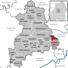 | |
 Steinenbronn  Steinenbronn | |
| Coordinates: 48°39′53″N 09°07′21″E | |
| Country | Germany |
| State | Baden-Württemberg |
| Admin. region | Stuttgart |
| District | Böblingen |
| Government | |
| • Mayor | Johann Singer |
| Area | |
| • Total | 9.72 km2 (3.75 sq mi) |
| Elevation | 431 m (1,414 ft) |
| Population (2019-12-31)[1] | |
| • Total | 6,490 |
| • Density | 670/km2 (1,700/sq mi) |
| Time zone | UTC+01:00 (CET) |
| • Summer (DST) | UTC+02:00 (CEST) |
| Postal codes | 71144 |
| Dialling codes | 07157 |
| Vehicle registration | BB |
| Website | www.steinenbronn.de |
Geography
Steinenbronn lies on the edge of the Nationalpark Schönbuch at the old trade route Stuttgart – Tübingen, five kilometers south of Leinfelden-Echterdingen, three kilometers north of Waldenbuch and five kilometers east of Schönaich.
Politics
Mayor
since the end of World War II:
- 1945–1950: Gottlob Krauß
- 1950–1980: Reinhold Buck
- 1980–1996: Hermann Walz
- since 1996: Johann Singer
Municipal Council
Elections in May 2014:
- Freie Wähler (Free voters): 5 seats
- CDU: 5 seats
- Offene Grüne Liste (Open green list): 2 seats
- SPD: 2 seats
Infrastructure
From 1928 to 1965 Steinenbronn was part of the Siebenmühlentalbahn (Leinfelden-Waldenbuch). Today Steinenbronn is connected to the mass transit of Stuttgart. Steinenbronn is located at the former Bundesstraße 27, now Landstraße 1208 which connects Stuttgart and Tübingen.
important Distances:
- Stuttgart-Airport: 8 km
- Stuttgart: 20 km
- Tübingen: 24 km
Education
Steinenbronn is the seat of a secondary school with more than 400 students.
Twin towns [2]
References
- "Bevölkerung nach Nationalität und Geschlecht am 31. Dezember 2019". Statistisches Landesamt Baden-Württemberg (in German). September 2020.
- http://www.steinenbronn.de/servlet/PB/menu/1179755_l1/index.html
Towns and municipalities in Böblingen (district) | ||
|---|---|---|
| Authority control |
|---|
